Storm Otto weather warning as Met Office confirms sudden stratospheric warming event – live
Disruption expected until afternoon
Your support helps us to tell the story
From reproductive rights to climate change to Big Tech, The Independent is on the ground when the story is developing. Whether it's investigating the financials of Elon Musk's pro-Trump PAC or producing our latest documentary, 'The A Word', which shines a light on the American women fighting for reproductive rights, we know how important it is to parse out the facts from the messaging.
At such a critical moment in US history, we need reporters on the ground. Your donation allows us to keep sending journalists to speak to both sides of the story.
The Independent is trusted by Americans across the entire political spectrum. And unlike many other quality news outlets, we choose not to lock Americans out of our reporting and analysis with paywalls. We believe quality journalism should be available to everyone, paid for by those who can afford it.
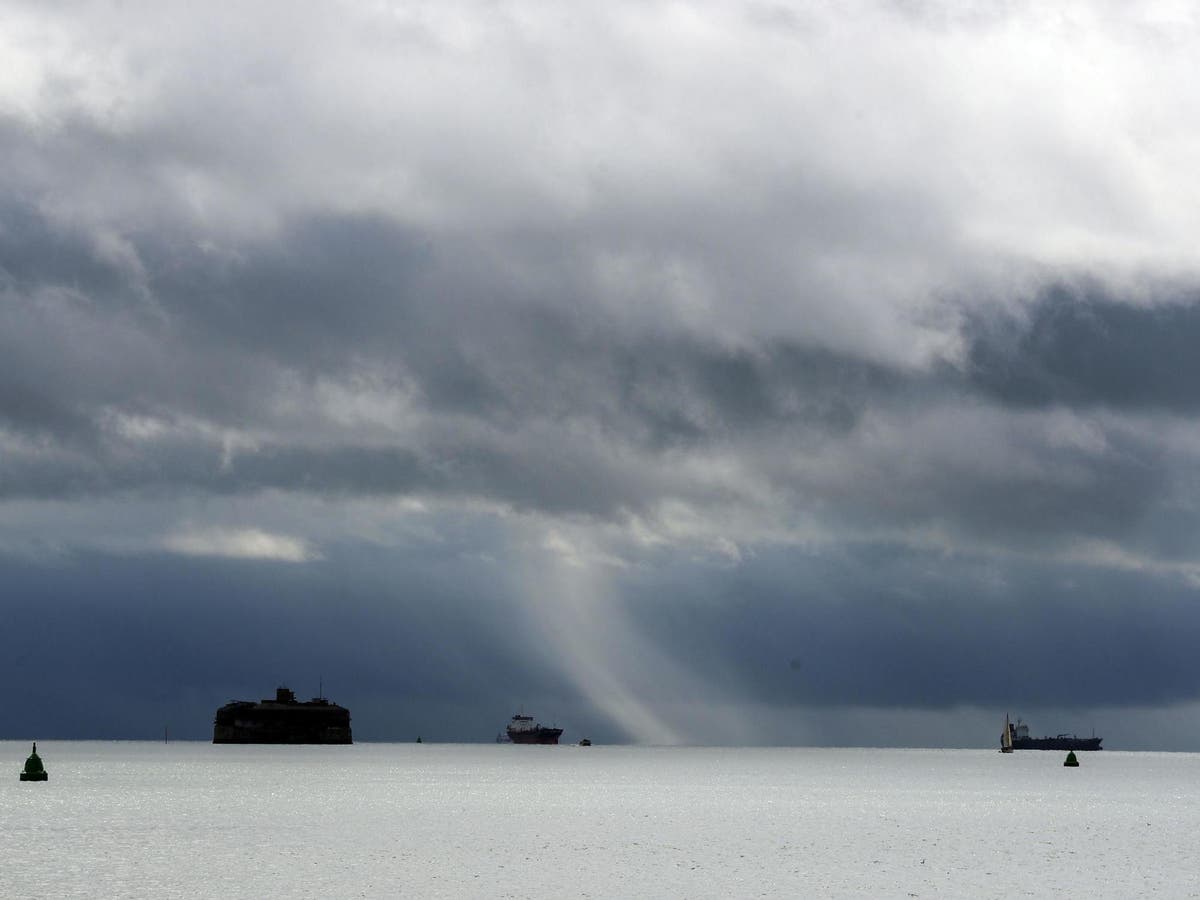
Your support makes all the difference.Trains have been cancelled and hundreds of schools closed as Storm Otto lashes Scotland and England.
Rail lines between York and Edinburgh are currently blocked as low-cost rail operator Lumo warned this morning: “Due to high winds between York and Edinburgh all lines are blocked.
Meanwhile The Met Office has confirmed a new ‘stratospheric event’ that previously led to the 2018’s Beast from the East snowstorm has started.
Despite the name, Sudden Stratospheric Warming (SSW) can cause very cold conditions similar to five years ago, when the UK saw up to 22 inches of snowfall.
Meanwhile, electricity company SSEN has said there are 101 power outages in Scotland, and more than 130,000 customers on its priority services register have been contacted with storm advice.
Yellow weather warnings for wind have been issued for the whole of Scotland and a stretch of north and north-east England running from Sheffield to the Scottish border.


We are now pausing our live updates on Storm Otto for the evening.
Thank you for joining us.
Storm Otto: First named storm of the year to batter UK with 75mph winds
The first named storm of the year is set to batter parts of the UK with 75mph winds on Friday.
Parts of Scotland and north-east England have been warned to brace for disruption from high winds and rain as Storm Otto approaches the UK.
The storm was named by the Danish Meteorological Institute (DMI) and will move east across the far north of the UK from the early hours of Friday morning, bringing gusts in excess of 75mph.
Read our full report here:
Storm Otto to batter UK with 75mph winds as Met Office issues weather warnings
Tips for staying safe in strong wind
The Met Office has shared five handy tips for staying safe in strong wind.
Protecting your property and people from harm
Check for loose items outside your home and plan how you could secure them in high winds.
Prepare before making journeys
Forecasters advise planning your route and checking for any delays or road closures. Otherwise, create a pack of essentials and make sure to take a fully charged mobile phone.
Drive safely, if at all
Suggestions include driving slowly to minimise the impact of wind gusts and being aware of high-sided vehicles/caravans on more exposed roads
Staying safe on the coast
If you live or work on the coast, stay alert to the possibility of large waves and walking near the edge of cliffs. Keeping an eye on the local forecast and ride predictions is also key.
Avoiding injuries
Stay indoors as much as possible. If you do go out, try not to walk or shelter close to buildings and trees.
For more detailed advice, visit this Met Office webpage.
Temperatures to climb overnight as winds descend
Temperatures are set to climb overnight as cloud and strong winds descend.
The Met Office has forecast highs of 12C in London and The Borders by 5am on Friday.
Map showing areas covered by yellow warnings
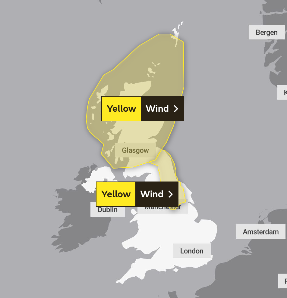
Scotland weather warning: What do forecasters say?
The first of two weather warnings issued by the Met Office covers the length and breadth of Scotland.
Here’s what the Met Office say:
A spell of very strong winds across Scotland associated with Storm Otto may bring some disruption during Friday.
What to expect
- Injuries and danger to life from flying debris are possible
- Some damage to buildings, such as tiles blown from roofs, could happen
- Road, rail, air and ferry services may be affected, with longer journey times and cancellations possible
- Some roads and bridges may close
- Power cuts may occur, with the potential to affect other services, such as mobile phone coverage
- Injuries and danger to life could occur from large waves and beach material being thrown onto sea fronts, coastal roads and properties
England weather warning: What do forecasters say?
A weather warning was also issued for a vast stretch of northeast and central England, starting from Newcastle in the north down to Sheffield further south.
Here’s what the forecasters say
Very strong winds developing through Friday morning associated with Storm Otto may bring disruption to travel.
What to expect
- Road, rail, air and ferry services may be affected, with longer journey times and cancellations possible. High-sided vehicles may be particularly prone in this set-up.
- Some roads and bridges may close
- Power cuts may occur, with the potential to affect other services, such as mobile phone coverage
- Some damage to buildings, such as tiles blown from roofs, could happen
- Injuries and danger to life from flying debris are possible
Latest from the Met Office as Storm Otto approaches
A “very windy morning” is on the cards for many, especially those further north, say forecasters.
The Met Office warns gusts in excess of 75mph will tear through the UK as Storm Otto approaches.
High winds, rain, and travel disruption expected in parts of the UK
Storm Otto is set to cause disruption to parts of Scotland and north-east England as it moves across the country today,
The Met Office has said the high winds will mean travel disruption and possible damage to buildings in places and warned the drivers of high-sided vehicles to be careful.
Read more:

Storm Otto to bring high winds, rain, and travel disruption to parts of the UK
How do storms and hurricanes get their names?
From the not-so-bygone days of Storms Eunice and Dudley, which battered the country this time last year, The Independent’s Joe Sommerlad took a look at how and why storms like these come to be given human names:

Join our commenting forum
Join thought-provoking conversations, follow other Independent readers and see their replies
Comments