Storm Agnes latest: Met Office issues new weather warning for torrential rain
The warning is set to kick in at 8pm on Thursday and remain in place until 2am on Friday morning.
Your support helps us to tell the story
From reproductive rights to climate change to Big Tech, The Independent is on the ground when the story is developing. Whether it's investigating the financials of Elon Musk's pro-Trump PAC or producing our latest documentary, 'The A Word', which shines a light on the American women fighting for reproductive rights, we know how important it is to parse out the facts from the messaging.
At such a critical moment in US history, we need reporters on the ground. Your donation allows us to keep sending journalists to speak to both sides of the story.
The Independent is trusted by Americans across the entire political spectrum. And unlike many other quality news outlets, we choose not to lock Americans out of our reporting and analysis with paywalls. We believe quality journalism should be available to everyone, paid for by those who can afford it.
Your support makes all the difference.The Met Office have issued a new weather warning for torrential rain this evening.
It comes as Storm Agnes arrived overnight with powerful 80mph gusts, leading to power outages, widespread flooding and the toppling of trees.
A yellow weather warning was issued by the forecaster on Thursday morning, just hours after the last weather warning for wind was removed at 7am. The new warning will affect areas in southern Wales including Cardiff, Newport and Swansea.
The warning is set to kick in at 8pm on Thursday and remain in place until 2am on Friday morning.
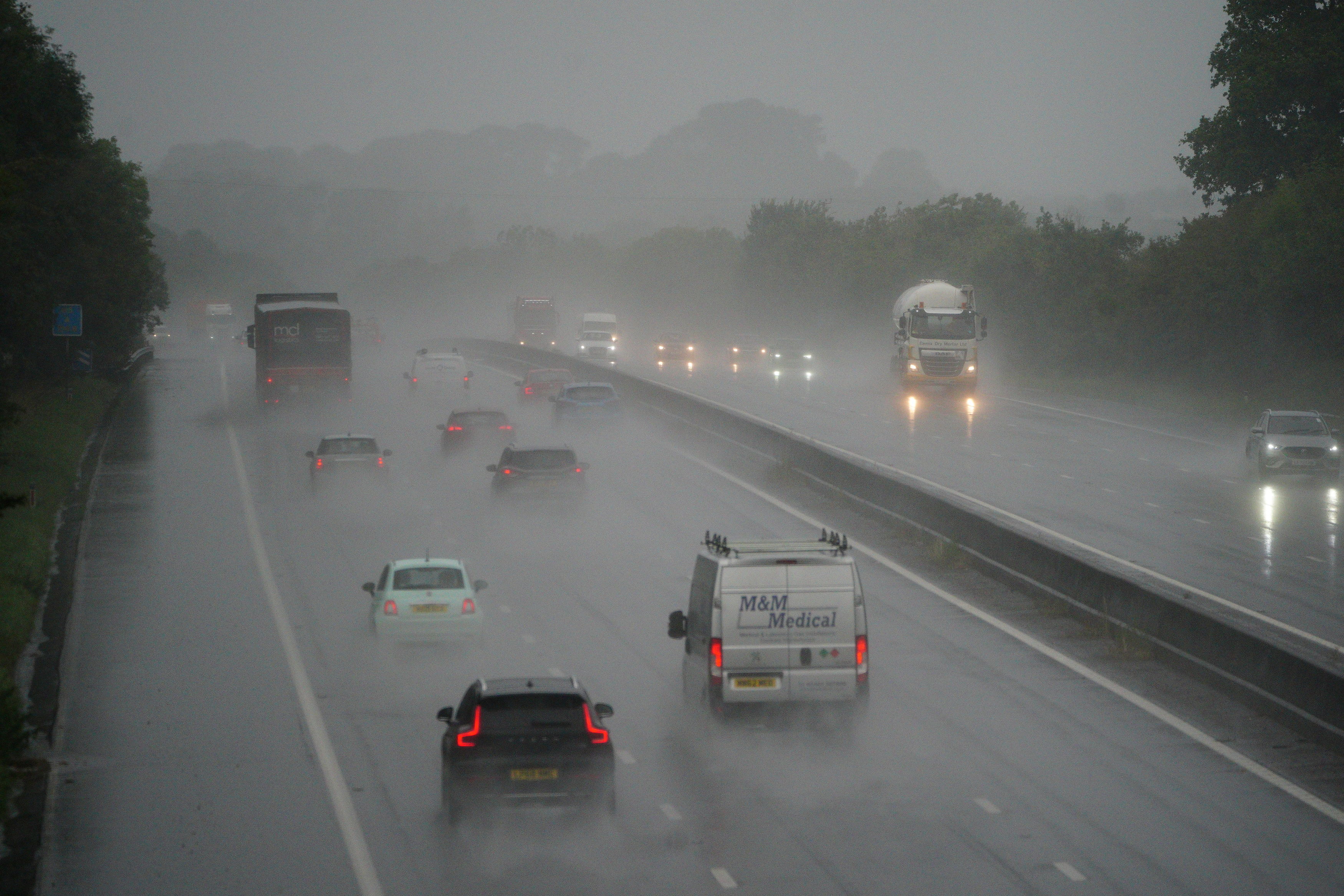
The Met Office say people should expect “difficult driving conditons and perhaps a few road closures”, as well as delays or cancellations to train and bus services.
Gusts of up to 70mph had already been recorded in south-west Ireland, with the storm hitting areas of northern England and Scotland on Wednesday.
In addition to the weather warning, there are currently 11 flood warnings and 20 flood alerts still in place across England, Scotland and Wales.
Impacted by Storm Agnes? Send your pictures and videos to alexander.ross@independent.co.uk.
Met Office issues fresh weather warning
The Met Office have issued a new weather warning for heavy rain this evening.
A yellow weather warning was issued by the forecaster on Thursday morning, just hours after the last weather warning for wind was removed at 7am.
The new warning will affect areas in southern Wales including Cardiff, Newport and Swansea.
The Met Office say people should expect “difficult driving conditons and perhaps a few road closures”, as well as delays or cancellations to train and bus services.
The warning is set to kick in at 8pm on Thursday and remain in place until 2am on Friday morning.
UK weather forecast today
The Met Office is predicting an initially dry and bright start to the day as Storm Agnes is set to arrive from the west by the afternoon.
The storm will bring heavy rain and strong winds, prompting yellow weather warnings in large parts of the UK.
The north is set to be battered by rain while a warning for heavy gusts of wind covers Scotland, Northern Ireland and Wales as well as the south-west of England, the West Midlands and most of the north of England.
The forecaster said disruptions like flooding and some localised damage are likely.
However, the southeast will escape the worst and may remain relatively drier, with lighter winds. Temperatures there are expected to be above normal for this time of year.
The rain and strong wind is forecast to stay overnight, especially across the north, as Storm Agnes continues to moves northeastwards.
The south will begin to turn drier with winds easing.
On Thursday the storm will start to diminish, the forecaster says. The day will start largely dry with possibilities of some bright spells. However, heavy showers will arrive from the west in the late afternoon and evening as another yellow warning is in place for the north.
Western coasts will continue to feel breezy.
⚠️ A windy Wednesday for most with #StormAgnes moving in
— Met Office (@metoffice) September 26, 2023
Find out how wet and #windy it will be where you live in today's edition of the #4cast 👇 pic.twitter.com/5JklZX13Xv
Storm tracker: When will Storm Agnes reach UK and what will be its path?
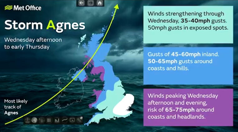
Storm Agnes will start impacting the UK this afternoon as it crosses through the northwest and then northern regions.
“The storm centre itself remains over the Atlantic and will continue approaching and cross the UK through Wednesday afternoon and will move away Wednesday night into Thursday,” Oli Claydon, a spokesperson for Met Office, said.
“In terms of most impacted areas, we’re looking at the Irish Sea coasts, so south-eastern parts of Northern Ireland, west and north-western coasts of Wales, and the north-western coast of England.”
The storm could cause power cuts, blow tiles from roofs and disrupt railways and roads, the Met Office warned on its website.
Mr Claydon also said the storm could knock over trees and disrupt the Irish Sea ferry network.
Here is the path of the storm:

Storm Agnes to cause 'dangerous conditions' on coasts around UK and Ireland
The Royal National Lifeboat Institution (RNLI) has said that Storm Agnes was likely to cause dangerous conditions on the coasts around the UK and Ireland as heavy rain and winds are set to lash both countries.
“The RNLI advises staying a safe distance away from the water and cliff edges as the conditions could knock you off your feet or wash you into the sea. It is not worth risking your life," Sam Hughes, an RNLI water safety partner, said.
“If you see someone else in danger in the water, call 999 or 112 and ask for the Coastguard. If you have something that floats that they can hold on to, throw it to them. Don’t go in the water yourself – you may end up in difficulty too.”
🌊 As well as strong winds, #StormAgnes will also bring very rough seas and large waves, especially through the Irish Sea
— Met Office (@metoffice) September 26, 2023
🛳️ With high spring tides, some coastal areas are at risk of flooding and some ferry services may be disrupted pic.twitter.com/EJm2eUpa1F
Storm Agnes to bring 75mph winds to the UK today
As Storm Agnes is set to arrive to the UK today Britain is bracing for 75mph winds and torrential rain.
Three yellow warnings have been issued for Wednesday so far, including two for rain and one for wind, with one remaining in place until Thursday morning. A danger to life warning was also issued by the forecaster for Wednesday and Thursday.
Last night, the Met Office said the storm was ‘intensifying quickly’ as it made it’s way over the Atlantic Ocean towards the UK.
The Met Office warned that some coastal areas are due to see winds of over 75 mph, while places inland will may experience gusts of up to 60mph. They say that these are most likely during the second half of Wednesday afternoon and through the evening.
People in Scotland will also see heavy rain in ‘many parts’ of the country, with flood alerts and warnings being “issued as necessary”.

Highway officials says to ‘adjust driving’ as Storm Agnes looms
A spokesperson at National Highways has warned British drivers to “adjust” their driving behaviour ahead of Storm Agnes.
Steve Basterfield, national network manager at National Highways, said: “With the stormy weather being forecast, it is important to plan ahead for your journey, and if weather conditions become challenging, adjust your driving behaviour and take extra care.
“We have a section of our website dedicated to travelling amid storms, high winds and gales, and considerations for different types of vehicle, as part of our guide to travelling in severe weather. It’s also a good idea for people to check their vehicles, such as tyres, coolant and oil levels, before heading out to reduce the risk of breakdowns.”

Met Office warns of winds 'quickly strengthening’ in today’s forecast
The Met Office have warned of “winds quickly strengthening’ in today’s morning forecast.
In a post on X, formerly known as Twitter: “A calm start to Wednesday morning with any mist and low cloud soon lifting giving bright or sunny skies for many.
“Winds quickly strengthening in the west as #StormAgnes approaches bringing bands of rain, turning heaviest and most persistent across Northern Ireland.”
Agnes ‘expected’ to bring travel disruption
A spokesperson for Transport Scotland said it is ‘expected’ that Agnes will bring some ‘disruption to the transport network’.
It comes as the Met Office has issued a yellow weather warning for wind across the UK today and say transpoty disruption is ‘likely’.
Stein Connelly from Transport Scotland said: “Storm Agnes is the first storm of the year and it’s expected to bring some disruption to the transport network, so we’d ask people who are looking to travel to plan their journeys ahead of time.
“The conditions could also lead to disruption on other modes of transport, so if you’re planning to travel by train, ferry or air, you should check with your operator to see if your service is affected.”

Weather warnings activated as Storm Agnes arrives in Ireland
Weather warnings have been activated as Storm Agnes arrives in Ireland.
Strong winds were reported in County Cork at 9am, with the storm expected to arrive in Northern Ireland at lunchtime. In the Republic of Ireland a status orange wind warning is in place in several counties and both Met Eireann and the Met Office have warned of the possibility of disruption to travel.
A status yellow warning for rain is also in place across large areas in Ireland. In Northern Ireland a yellow warning for rain is in place until 8pm on Wednesday, with a yellow warning for high winds.
The storm, which is the first named storm of the season, is forecast to bring strong and disruptive winds until Thursday morning.
The Met Office has warned this could lead to an increased risk of flooding as the storm continues to push north and east.
Storm Agnes caught on camera arriving in Ireland
As Storm Agnes arrives on the south coast of Ireland, people have taken to social media to post footage of the extreme weather.
One video, filmed in Clonakilty Bay, shows extreme wind accompanied by heavy rain arrive at the Irish shore.


Join our commenting forum
Join thought-provoking conversations, follow other Independent readers and see their replies
Comments