Storm Claudio news – live: Met Office issues new weather warning as trains cancelled
Winds of up to 70mph hit England’s southern coast
Your support helps us to tell the story
From reproductive rights to climate change to Big Tech, The Independent is on the ground when the story is developing. Whether it's investigating the financials of Elon Musk's pro-Trump PAC or producing our latest documentary, 'The A Word', which shines a light on the American women fighting for reproductive rights, we know how important it is to parse out the facts from the messaging.
At such a critical moment in US history, we need reporters on the ground. Your donation allows us to keep sending journalists to speak to both sides of the story.
The Independent is trusted by Americans across the entire political spectrum. And unlike many other quality news outlets, we choose not to lock Americans out of our reporting and analysis with paywalls. We believe quality journalism should be available to everyone, paid for by those who can afford it.
Your support makes all the difference.The Met Office has issued a new weather warning as Storm Claudio continues to batter the UK with strong winds and rain.
While southern England has been the worst-hit so far, northern England has now been given a yellow weather warning for wind for most of tomorrow. Areas of Wales are also covered.
Meanwhile, Northern Ireland and southern parts of Scotland have now been hit with a rain warning on Wednesday..
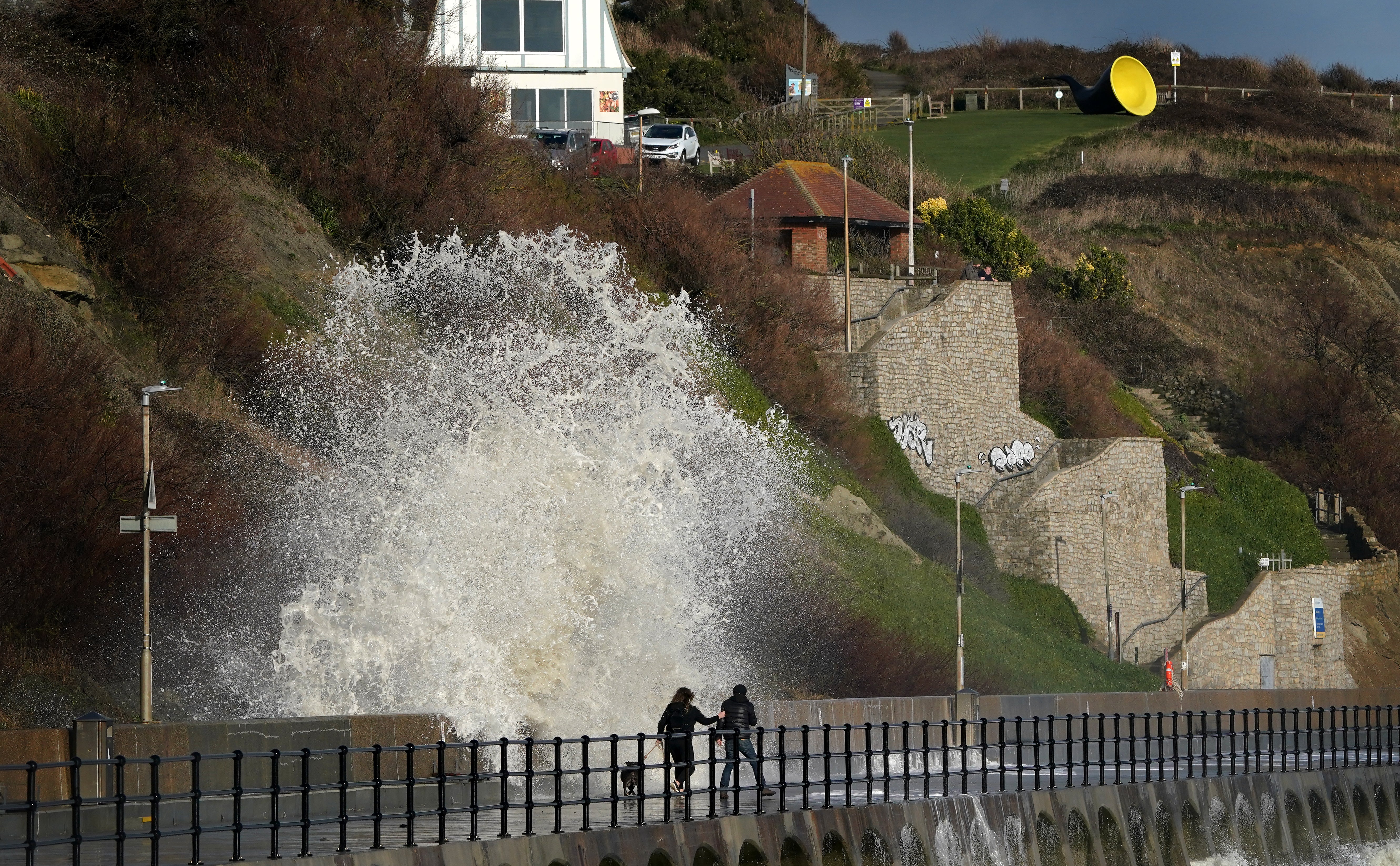
Storm Claudio has already brought 70mph winds to southern England. and caused disruption to the rails, with trains cancelled or services facing delays this morning.
It is expected to move eastward to bring heavy showers across southern and central England throughout the day.
Human-induced global heating is making extreme weather events including rainfall during storms more intense, meaning the storms can cause more damage.
The new storm comes after the UK experienced above-average temperatures as October drew to a close.


Cancelled trains
The storm is already causing travel disruption on the rails:
Videos from Storm Claudio
Here are some other dramatic images and videos from the storm being shared on social media:
Bins and trampolines blown around
People are waking up to the impacts of Storm Claudio...
Full story: Storm Claudio to bring 70mph gusts and heavy rain
Storm Claudio is set to bring gusts up to 70 miles per hour with heavy rain across areas of southern England, Thomas Kingsley reports.
The Met Office has issued a yellow weather warning for wind for the south until 8am on Tuesday, saying the weather could risk causing disruption.
Full story:

UK braces for Storm Claudio with three day warning for heavy rain and 70mph winds
Heavy rain could bring flooding in some areas, the Met Office warns
What does a yellow warning mean for UK?
A yellow warning for rain is in place until 8am across much of England and parts of Wales as Storm Claudio moves eastwards to leave a showery day in its wake.
Some delays to road, rail, air and ferry transport can be expected as large parts of the country remain under the yellow warning.
Bus and train services may also be affected, with some journeys taking longer.
'Wild now in Cornwall': People share experiences as Storm Claudio hits
November is getting off to a wet and windy start as parts of the UK feel the effects of a storm arriving from France.
Some people shared on social media how the winds kept them up at night or the intensity of the storm exceeded their expectations.
“This is absolutely wild in Cornwall now. And we not even in red zone according to this. Good luck along the channel coast #stormclaudio,” wrote one user.
“Sounded like a tornado out there with all of whatever flying about,” wrote another user.
Southern and western areas of the country were forecast to face blustery winds and frequent heavy rain showers overnight on Monday and into today.
Winds likely to be strongest along Irish Sea
The Met office has said winds are likely to be strongest along Irish Sea coastal areas, including western Wales, north-west England and south-west Scotland, as well as the east coast of Northern Ireland.
It has issued a yellow weather warning for wind tomorrow from the morning until the early evening.
Deputy chief meteorologist Steven Keates said: “Within the warning area, gusts are expected of between 55 and 65mph.
“This is associated with low pressure moving towards the north-west of the UK, which is bringing with it some heavy rain on Wednesday, especially across parts of south-west Scotland, Cumbria and western Wales, although much of the UK will see some rain through the day.”
“In addition to high winds in the warning area, many parts of the UK will experience strong and gusty winds, at least for a time, during Wednesday.”
Northern France to be hardest hit by Storm Claudio
Met Office chief meteorologist Neil Armstrong said: “The biggest impacts from Storm Claudio are expected in northern France, which is why is has been named as a system by Météo-France. What it means for us in the UK is for some high winds to be possible along much of the southern coast of England.
“Some isolated and especially exposed coastal areas could see gusts in excess of 70mph, while much of the warning area will see gusts of between 50 and 60mph.”
Heavy rain could bring flooding, Met Office warns
Deputy Chief Meteorologist Steven Keates said heavy rain will continue into Wednesday with the risk of flooding and travel disruption.
“Within the warning area, gusts are expected of between 55 and 65mph. This is associated with low pressure moving towards the northwest of the UK, which is bringing with it some heavy rain on Wednesday, especially across parts of southwest Scotland, Cumbria and western Wales, although much of the UK will see some rain through the day,” Mr Keates warned.
“In addition to high winds in the warning area, many parts of the UK will experience strong and gusty winds, at least for a time, during Wednesday.”
The Met Office warned that the heavy rain could bring flooding and other travel disruption.
Join our commenting forum
Join thought-provoking conversations, follow other Independent readers and see their replies
Comments