Winter storm warnings: Flash flooding continues as weekend threatens repeat storms
At least four deaths were attributed to Storm Finn, a major winter storm pummeling the US including Florida and New York
Your support helps us to tell the story
From reproductive rights to climate change to Big Tech, The Independent is on the ground when the story is developing. Whether it's investigating the financials of Elon Musk's pro-Trump PAC or producing our latest documentary, 'The A Word', which shines a light on the American women fighting for reproductive rights, we know how important it is to parse out the facts from the messaging.
At such a critical moment in US history, we need reporters on the ground. Your donation allows us to keep sending journalists to speak to both sides of the story.
The Independent is trusted by Americans across the entire political spectrum. And unlike many other quality news outlets, we choose not to lock Americans out of our reporting and analysis with paywalls. We believe quality journalism should be available to everyone, paid for by those who can afford it.
Your support makes all the difference.As the northeast braces for flooding rain and damaging winds through Wednesday, meteorologists forecast a second storm will blow through the eastern half of the US late this week.
The southeast should brace for a repeat of destructive winds and possible tornadoes, the National Weather Service (NWS) Storm Prediction Center said Wednesday. Meanwhile, the midwest can expect even more snow over the weekend, while rain will continue to beat down on the northeast, according to the NWS.
As for Wednesday, flooding rain and damaging winds will hit Boston, Massachusetts overnight, while New York City residents should remain braced for potential flooding throughout the day.
Meanwhile, the south is recovering from the destruction of a devastating storm earlier this week.
Four people have died and 890,000 homes were left without power after Storm Finn ripped through the Atlantic Coast, from Florida to New York. The deaths were reported in North Carolina, Georgia and Alabama.
Fourteen tornadoes were reported across Florida, Alabama, Georgia and South Carolina on Tuesday, causing significant damage, blowing roofs off homes and prompting rescues in Florida’s panhandle, which was hit with 55 mph winds and hail.


Major storm to bring dangerous blizzards and floods to southeast
Major winter storms are pummelling vast swathes of the US, with dangerous blizzards, flash flooding and possible tornadoes heading to the Southeast this week after the East Coast was blanketed in heavy snow over the weekend.
Almost 70 million Americans are bracing for severe weather which is currently charting a path towards the Gulf Coast and Southeast on Monday and Tuesday.
Storm Finn is expected to bring tornadoes to cities including New Orleans, Louisiana, Gulfport, Mississippi, and Mobile, Alabama, while more than half a dozen states could see snowfall through Monday afternoon and overnight.
The National Weather Service forecasts that the storm will head further east on Tuesday, hitting Tallahassee, Florida, Albany, Georgia, and Panama City, Florida, meanwhile the Cuyama Valley, California, is under a hard freeze warning until Tuesday morning.
Severe weather has already caused disruption, with officials in Arizona warning against non-essential travel after multiple crashes closed parts of the I-40.
More than 6,000 flights into, out of, or within the US were also delayed or cancelled on Sunday due to severe weather, according to FlightAware. It comes after Storm Ember brought 18 inches of snow to parts of the Northeast including New York.
Texas Governor increases readiness of State Operations Center ahead of severe weather
Texas Governor Greg Abbott has increased the readiness of State Operations Center to level two ahead of a severe storm that is expected to hit the southeast today.
According to the National Weather Service, an early week system of storms will bring multiple hazards to the state beginning Monday, including strong winds, blowing snow, critical fire weather conditions, and severe thunderstorms.
Snowfall and dangerous wind chills are expected to impact the Panhandle, while fire weather conditions are anticipated in West/Southwest Texas.
Meanwhile, severe thunderstorms with large hail, heavy rainfall, and flash flooding threats are expected to impact East/Southeast Texas, while gusts could reach 60-70 miles per hour in some areas.
“The State of Texas stands ready to deploy all available resources to take care of Texans and our communities as multiple severe weather threats begin to impact the state tomorrow,” said Governor Abbott. “To ensure that support and resources are swiftly deployed to all impacted communities, I directed the Texas Division of Emergency Management to increase the readiness level of the State Operation Center. Texans in at-risk areas are encouraged to remain vigilant, monitor weather conditions, and heed the guidance of local officials and emergency management personnel.”
Cuyama Valley, California, under a hard freeze warning until Tuesday morning
Cuyama Valley, California is under a hard freeze warning until Tuesday morning, the National Weather Service has said.
NWS issues a hard freeze warning when temperatures are expected to drop below 28°F for an extended period of time, killing most types of commercial crops and residential plants.
The warning will remain in effect until 10am PST, while a hard freeze watch will be in place until Tuesday morning.
The NWS has warned of damage to outdoor plumbing and severe damage to crops or sensitive vegetation, as well as harm to unprotected pets or livestock.
“Take steps now to protect tender plants from the cold,” the NWS said in a statement. “To prevent freezing and possible bursting of outdoor water pipes they should be wrapped, drained, or allowed to drip slowly. Those that have in-ground sprinkler systems should drain them and cover above-ground pipes to protect them from freezing.“
Major storm causes road closures and flight cancellations
A major storm has caused severe travel disruption in the southeast, with roads closed and flights cancelled.
Officials in Arizona have warned against non-essential travel after multiple crashes closed parts of the I-40.
Meanwhile, More than 6,000 flights into, out of, or within the US were also delayed on Sunday due to severe weather, according to FlightAware.
At least 828 US flights were canceled on the same day.
Some airports have also reported significant operational disruptions. Near Hartford, Connecticut, Bradley International Airport, announced 20 percent of its flights had been canceled Sunday as snow removal operations were underway.
Strong winds to bring flash flooding to eastern Gulf Coast and much of the East Coast
Strong winds could cause flash flooding along the eastern Gulf Coast and much of the East Coast, according to the Weather Prediction Center.
Between one to three inches of rainfall is expected in the Gulf Coast, stretching to New England, while rainfall in isolated locations could exceed four inches.
“Widespread and potentially significant river and flash flooding are likely from the central Gulf Coast through much of the Eastern U.S. early this week,” the Weather Prediction Center said. “Powerful onshore winds will lead to widespread coastal flooding along the eastern Gulf Coast and much of the East Coast.”
There’s serious concern for flooding in the Northeast with this next wave of rain coming right after a previous snowstorm dropped more than half a foot of snow in multiple Northeast states.
Meanwhile, there is a Level 3 out of 4 risk for flooding in portions of New Jersey, New York and Pennsylvania on Tuesday. A Level 2 of 4 threat spans nearly the entire path of the first storm – from Georgia through Massachusetts.
A Level 3 of 4 risk for flooding is also in place along the western coast of Louisiana to the Florida Panhandle for the flood potential from the initial round of rain on Monday.
Recap: Heavy snow coats New York as Winter Storm hits Northeast
Tornadoes could hit multiple states on Monday
Tornadoes could hit multiple states on Monday amid a powerful storm in the southeast of the US.
Storm Finn is expected to bring tornadoes to cities including New Orleans, Louisiana, Gulfport, Mississippi, and Mobile, Alabama.
The threat of dangerous nighttime tornadoes may ramp up Monday night and early Tuesday, especially from southeast Louisiana to southern Mississippi, southern Alabama and the western Florida Panhandle.
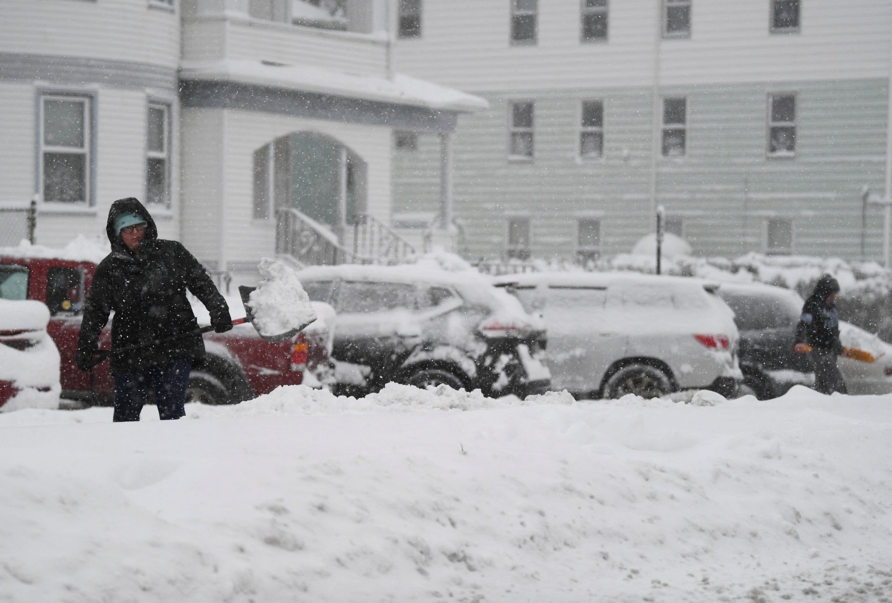
Heavy sonwfall pictured in Massachusetts
Storm Finn a ‘Kitchen Sink Storm,’ says senior meteorologis
The Weather Channel’s senior meteorologist Chris Dolce called has called Finn a “kitchen sink storm.”
A kitchen sink storm described a storm that causes many hazards at once, according to Mr Dolce.
Storm Finn is expected to bring rainfall, strong winds, snow and tornadoes to the southeast of the US on Monday.
“Finn’s threats cover a broad spectrum and the storm is just getting underway in the West,” Mr Dolce said.
“Areas from the Central Plains to the upper Midwest and parts of the western and northern Great Lakes will see a combo of snow and strong winds, contributing to low visibility and dangerous travel conditions Monday through Tuesday,” he added.
Join our commenting forum
Join thought-provoking conversations, follow other Independent readers and see their replies
Comments