Mapped: Where snow is forecast this week as temperatures plummet
Parts of UK expected to see ‘disruptive’ snow this week
Your support helps us to tell the story
From reproductive rights to climate change to Big Tech, The Independent is on the ground when the story is developing. Whether it's investigating the financials of Elon Musk's pro-Trump PAC or producing our latest documentary, 'The A Word', which shines a light on the American women fighting for reproductive rights, we know how important it is to parse out the facts from the messaging.
At such a critical moment in US history, we need reporters on the ground. Your donation allows us to keep sending journalists to speak to both sides of the story.
The Independent is trusted by Americans across the entire political spectrum. And unlike many other quality news outlets, we choose not to lock Americans out of our reporting and analysis with paywalls. We believe quality journalism should be available to everyone, paid for by those who can afford it.
Your support makes all the difference.Parts of Britain are facing a week of heavy snow as temperatures plummet below freezing for most of the country.
The Met Office has issued five yellow snow and ice warnings across Scotland, Northern Ireland, northern England, parts of Wales and eastern England as an “Arctic chill” is expected to bring up to 20cm of snow.
Temperatures are expected to be about 5 to 6C lower than usual for this time of year - with the Met Office warning the cold snap will wreak havoc on travel plans, trigger power cuts and even cut off rural communities.
All warnings are expected to expire by 11.59pm on Thursday.
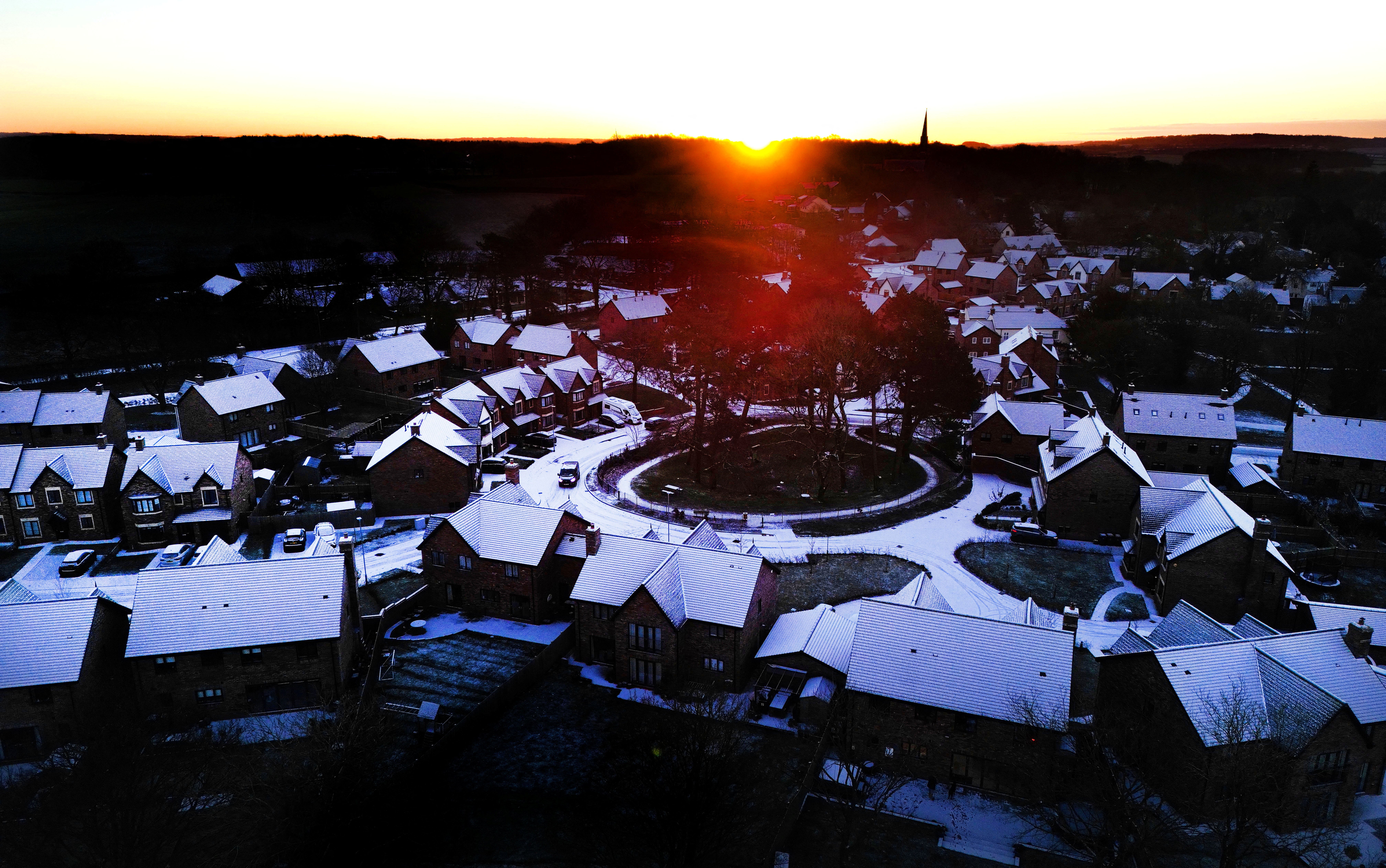
Snow has already started to fall in northern Scotland, with Aberdeen residents sharing pictures of their snow-covered streets on Monday morning.
Up to 10cm of snow is expected to fall there in just a few hours in some low-lying areas, with most places seeing 2-5cm of snow.
The wintry showers began there on Sunday night and are expected to continue to affect many areas until Thursday night, with the heaviest showers sweeping across northern Scotland on Wednesday and Thursday, where 20cm of snow could build up in some places.
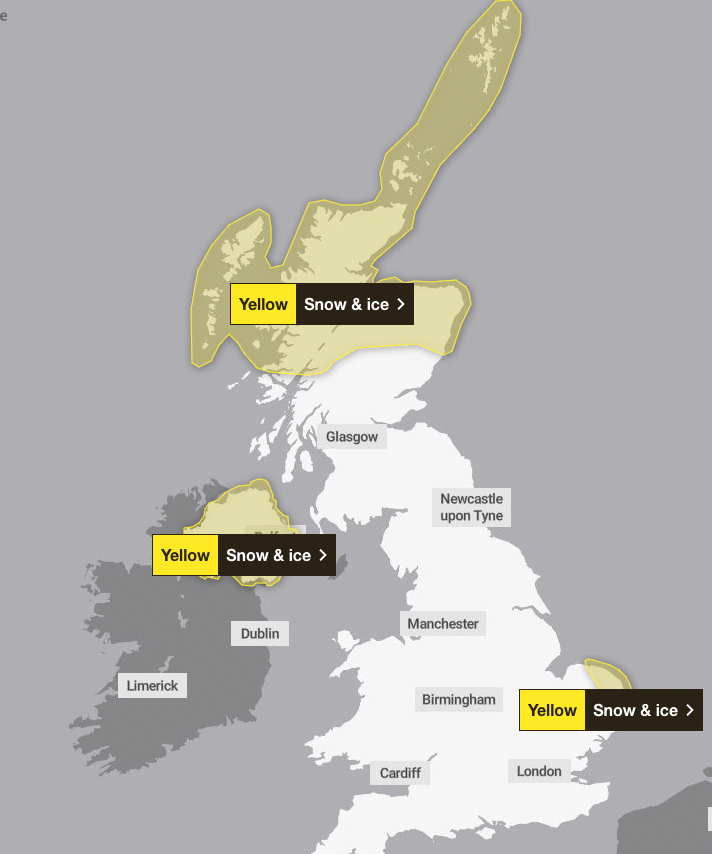
Norfolk and Suffolk will also see significant snowfall on Monday, particularly near the coast. This weather is expected to bring disruption to travel and injuries from slips on ice.
Meanwhile, in Northern Ireland, snow is likely to wreak havoc on roads and railways on Monday and Tuesday morning.
On Wednesday, heavy and frequent snow showers are expected to return to northern areas of the region, with 5cm of snow expected in many places.
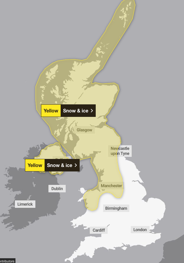
In England, the snow will sweep across northern England, Wales and even reach as far south as the Midlands on Tuesday.
Regions including Manchester, Newcastle and Derbyshire will see snow showers on Tuesday morning which the Met Office warns could cut off some rural communities and trigger power cuts across the nation.
The disruptive snow is expected to continue into Wednesday and Thursday in some of these areas including Yorkshire, the Midlands, Wales, northern Scotland and North West England.
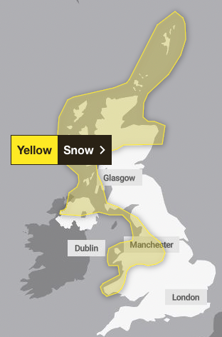
“Snow showers from Sunday onwards are most likely to move inland from coasts exposed to northerly winds,” Met Office deputy chief meteorologist Chris Bulmer explained.
He added: “There are a couple of weather systems for Tuesday and Wednesday which we are keeping an eye on that bring the potential for disruptive snow for some regions.
“With cold air firmly in place, any weather systems that move across the country next week will bringing mainly snowfall inland. Models are currently showing us a variety of options for both systems and we’ll be able to add more details to in the coming days.”
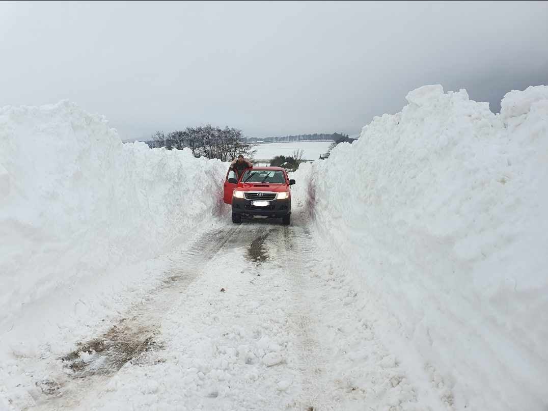
The mercury dipped to -10.4C in Aviemore, near Inverness, on Wednesday and temperatures are forecast to struggle to get above 0C across much of the country last week.
Highs of 3C are forecast for Glasgow, 4C in Manchester and 7C in London. South Wales is expected to be the warmest part of the country, with highs of 8C in the Cardiff region. Temperatures will then fall to -1C or -2C in most urban areas overnight on Monday.
On Thursday and Friday, forecasters say it will remain “very cold” with the potential for severe overnight frost.
The sub-zero temperatures have prompted the UK Health Security Agency to issue a Cold-Health Alert which highlights the significant impact the weather has on health and social care.
Dr Agostinho Sousa, Head of Extreme Events and Health Protection at UKHSA, said: “The temperatures we will see leading into the weekend can rapidly have a serious impact on the health of those over the age of 65 and those with pre-existing health conditions as it increases the risk of heart attacks, strokes and chest infections. It is therefore vital to check in on friends, family and neighbours to ensure they are well prepared for the cold weather next week.”
Towards the end of the week, it’s likely there will likely be a transition back to less cold conditions as Atlantic weather systems start to arrive from the west.
This will see a return to unsettled conditions with spells of rain and strong winds across all areas at times, forecasters say.

Join our commenting forum
Join thought-provoking conversations, follow other Independent readers and see their replies
Comments