Severe weather warning issued as torrential rain and hail to lash UK
Met Office warns of flooding as half a month’s rain could fall in an hour


A national severe weather warning has been issued as thunderstorms and hail are set to lash parts of the UK.
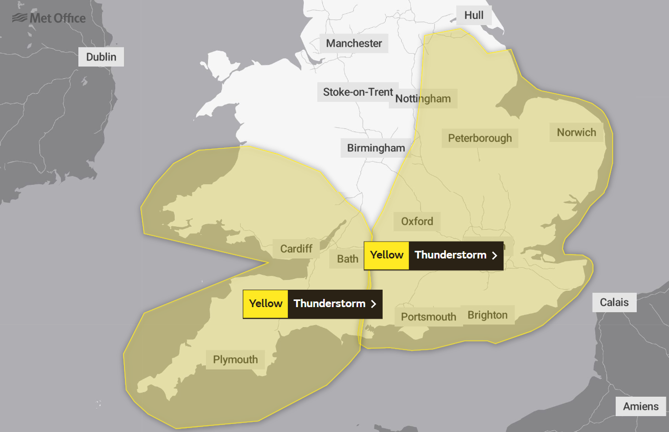
The Met Office yellow weather alert for southern and eastern England will come into force at 1pm on Sunday and will expire at 6am on Monday, with half a month’s rainfall set to fall within the space of an hour in some parts.
Heavy showers and thunderstorms are expected to bring some disruption, including the potential of surface-water flooding which could impact homes.

Potential road closures and difficult driving conditions could be caused by spray and sudden flooding.
The Met Office’s Chief Forecaster Steve Willington said: “Some within the warning area could see torrential rain, perhaps even reaching 40mm of rainfall within the hour.
“Later in the warning period there is a risk of large hail, frequent lightning and gusty winds.”
The fresh alert follows an earlier warning issued across parts of southwest England and south Wales, warning of a possible “risk to life”, which is due to expire at 6pm today.
Heavy rain brought “torrential downpours” across the southwest of England on Sunday morning, with localised flooding in south Devon.
Further storms are also possible in the coming days as the remnants of Hurricane Lee, which hit New England in the US and eastern Canada, set to move across the UK from Tuesday.
Commenting on the longer-term outlook, the Met Office’s David Oliver said: “During the rest of today (Sunday) and tomorrow we will see a transition to fresher conditions, with the warmth and humidity of recent days being pushed eastwards away from the UK.
“This will allow fresher and, at times, unsettled conditions driven by what is happening in the Atlantic.”
It comes after weeks of unseasonably high temperatures that saw a new record set when the UK experienced the seventh consecutive day of temperatures above 30C, making it the longest-running heatwave in the month of September.
Last Saturday was named the hottest day of 2023 with 32.7C recorded at Heathrow.
Downpours and thunderstorms followed the 2016 September heatwave, with forecasters predicting a similar pattern this year.
Join our commenting forum
Join thought-provoking conversations, follow other Independent readers and see their replies
Comments


Bookmark popover
Removed from bookmarks