Mapped: Met Office issues 10-hour warning for thunderstorms for UK
The Met Office says heavy rain and thunderstorms could lead to flooding and power cuts on Sunday

Your support helps us to tell the story
From reproductive rights to climate change to Big Tech, The Independent is on the ground when the story is developing. Whether it's investigating the financials of Elon Musk's pro-Trump PAC or producing our latest documentary, 'The A Word', which shines a light on the American women fighting for reproductive rights, we know how important it is to parse out the facts from the messaging.
At such a critical moment in US history, we need reporters on the ground. Your donation allows us to keep sending journalists to speak to both sides of the story.
The Independent is trusted by Americans across the entire political spectrum. And unlike many other quality news outlets, we choose not to lock Americans out of our reporting and analysis with paywalls. We believe quality journalism should be available to everyone, paid for by those who can afford it.
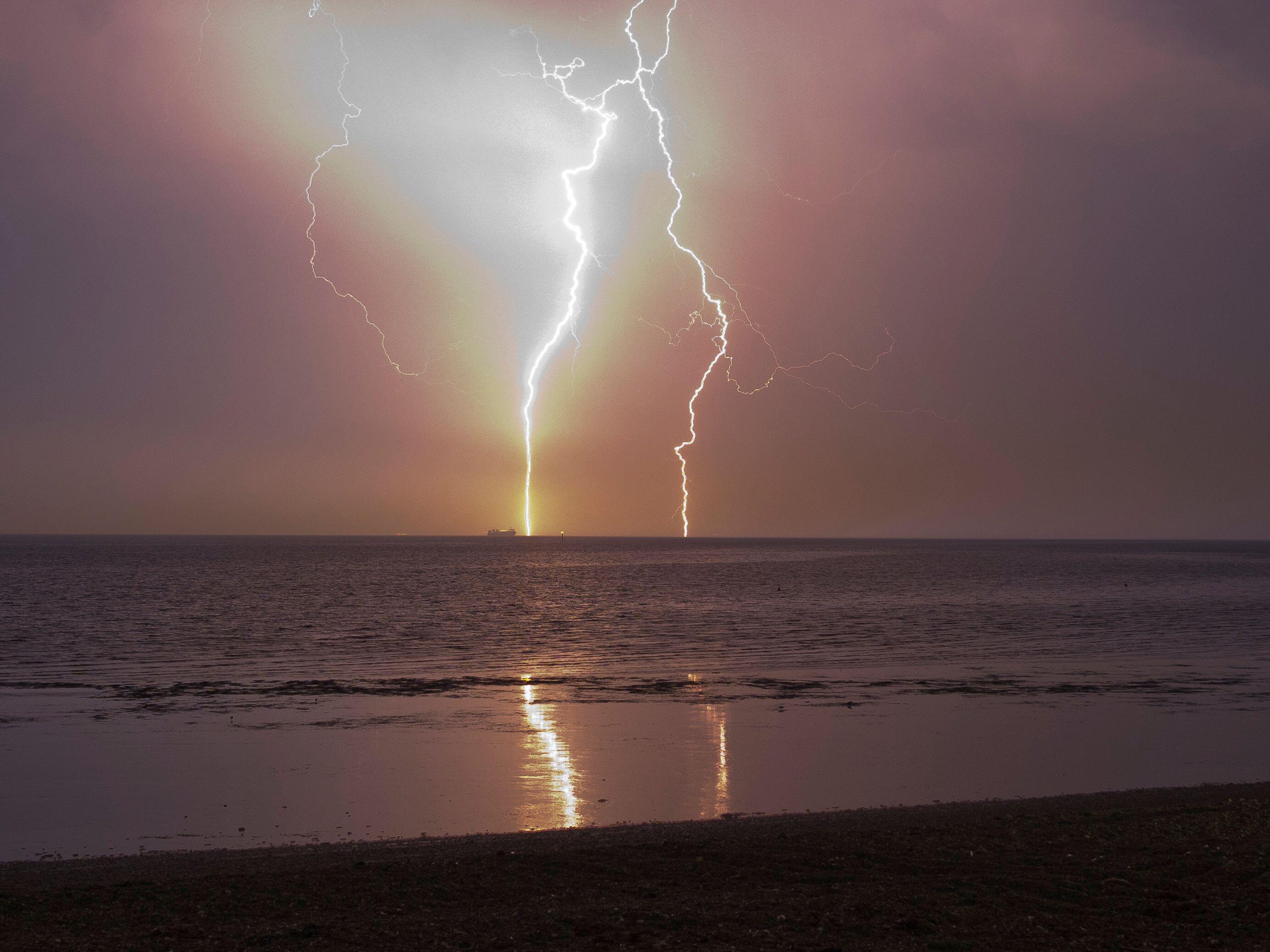
Your support makes all the difference.Heavy showers and thunderstorms are set to hit large parts of the UK on Sunday – after the country recorded the warmest day of the year so far on Saturday.
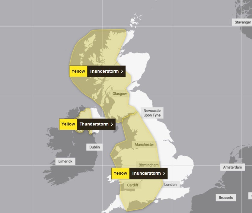
The Met Office has issued three yellow thunderstorm warnings from midday, with people warned of the chance of flooding and power cuts.
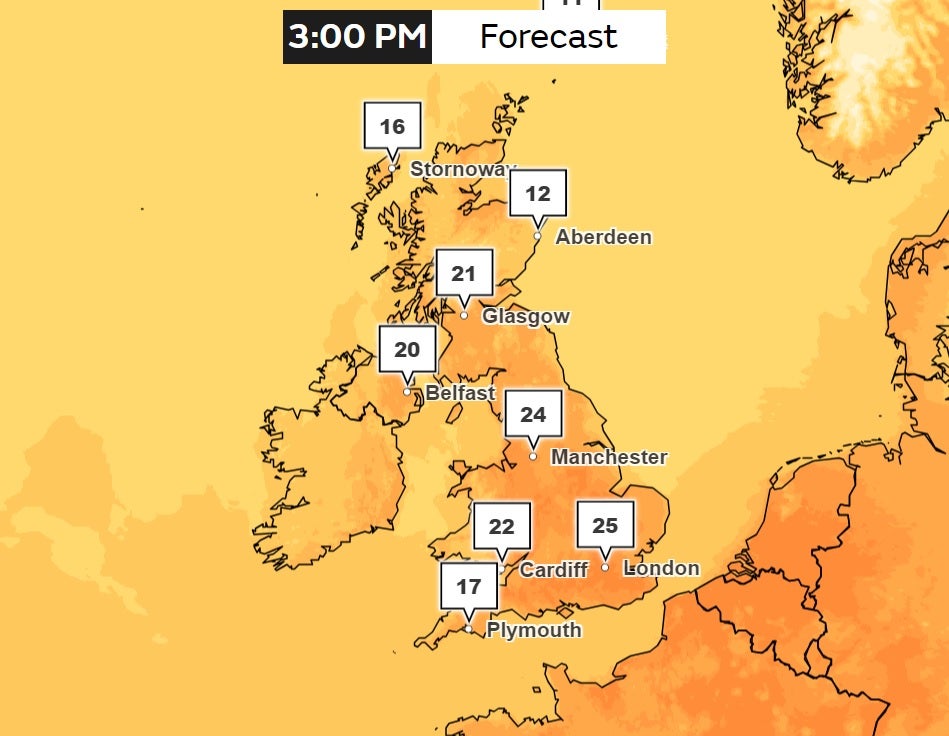
It will feel warm and humid, it said, with temperatures set to hit 27C in the southeast.
The first alert covering most areas of the west of the UK, including the majority of Wales, comes in at midday and lasts until 10pm.
The second is for the western half of Northern Ireland between 11am and 7pm. The third is for western parts of Scotland between 2pm on Sunday to 4am on Monday.

Simon Partridge, a meteorologist at the Met Office, said the record for the warmest day of the year so far on Saturday was “not likely to last long”.
He added: “The difference tomorrow is that it is not likely to be as warm for Northern Ireland, Wales or Scotland.
“The really warm air will probably be confined to southern and eastern parts of England, with temperatures expected to peak in central parts of the country at around 27C.”
On Saturday, temperatures peaked at 25.9C in Herstmonceux, East Sussex, and in northern Scotland a temperature of 25.7C was recorded in Cassley.
But unlike on Saturday, Mr Partridge said significant rainfall was expected on Sunday.

People in areas with a yellow warning should expect some disruption, especially to travel.
Spray and sudden flooding could lead to difficult driving conditions and there is a slight chance of power cuts, the Met Office said.
Temperatures climbed steadily over the past week, with the previous year record set on Thursday, with a peak of 24.6C in London’s St James’s Park.
The Royal Life Saving Society UK has warned that warmer weather is directly linked to an increase in fatal drowning incidents.
On Friday, 17-year-old Ronalds Abele died after getting into difficulty while swimming at the Embankment, in Wellingborough, and was pulled from the water by emergency services, Northamptonshire Police said. He was pronounced dead in hospital.
Join our commenting forum
Join thought-provoking conversations, follow other Independent readers and see their replies
Comments