UK set to have hottest day of year so far – as Storm Kathleen tears towards Britain with danger-to-life winds
Met Office warns of travel disruption and power cuts across swathes of country
Your support helps us to tell the story
From reproductive rights to climate change to Big Tech, The Independent is on the ground when the story is developing. Whether it's investigating the financials of Elon Musk's pro-Trump PAC or producing our latest documentary, 'The A Word', which shines a light on the American women fighting for reproductive rights, we know how important it is to parse out the facts from the messaging.
At such a critical moment in US history, we need reporters on the ground. Your donation allows us to keep sending journalists to speak to both sides of the story.
The Independent is trusted by Americans across the entire political spectrum. And unlike many other quality news outlets, we choose not to lock Americans out of our reporting and analysis with paywalls. We believe quality journalism should be available to everyone, paid for by those who can afford it.
Your support makes all the difference.The UK is expected to record its hottest day of the year so far – as storms batter parts of the country with heavy rain and winds that pose a risk to life.
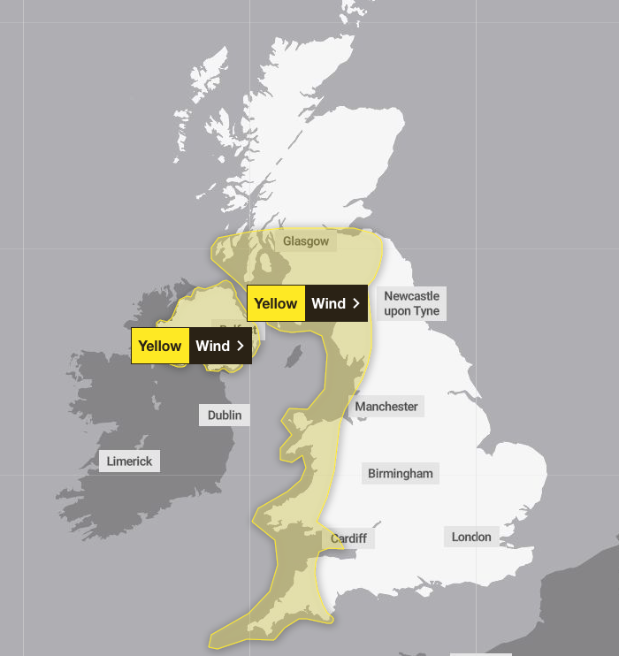
The Met Office said temperatures on Saturday could reach up to 22C in East Anglia, but issued a yellow warning elsewhere for gusts of up to 70mph.
Road, rail, air and ferry travel could all be disrupted as Storm Kathleen rolls in, forecasters said.

They warned of injuries and danger to life from “large waves and beach material being thrown on to sea fronts, coastal roads and properties”, adding: “Road, rail, air and ferry services may be affected, with longer journey times and cancellations possible.”
Roads and bridges might have to close, mobile phone coverage could be affected, and there could be power cuts, the experts said.
On Friday, the Met Office updated its weather warning to forecast stronger gusts during Storm Kathleen than previously predicted.

Kathleen started to roll in on Friday, bringing high winds to many areas.
The yellow warning, from 8am to 10pm on Saturday, covers western areas of the UK, including the northwest and southwest of England, Northern Ireland and parts of Scotland and Wales.
Follow live coverage of Storm Kathleen
Met Office chief meteorologist Dan Suri said Kathleen would bring strong gusty winds, particularly to western areas.
“Gusts of 50mph to 60mph are expected quite widely, while some exposed spots, particularly in coastal Northern Ireland, will have 60mph to 70mph gusts, with large waves also expected.”
There will also be blustery showers in the west, he said, although the eastern side of the UK is set to have a drier and brighter day.
“With the winds coming from the south, some unseasonably warm air will be drawn across parts of the UK.”

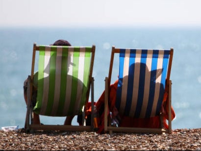
Temperatures in East Anglia could reach 21C or 22C on Saturday, he said – well above average for the time of year and the highest in the UK since October.
RAC Breakdown spokesperson Rod Dennis said: “This intense period of stormy weather is going to prove extremely challenging for anyone driving on the western side of the UK.
“We strongly urge drivers to avoid exposed coasts and higher routes where the impact of the very strong winds is most likely to be felt.”
Storm Kathleen, named by the Irish meteorological service Met Eireann, is the 11th named storm in eight months.
Join our commenting forum
Join thought-provoking conversations, follow other Independent readers and see their replies
Comments