UK weather: Thunderstorms and intense rain as Met Office issues three yellow weather warnings
Three simultaneous weather warnings could see the UK battered with rain over the weekend
Your support helps us to tell the story
From reproductive rights to climate change to Big Tech, The Independent is on the ground when the story is developing. Whether it's investigating the financials of Elon Musk's pro-Trump PAC or producing our latest documentary, 'The A Word', which shines a light on the American women fighting for reproductive rights, we know how important it is to parse out the facts from the messaging.
At such a critical moment in US history, we need reporters on the ground. Your donation allows us to keep sending journalists to speak to both sides of the story.
The Independent is trusted by Americans across the entire political spectrum. And unlike many other quality news outlets, we choose not to lock Americans out of our reporting and analysis with paywalls. We believe quality journalism should be available to everyone, paid for by those who can afford it.
Your support makes all the difference.Over a month’s worth of rain could strike in just 12 hours over the weekend, as the Met Office issues yellow weather warnings for large areas of England and Wales.
Flooding, power cuts and travel disruption are also possible, as the UK braces for three consecutive weather warnings lasting from Saturday morning until 11.59pm on Monday.
The Met Office warns that train delays are possible in the worst-affected areas.
Until close of Monday, there is a risk of businesses and homes being flooded, communities being cut off by flooding and power cuts affecting businesses in areas within the weather warnings.
Saturday thunderstorms
Saturday’s weather warning for thunderstorms covers all of Wales, southwest England and large parts of the Midlands and southern England.
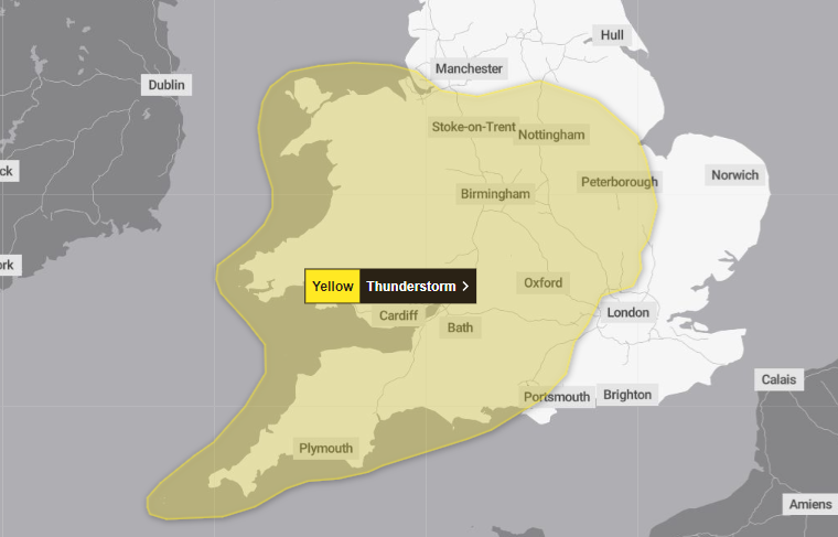
“Scattered showers and thunderstorms” are expected to spread northwestwards from southern England - but many places will remain dry without seeing storms.
The most intense storms will be accompanied by hail and lightning, the Met Office said, particularly going into Saturday afternoon and evening in areas of the Midlands, western England and east Wales.
Sunday rain
A weather warning for rain will come into place at 12am on Sunday, covering a similar area but barring Wales’ northern coast.
The forecaster warns that some areas may receive up to 80mm of rain over the course of 12 to 24 hours - roughly matching the September average for rain in the UK.
The Met Office says: “Showers and thunderstorms are expected to merge into broader areas of heavy rain across parts of Wales, central and southern England during Sunday.”
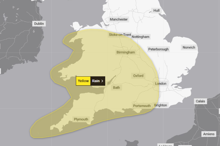
East Wales and west-central England are expected to be the most severely impacted areas, while the southwest can expect heavy rainfall during the early hours.
“The areas of heavy rain are likely to continue pushing north and west, becoming slow moving across some northern and possibly eastern reaches of the warning area during the rest of Sunday,” the forecaster added.
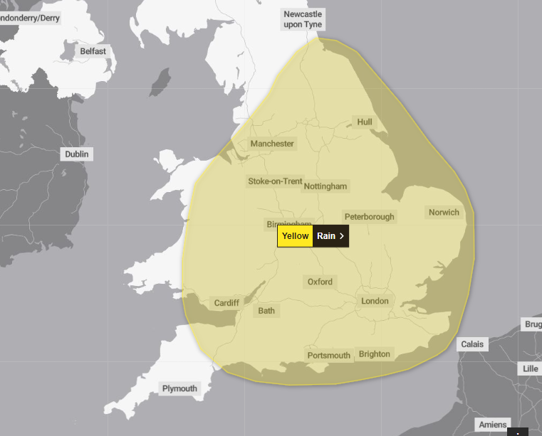
Monday rain
Going into Monday, the weather warning will expand to cover the majority of England and Wales.
Southwest England, western Wales and the most northerly parts of England will avoid the yellow weather warning for rain.
The worst-affected areas could see as much as 100mm of rainfall in 12 hours.
Two flood warnings and 25 flood alerts are also in place, mostly in the South West, Norfolk, and the Thames and Wye estuaries.
A flood warning is the second most severe of the cautions issued by the Environment Agency, meaning that flooding is expected.
A flood alert is the least severe of the cautions, meaning flooding is possible.
Somerset coast at Porlock Weir and Wye Estuary at Brockweir are both currently under flood warnings.
Join our commenting forum
Join thought-provoking conversations, follow other Independent readers and see their replies
Comments