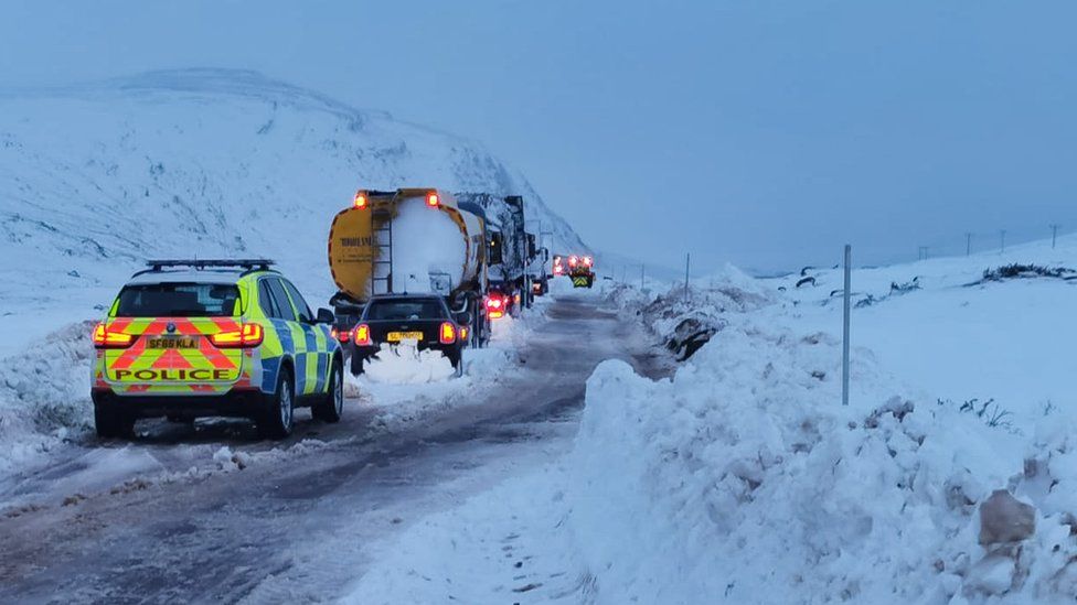
UK weather: Snow traps drivers in Scotland as more warnings in place
Met Office says more snow is on the way

Your support helps us to tell the story
From reproductive rights to climate change to Big Tech, The Independent is on the ground when the story is developing. Whether it's investigating the financials of Elon Musk's pro-Trump PAC or producing our latest documentary, 'The A Word', which shines a light on the American women fighting for reproductive rights, we know how important it is to parse out the facts from the messaging.
At such a critical moment in US history, we need reporters on the ground. Your donation allows us to keep sending journalists to speak to both sides of the story.
The Independent is trusted by Americans across the entire political spectrum. And unlike many other quality news outlets, we choose not to lock Americans out of our reporting and analysis with paywalls. We believe quality journalism should be available to everyone, paid for by those who can afford it.
Your support makes all the difference.Heavy snow blocked roads and left drivers stranded overnight in the Scottish Highlands.
Highland Council said about 20 vehicles became stuck in the snow near Loch Darma, Wester Ross, and were rescued by emergency services.
Due to the adverse weather conditions, the A835 between Ullapool and Garve was closed.
Road management organisation Bear NW Trunk Roads said there were snowdrifts of up 2m (6ft) deep on some parts of the road.
It came amid heavy snowfall in the Highlands and other parts of Scotland. And there is more snow on the way.
The Met Office has issued an amber alert for Central, Tayside and Fife, Grampian, the Highlands and Islands and Argyll and Bute, warning snow could cause road and rail disruption as well as power cuts.
It forecast 10-15cm of snow at low levels, with 20-30cm accumulating on higher ground.
A separate yellow warning forecasts periods of snow, heavy at times, for much of inland central and northern Scotland through Friday and into Saturday.
A further warning for snow and ice covers the length of Britain from midday on Saturday to midnight on Monday.
By next week, temperatures will be struggling to get much above 0C in quite a few places, with some areas such as the Pennines and high parts of Scotland seeing several degrees below that.
Birmingham faces lows of minus 2C by Tuesday morning, while a strong easterly wind will make it feel many degrees below freezing in some parts, according to Met Office forecaster Steven Keates.
He said it will be "really unpleasant" to be outdoors, adding: "If you do have to go outside there are lots of layers required, I think."
Mr Keates said the south of Britain will see a "marked" drop in temperatures across Saturday and Sunday, with some parts possibly seeing 5-10cm of snow.
He added: "Enough snow is on the cards to cause potentially quite a bit of disruption in the south-east of England through Sunday, and potentially very early next week as well."
Additional reporting by Press Association


Join our commenting forum
Join thought-provoking conversations, follow other Independent readers and see their replies
Comments