When will 30C heat return after heavy rains? Met Office issues update
Temperatures set to take a turn again this week after days of rain and flash floods
Your support helps us to tell the story
From reproductive rights to climate change to Big Tech, The Independent is on the ground when the story is developing. Whether it's investigating the financials of Elon Musk's pro-Trump PAC or producing our latest documentary, 'The A Word', which shines a light on the American women fighting for reproductive rights, we know how important it is to parse out the facts from the messaging.
At such a critical moment in US history, we need reporters on the ground. Your donation allows us to keep sending journalists to speak to both sides of the story.
The Independent is trusted by Americans across the entire political spectrum. And unlike many other quality news outlets, we choose not to lock Americans out of our reporting and analysis with paywalls. We believe quality journalism should be available to everyone, paid for by those who can afford it.
Your support makes all the difference.Hot weather is set to return to the UK this week after days of heavy rains and thunderstorms, according to a Met Office forecast.
Almost the entire country had been blanketed in yellow weather warnings for the last few days, with some parts experiencing the equivalent of half a month’s worth of rain in just one hour.
Severe flooding was reported in various areas, including Water Street in Radcliffe, Crumpsall and Manchester.
On Monday, however, heavy rain gradually cleared from the north, allowing for sunny spells and scattered showers to follow. But more rain arrived in the southwest later in the day.
On Tuesday, rain is set to continue to move northeastward across England and Wales and eventually reach Scotland later in the day. There is a possibility of heavy and thundery bursts during this time.
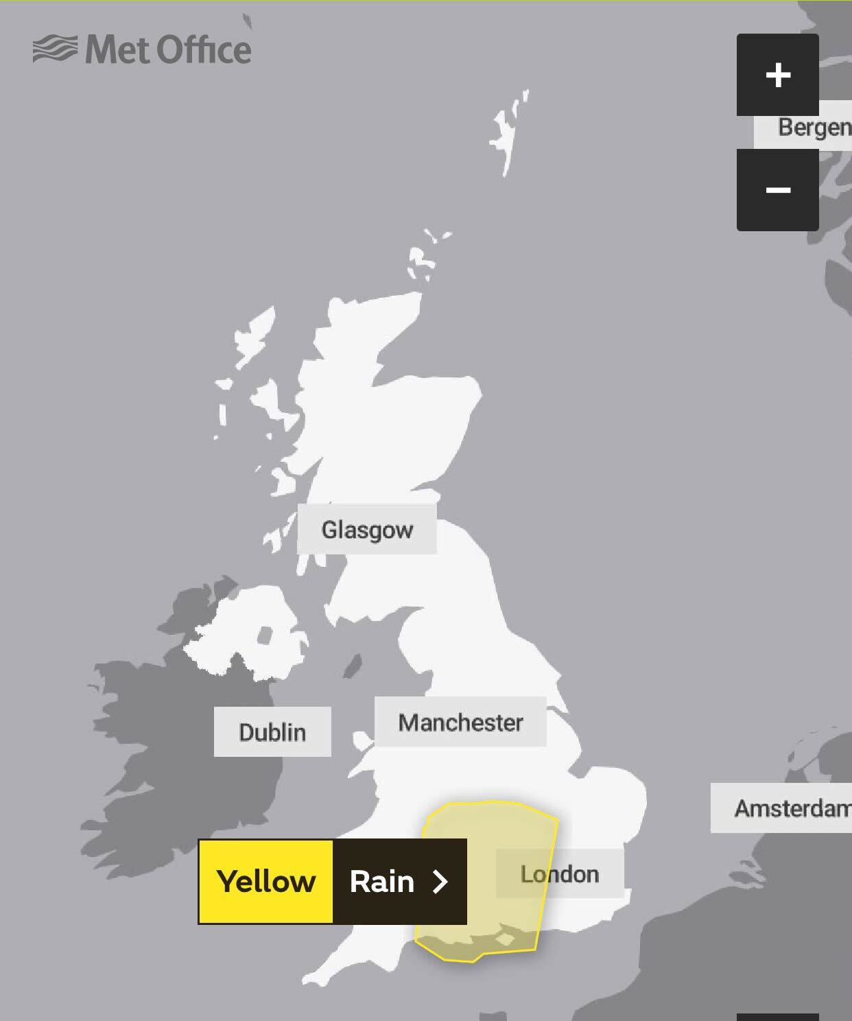
A yellow weather warning is still in place in parts of central, southern England and southeast Wales until 10pm on Tuesday.
But while the weather remains humid, there will be intervals of sunshine as well that will occasionally be accompanied by thunderstorms, said the forecaster.

Southern and western parts of England could see 30mm of rain which would make for “uncomfortable driving conditions”, Met Office spokesman Stephen Dixon said.
As the week progresses, a mix of sunshine and showers is expected to continue, with the potential for further thunderstorms.
But the intensity and duration of showers will gradually decrease, according to the latest forecast. Thursday will see fewer showers than Wednesday.
The Met Office predicts Friday to be “dry and very warm” for many regions. Scotland and Northern Ireland, however, could experience wet weather during this period.
The weather is expected to get back to hotter conditions, potentially hitting heatwave criteria, by the weekend.
“The weekend could get up to the high 20s or low 30s, the south east will see the warmer weather,” Mr Dixon said.
“The week will be sitting relatively warmer for this time of year but more subdued than we’ve seen, but areas will hit heatwave criteria as we get to the weekend.”
Last week, large parts of England and Wales baked in a 30C heatwave that led to health alerts and left taps to run dry in schools.
The weather throughout this summer is expected to be higher than average, but it isn’t clear yet whether last year’s extreme heat records will be broken.
Meanwhile, a “severe” marine heatwave is developing off the coast, smashing records for late spring and early summer. The marine heatwave is worrying scientists as the Arctic continues to warm up.


Join our commenting forum
Join thought-provoking conversations, follow other Independent readers and see their replies
Comments