Carolinas slammed by tropical cyclone bringing flooding and tornado threats
Several North Carolina communities were in a state of emergency as inches of rain pounded the area
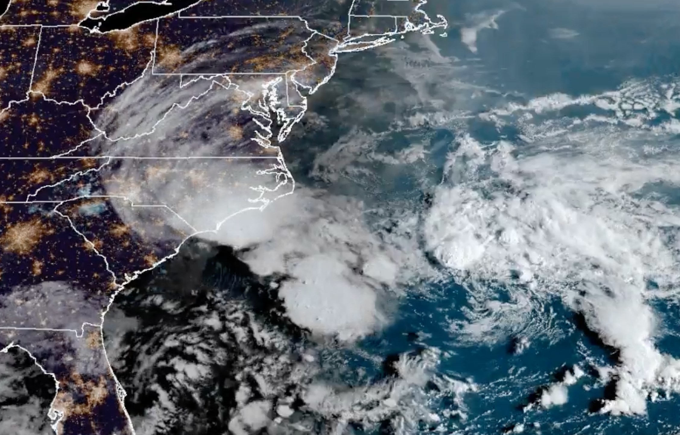
The Carolinas and Southeast are being threatened Monday by a tropical cyclone that’s brought life-threatening flash flooding and tropical storm force wind gusts to North Carolina, forcing multiple schools to shut for the day.
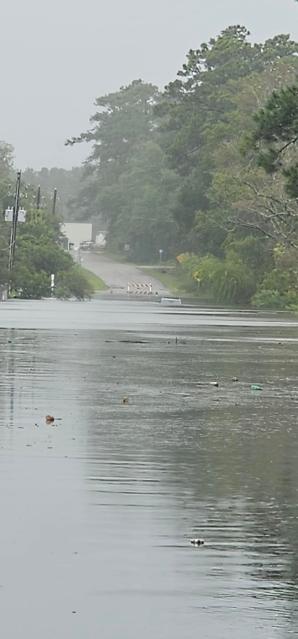
Video and images posted to social media showed severe flooding along the coast, with cars under water and multiple rescues underway. Thousands of residents left without power thanks to the storm, known by forecasters as Potential Tropical Cyclone Eight. It could still become Tropical Storm Helene and the eighth named storm of the Atlantic Hurricane season, but it’s expected to weaken throughout the day.
“Due to the inclement weather, Cape Fear Community College will close at all campus locations today ... We urge you to exercise caution while driving home,” Cape Fear Community College told its students.
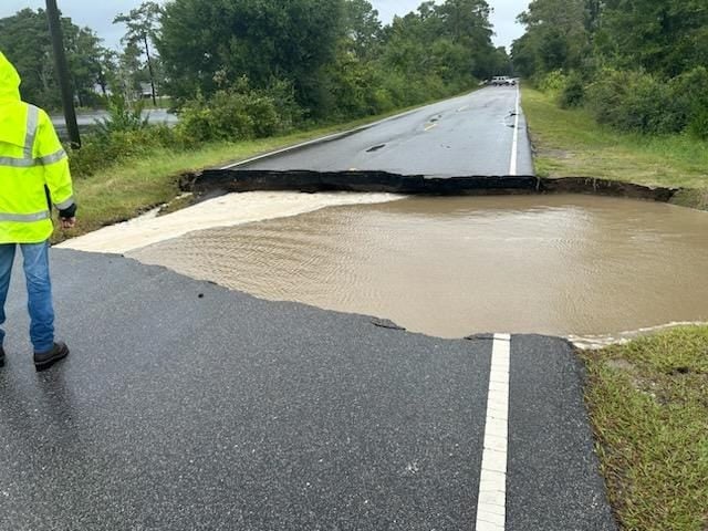
Multiple tornado warnings were issued in North Carolina through the early afternoon. Brunswick County highways were jammed and many roads were closed from flooding and washouts, according to local station WECT. The county was under a tropical storm warning.
New Hanover County said it had postponed meetings due to the weather conditions and WECT said there had been power outages for thousands of customers in the area.
The city of Southport declared a state of emergency. There, emergency officials said they had handled multiple calls of people stranded in floodwaters and urged people to stay off roads. Images posted by the local fire department showed bridges that had been washed out.

There was also a state of emergency in Carolina Beach, where Mayor Lynn Barbee said there were people sheltering at town all. The Red Cross was on the way to assist residents, and high water vehicles were continuing to “extract folks in need. “
“We have had to rescue storm water crews as well and have pulled them back from some areas. If you are safe stay put please!” he wrote on Facebook.
As of 2:15 p.m. EDT, there were nearly 7,000 customers without power between the two states, with the majority in North Carolina, according to outage tracking website PowerOutage.US.
Photos shared by the National Weather Service’s office in Wilmington showed cars about halfway submerged under floodwaters. The agency said that historic rain had fallen over Carolina Beach, Southport, and Boiling Springs Lakes.
Over a foot of rain had been recorded there since midnight.
“NOAA Atlas 14 shows 12”/12 hr occurs, on average, once every 200 years. 18”/12hr is once every 1000 years!” the agency said.
But, some parts of northeast South Carolina and southeast North Carolina could see between 4 to 8 inches, with isolated totals near 10 inches. The weather service Monarch said some areas were already reporting as many of 16 inches from the system.

Rainfall continued to fall over central North Carolina, with totals of up to an inch-and-a-half over the Sandhills. A flood watch was in effect for all of the region until 8 a.m. Tuesday, with the greatest risk for flash flooding later Monday and into the evening.
The National Weather Service in Raleigh said 2 to 5 inches of rain would fall across the southern part of central North Carolina, with some parts seeing up to 6 inches.
In South Carolina, tropical storm warnings were issued for Charleston and Berkeley counties, as well as some coastal areas.
The unnamed storm was approaching the coast mid-Monday afternoon, located about 90 miles east-northeast of Charleston and just 60 miles south-southwest of North Carolina’s Cape Fear.
Some rain — up to three inches — will fall over much of Virginia, with some higher amounts through Wednesday.

Coastal flooding and high surf are likely along the southeastern coast for the next day or two, with some areas seeing up to three feet.
Tropical storm conditions are forecast to diminish through the afternoon.
Join our commenting forum
Join thought-provoking conversations, follow other Independent readers and see their replies
Comments
Bookmark popover
Removed from bookmarks