Storm Debi – live: London weather warning extended as Met Office warns of lightning damage to buildings
Yellow warnings currently in place as blustering winds and flooding wreak havoc across UK
Your support helps us to tell the story
From reproductive rights to climate change to Big Tech, The Independent is on the ground when the story is developing. Whether it's investigating the financials of Elon Musk's pro-Trump PAC or producing our latest documentary, 'The A Word', which shines a light on the American women fighting for reproductive rights, we know how important it is to parse out the facts from the messaging.
At such a critical moment in US history, we need reporters on the ground. Your donation allows us to keep sending journalists to speak to both sides of the story.
The Independent is trusted by Americans across the entire political spectrum. And unlike many other quality news outlets, we choose not to lock Americans out of our reporting and analysis with paywalls. We believe quality journalism should be available to everyone, paid for by those who can afford it.
Your support makes all the difference.A yellow weather warning for thunderstorms, heavy rain and severe gale-force wings has been extended across London and southern England, as Storm Debi continues to batter parts of the UK.
The Met Office has warned of potential damage to buildings from lightning strikes or strong winds, as well as a chance of power cuts, and possible travel disruption and delays.
In its update on Tuesday, the forecaster said the warning area has been adjusted to focus on southern and southeast England, with the end time delayed until mid-afternoon. The warning has been in place since 5am and was supposed to run until midday but has now been extended to 3pm.
It comes as multiple “danger to life” weather warnings were issued across the country on Monday.
High winds and rain from Storm Debi were causing road closures and disruption to public transport across Northern Ireland, as the Met Office warned of “danger to life” from flying debris, “fast flowing or deep floodwater”, and large waves in some areas.
Strong winds have also been recorded in the region on Tuesday morning, with the highest reaching 74mph at Killowen in Co Down.


Watch: Andy Burnham on Manchester trains being cancelled
Environment Agency issue 11 flood warnings
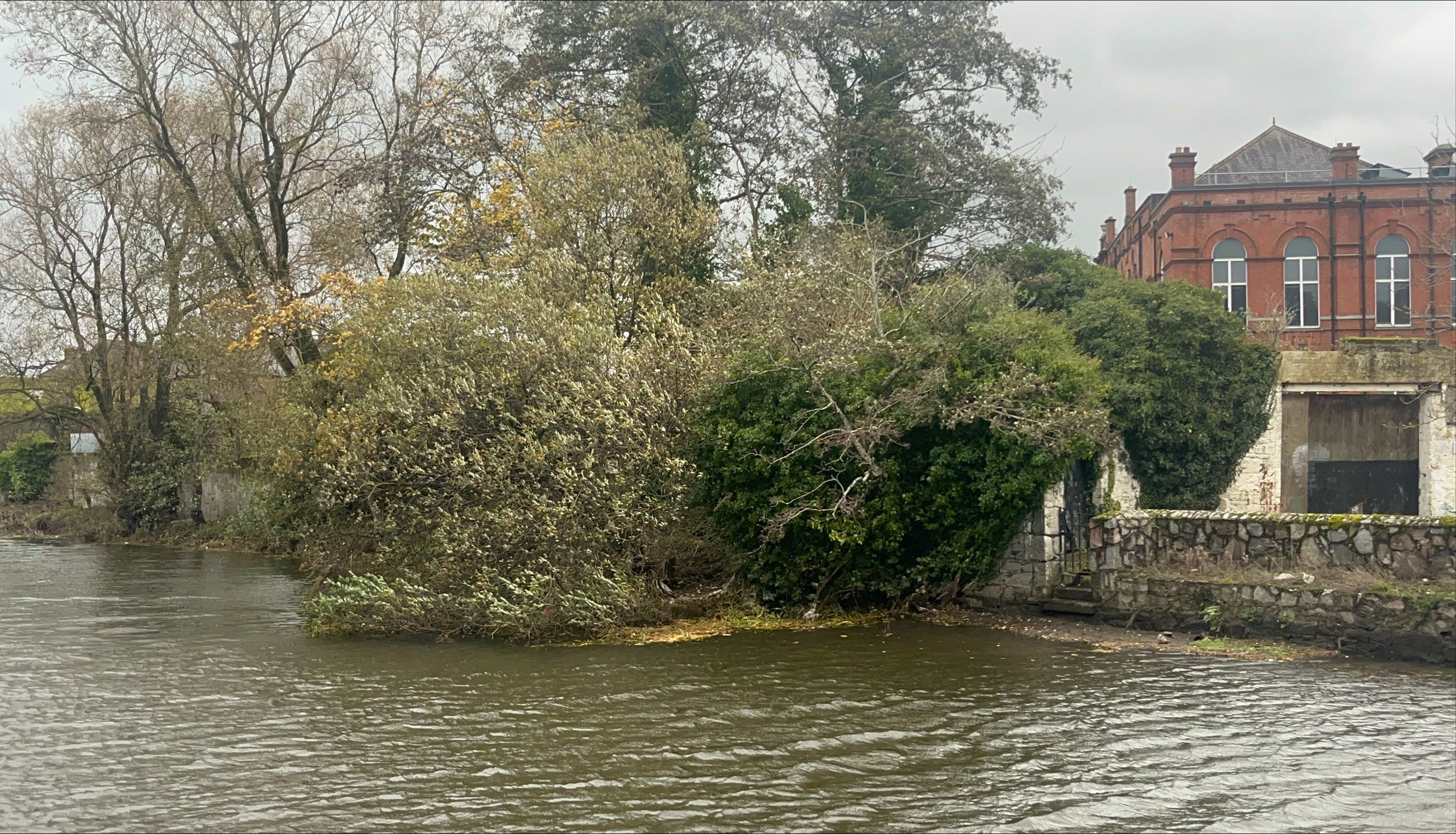
On Tuesday morning, the Environment Agency had 11 flood warnings in place, meaning flooding is expected, with 120 lesser flood alerts also active. Areas of concern include the River Severn in Gloucester and the River Eden in Cumbria.
Met Office meteorologist Marco Petagna said Storm Debi is expected to clear away from the UK to the east in the early hours of Tuesday, but “wet and windy weather” should linger.
He said on Monday: “Tomorrow morning you will see heavy and potentially thundery showers moving eastwards across the south of England.
“We could see 15-20mm, almost an inch, of rain across some southern counties of England combined with fairly gusty winds as well.
“A week’s worth of rain could fall in an hour or two in that warning area and you could see wind speeds of 40-50mph. If you are in that warning area, it is going to be quite tricky (to travel).
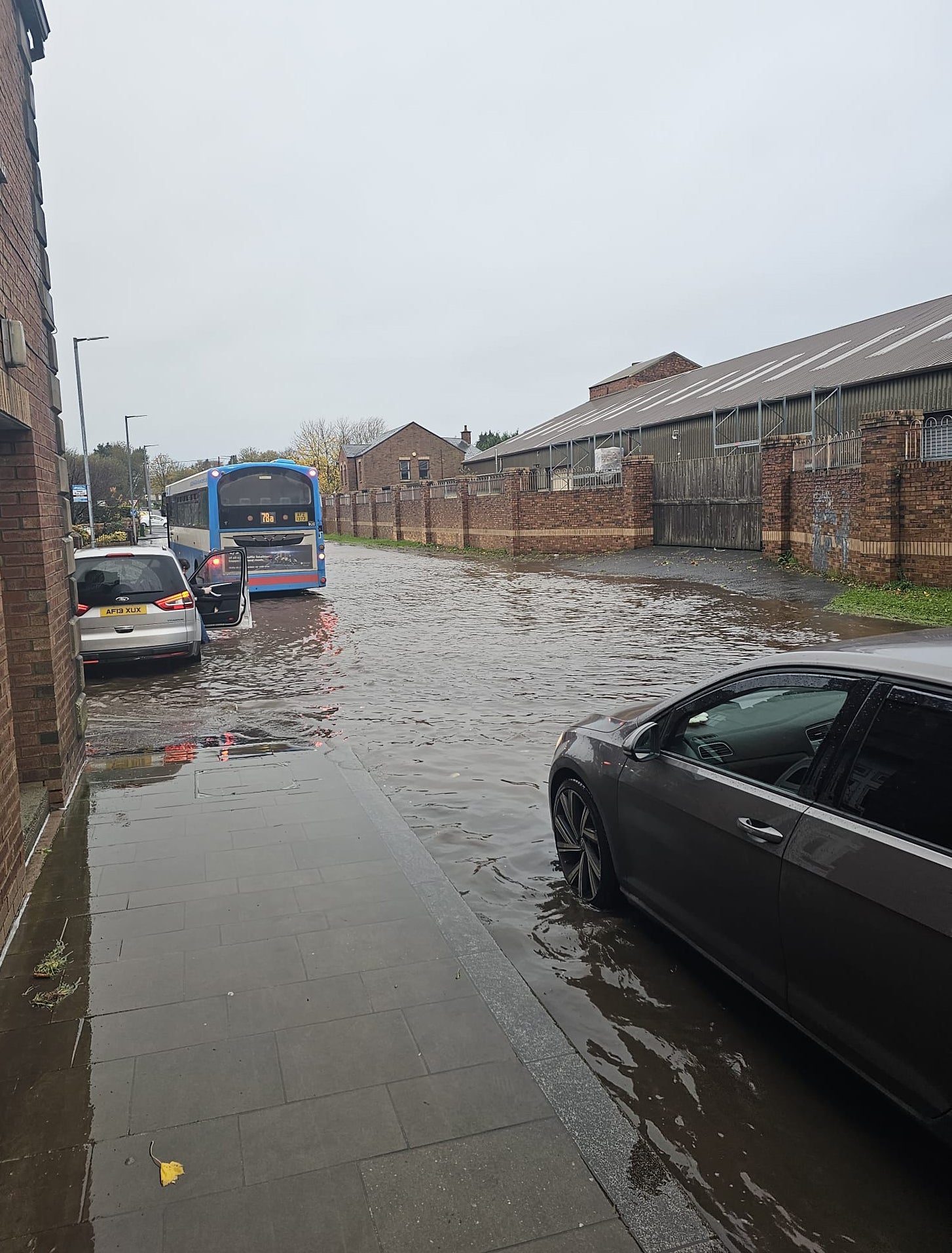
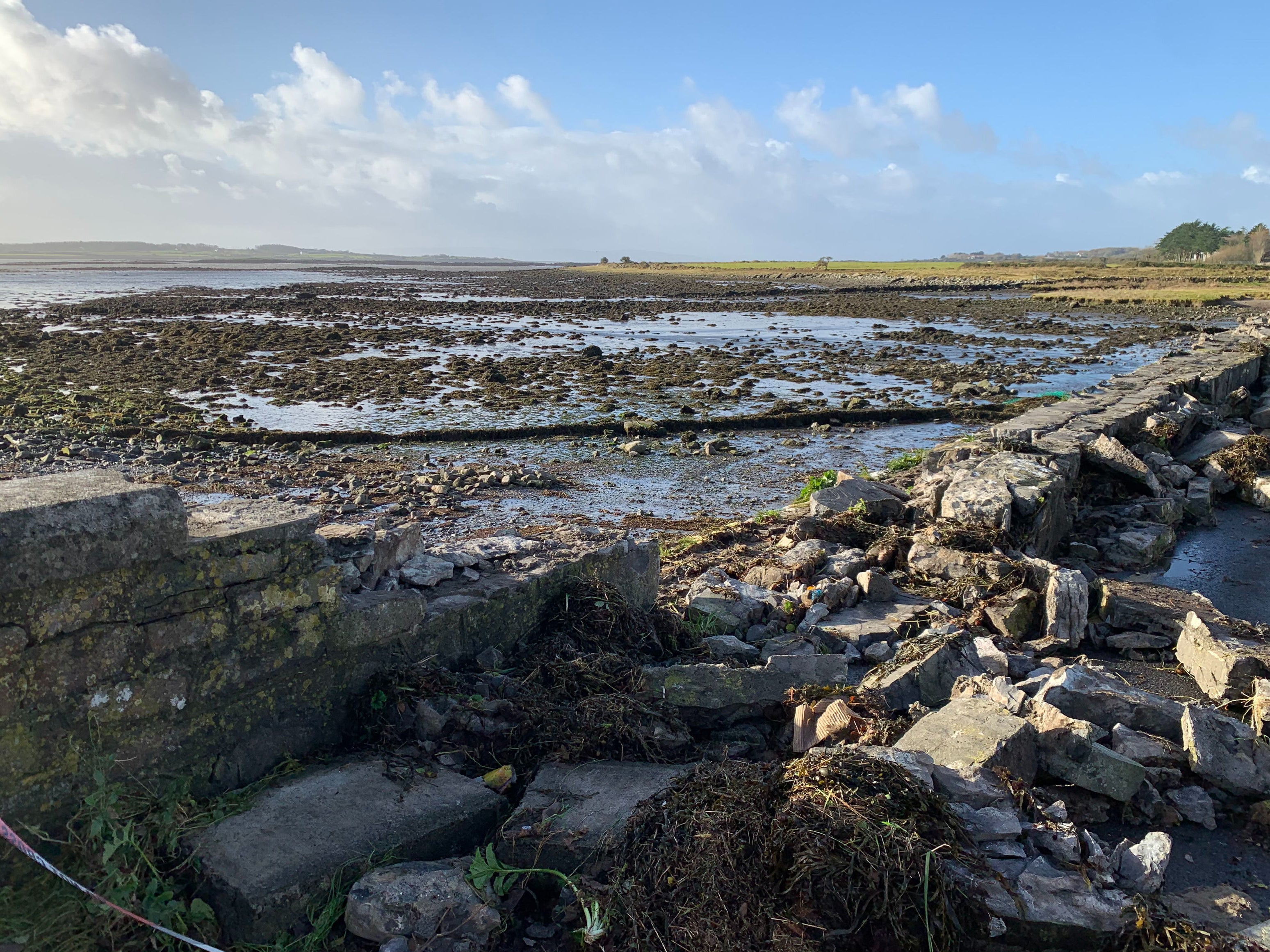
Latest pictures from Storm Debi

Passengers in Scotland face delays while overnight works add to travel chaos
Passengers in Scotland are experiencing delays during the morning rush hour. ScotRail posted on X: “Due to adverse weather yesterday and today, Tuesday 14 November, blanket speed restrictions will be imposed on numerous sections on the ScotRail network up until 8.30am today.
“Please check your entire journey before travelling today.”
Overnight engineering works are overrunning in several locations, including the crucial link between Surbiton and Wimbledon on South Western Railway, serving the UK’s busiest rail station, London Waterloo.
The same problem is affected passengers between Bracknell and Wokingham in Berkshire, and between Barrow and Workington in Cumbria.
Signal failure between Ashford International and Maidstone are delaying some trains in Kent. A broken-down freight train between Ashford and Folkestone is adding to the problems.
Rail chaos continues across Britain
Tens of thousands of rail passengers face cancellations and disruption as bad weather continues to batter the UK.
A landslip between Darlington and Newcastle has been delaying operations on the East Coast main line for several days. One of the two tracks is currently closed, with long delays expected as northbound and southbound trains share the same line.
National Rail reports: “Disruption is expected for the rest of the day.”
In West Yorkshire, the main line between Leeds and Wakefield Westgate remains disrupted after high winds on Monday brought down overhead wires. Delays and cancellations are expected on LNER, CrossCountry and Northern.
Debi ‘probably the most intense storm’ this season
Storm Debi, the fourth storm to affect Ireland since September, left many roads flooded in Ireland with thousands without power after it hit the island with heavy gusts and rain on Monday.
The storm came just a few days after flooding from Storms Babet and Ciaran left shops and homes in Midleton, Carlingford and Newry as well as elsewhere flooded after intense rainfall.
The Irish national director for fire and emergency management said Storm Debi is “probably the most intense storm” of the season so far.
Keith Leonard said: “It was probably the high winds of that leading edge of the storm as it came across the country that was the most hazardous piece.
“So probably the most intense storm we’ve had so far in the season.”
Yellow warning in place till noon
A band of squally, thundery rain is likely to push quickly across the southern parts of the UK on Tuesday morning.
A yellow warning is in place for Tuesday morning covering Plymouth to London, until noon.
The forecaster warns that there is a chance of some damage to a few buildings and structures from lightning strikes or strong and gusty winds.
Storm Debi led to flight cancellations
Storm Debi caused 70mph gusts on Monday, leading to flight cancellations.
British Airways said that, like other airlines, it had to “make a small number of cancellations” due to the bad weather which has reduced the number of flights air traffic controllers will allow to land per hour.
A spokesperson said: “We’ve apologised to our customers for the disruption to their travel plans and our teams are working hard to get them on their way as quickly as possible.”
Storm Debi marks the earliest point in a storm season the letter D has been reached in the alphabet.
Tuesday weather forecast
Blustery thundery showers will move eastwards across southern counties of England this morning, the Met Office says.
Central, southern and western parts of Scotland, along with northern England will have a cloudy day with showery rain. Otherwise, there will be sunshine and scattered showers, the Met Office says.
Met Office meteorologist Marco Petagna said Storm Debi is expected to clear away from the UK to the east in the early hours of Tuesday, but “wet and windy weather” should linger.
He added: “Tomorrow morning you will see heavy and potentially thundery showers moving eastwards across the south of England.
“We could see 15-20mm, almost an inch, of rain across some southern counties of England combined with fairly gusty winds as well.
“A week’s worth of rain could fall in an hour or two in that warning area and you could see wind speeds of 40-50mph.
“If you are in that warning area, it is going to be quite tricky (to travel).
“Allow extra time to travel and keep tuned to the forecast overnight.
“If you are out and about, take extra care and be prepared to see thundery showers.”
A “very active” jet stream has been the cause of much of the wet weather, Mr Petagna said, as he warned it shows “no sign” of stopping in the next week.
He said: “The active jet stream is helping to move a deep area of low pressure. It is quite a long way south and much of the UK is in the firing line.
“The next week or so will still be pretty unsettled, with some brighter spells but not for long.”
Storm Debi 'earliest named storm with the letter D'
Storm Debi is the earliest storm in the UK to start with the letter D, a climate expert has noted – in other words, the country has reached its fourth named storm this year faster than ever before.
The Met Office maintains an alphabetic list of names for storms. Before Storm Debi, Storm Ciaran and Storm Babet have lashed the country in recent weeks while Storm Agnes hit in September.
"Another storm leaves yet more devastation, marking #StormDebi as the earliest named storm with the letter D for this stage in a season," Peter Dynes, chief strategic officer at non profit MEER wrote.
"Those who deny the worsening state of the climate system are deluding themselves."
Join our commenting forum
Join thought-provoking conversations, follow other Independent readers and see their replies
Comments