Met Office responds to claim of ‘snow bomb’ hitting UK
Met Office dismisses reports saying any disruption next week ‘looks unlikely’
Your support helps us to tell the story
From reproductive rights to climate change to Big Tech, The Independent is on the ground when the story is developing. Whether it's investigating the financials of Elon Musk's pro-Trump PAC or producing our latest documentary, 'The A Word', which shines a light on the American women fighting for reproductive rights, we know how important it is to parse out the facts from the messaging.
At such a critical moment in US history, we need reporters on the ground. Your donation allows us to keep sending journalists to speak to both sides of the story.
The Independent is trusted by Americans across the entire political spectrum. And unlike many other quality news outlets, we choose not to lock Americans out of our reporting and analysis with paywalls. We believe quality journalism should be available to everyone, paid for by those who can afford it.
Your support makes all the difference.The Met Office has responded to claims of a “snow bomb” hitting the UK next week after some reports based on weather charts claimed parts of the country were going to be covered in ice.
This week, several media reports claimed an “ice blast” was heading towards Britain, which will cover Scotland to the Midlands in up to 10cm of snow. These reports were based on WX Charts which is owned by private company MetDesk.
The Met Office has dismissed these reports saying any disruption next week “looks unlikely”.
“The Met Office is not forecasting 10cm of snow next week,” a spokesperson told The Independent.
“There may be a few cm over the tops of the Scottish Mountains and perhaps the northern Pennines but any disruption at this stage looks unlikely.”
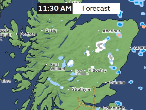
Maps from the Met Office show some snowfall in northeast Scotland this week.

But in its long-range forecast for next week, the Met Office says the country is going to see a largely dry week with some occasional showers.
After some rainfall on Sunday, “mainly dry conditions developing for most areas at the start of next week”, the forecast said.
“It will probably stay drier and brighter across the north, although still with a few showers in places.”
This week also looks generally calm, featuring bright or sunny spells. There might be cloudy weather with occasional showers near eastern coasts on Thursday and Friday, the forecast shows.
“It’s not going to be entirely rain-free, but certainly compared with recent weeks, there will be less wet weather around now,” Met Office meteorologist Aidan McGivern said.
Tuesday is also going to get a dry start, with any fog patches lifting during the morning. There could be some cloudier skies in the east and some drizzle here. But overall it is going to be a bright day in the west with long sunny spells developing.
Temperatures are expected to be near normal for this time of the year, with highs of 10-11C forecast in the south. But some dip in temperatures is expected for northern regions.
“A marked temperature contrast starts to form through Wednesday, Thursday and Friday,” Mr McGivern said.
“We’re going to see 6-7C and a brisk wind coming in from the North Sea.”

Join our commenting forum
Join thought-provoking conversations, follow other Independent readers and see their replies
Comments