How long will the UK heatwave last? Temperatures to hit 27C, but more wet weather on the way
While not technically a heatwave, the UK’s warm weather continues with rainy showers

Your support helps us to tell the story
From reproductive rights to climate change to Big Tech, The Independent is on the ground when the story is developing. Whether it's investigating the financials of Elon Musk's pro-Trump PAC or producing our latest documentary, 'The A Word', which shines a light on the American women fighting for reproductive rights, we know how important it is to parse out the facts from the messaging.
At such a critical moment in US history, we need reporters on the ground. Your donation allows us to keep sending journalists to speak to both sides of the story.
The Independent is trusted by Americans across the entire political spectrum. And unlike many other quality news outlets, we choose not to lock Americans out of our reporting and analysis with paywalls. We believe quality journalism should be available to everyone, paid for by those who can afford it.
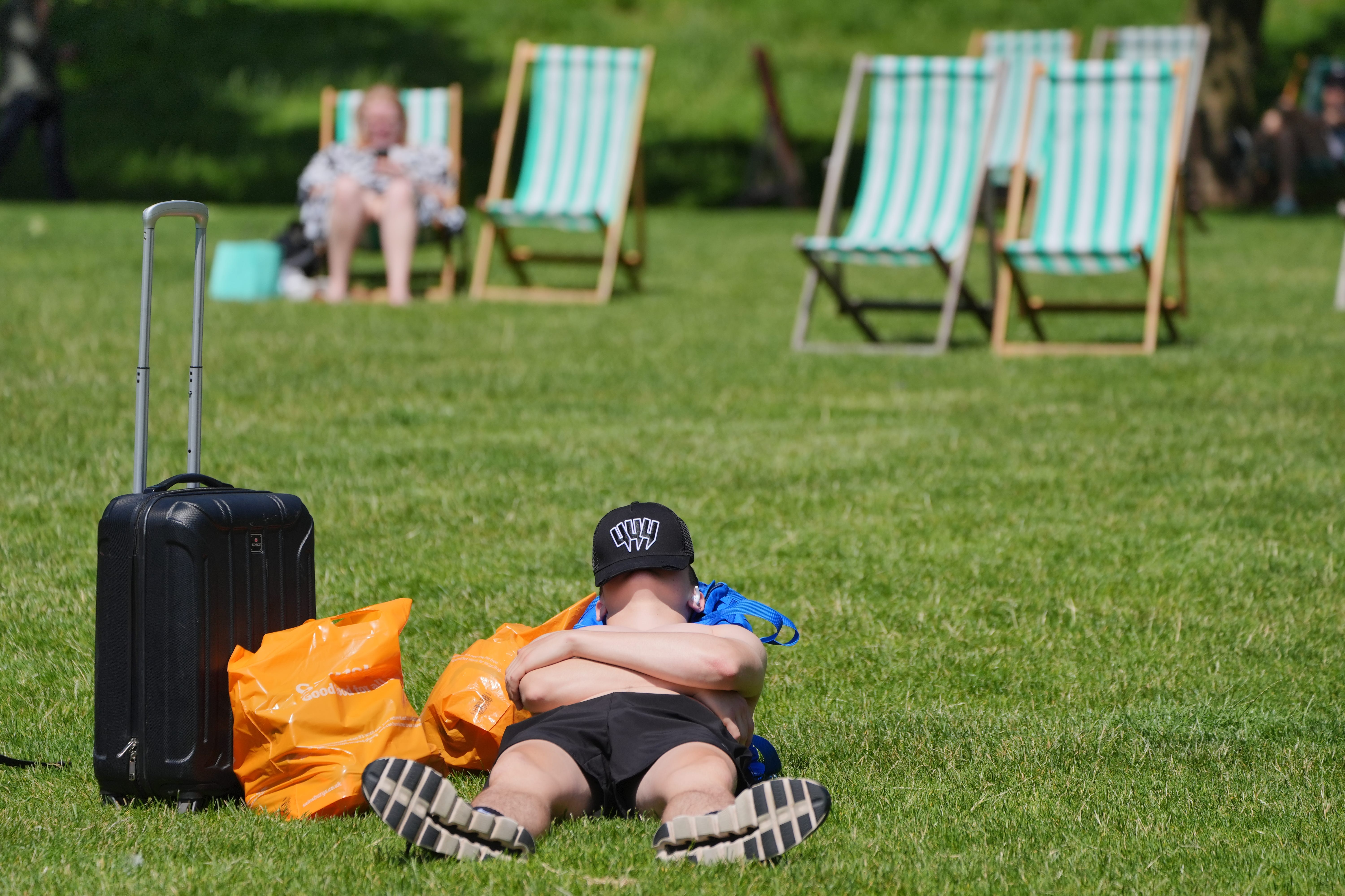
Your support makes all the difference.The UK is set to continue basking in warm weather this week, but sunseekers shouldn’t get carried away: rain is also hitting the country on the first week of the summer holidays.
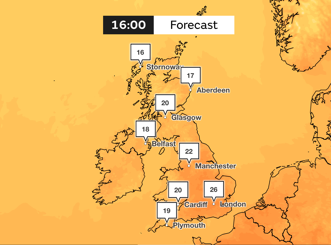
After a wet start to Tuesday for many, temperatures could climb to 27C on Wednesday in the South East around London with dryer and brighter weather expected across the country, according to the Met Office.
Much of the UK will experience a ridge of high pressure, with double figures set to stay for the remainder of the week.
But some parts of the country will experience bursts of rain but further unsettled conditions will only unfold towards the midweek with afternoon showers forecasted.

It comes after the UK experienced a mini-heatwave last week with temperatures hitting 31.9C on Friday in central London.
The Met Office says a further frontal system arriving from the west has triggered showers developing through the midlands and up to south Scotland.
Tuesday will feel warmer than Monday with temperatures expected to climb to 25C in the South East.
Into the evening, showers will die away with lots of clear spells around and more cloud expected into western Scotland and Northern Ireland.
Any foggy and misty spells will be short-term as the week looks to remain mostly dry and bright.
Met Office spokesperson Stephen Dixon said: “The long-range outlook for early August suggests what’s most likely is drier weather further south, with showers and rain more frequent further north and west.
“There remains a signal for some more changeable interludes of weather through the first half of August, with some periods of low pressure bringing periods of more unsettled weather at times.”
Tuesday
Much of the country woke to some light drizzly spells this morning which quickly eased as the morning developed. Temperatures are expected to reach up to 25C in the South East and will feel warmer than Monday. Sporadic showers should be anticipated across the country and these should settle by the evening with clear skies anticipated.
Wednesday to Friday
Temperatures will peak up to 27C on Wednesday in the South East around London but these will drop to cooler conditions on Thursday with heavier rain spells expected. Mild conditions will stay with temperatures dropping below 20C in parts of the country. A light breeze is also expected on Thursday. Friday will see some showers in the north of the UK but the south will be drier, and again temperatures will be mild.
Over the weekend
The first of the thunder will be felt towards the latter part of the week when a band of cloud and rain will clear south-eastwards. This will pave the way for scattered showers across much of the northwest but these will settle overnight.
Sunshine and showers, some of which could be heavy and thundery for much of the country and temperatures will fall below average.
End of July to August
The UK should continue to enjoy the sunny spells but can expect spells of rain as August is set to be changeable, says the Met Office.
Wet weather will be interspersed with intervals of dry, and bright weather with most of the rain to be felt across northern and western areas. Minimal rain is expected in the southern and eastern parts of the UK and temperatures may climb above average.
High ultra-violet levels will persist throughout and charities such as Cancer Research UK have highlighted the risks of not wearing adequate sun protection during the summer months.
Cancer Research UK chief executive Michelle Mitchell said: “The fact that the majority of these cases are preventable underlines the importance of people taking sun safety seriously.”

Join our commenting forum
Join thought-provoking conversations, follow other Independent readers and see their replies
Comments