Your support helps us to tell the story
From reproductive rights to climate change to Big Tech, The Independent is on the ground when the story is developing. Whether it's investigating the financials of Elon Musk's pro-Trump PAC or producing our latest documentary, 'The A Word', which shines a light on the American women fighting for reproductive rights, we know how important it is to parse out the facts from the messaging.
At such a critical moment in US history, we need reporters on the ground. Your donation allows us to keep sending journalists to speak to both sides of the story.
The Independent is trusted by Americans across the entire political spectrum. And unlike many other quality news outlets, we choose not to lock Americans out of our reporting and analysis with paywalls. We believe quality journalism should be available to everyone, paid for by those who can afford it.
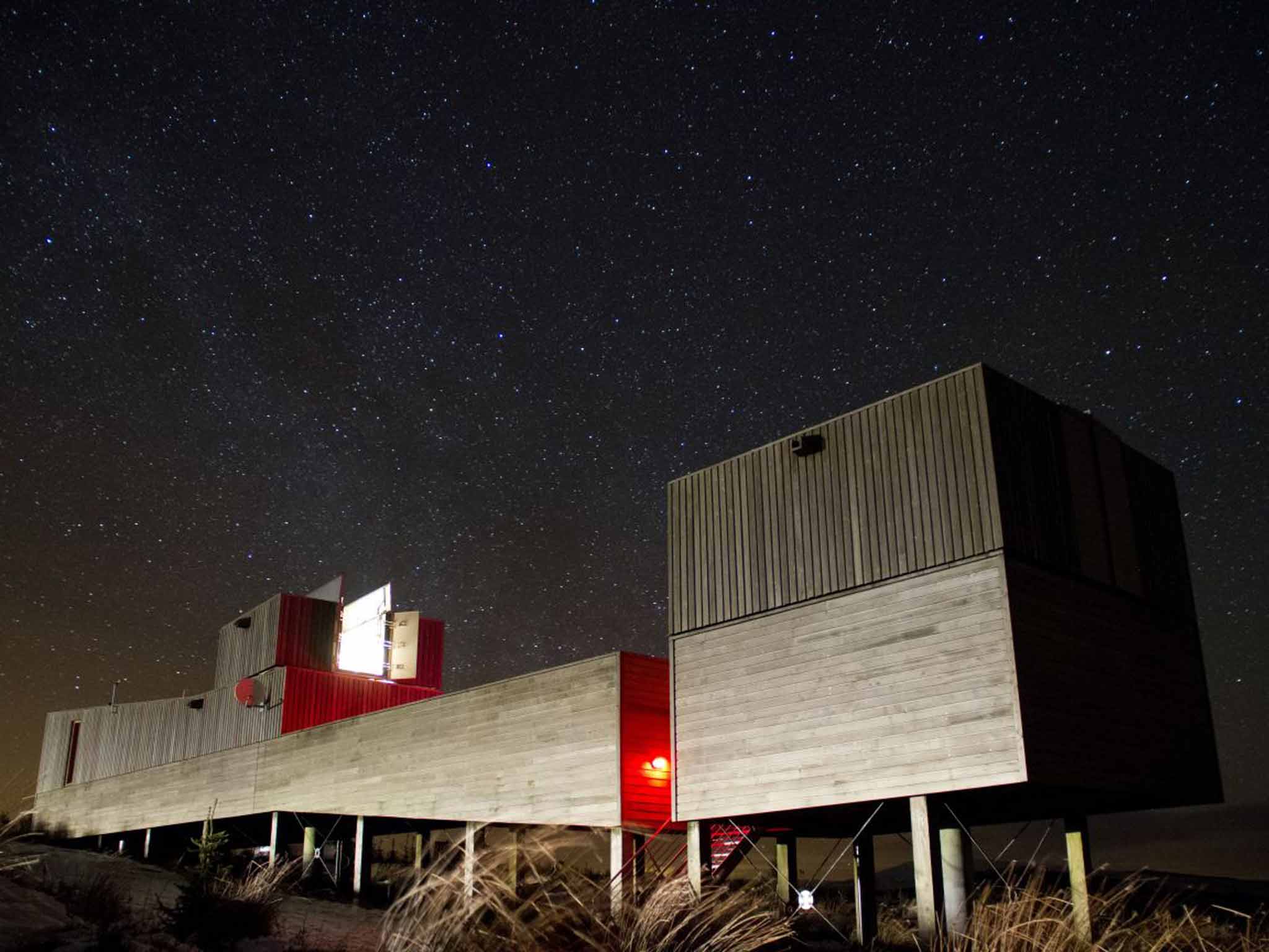
Your support makes all the difference.You might call it the curse of the dark skies. I've arrived at Kielder Forest with a walk in mind that would highlight the area's lack of light pollution. Tucked away deep in the rarely visited folds that lurk between Northumbria, Cumbria and Scotland, Kielder is a long way from the world of night-time street- light glow most of us are used to. After sunset, this means – weather permitting – the stars can put on a show of some drama.
I was hoping to time my walk to descend the lower flanks of Deadwater Fell at dusk, and use a head torch to follow the forest tracks back to Kielder village. The double-rain symbols on the weather forecast, though, firmly suggest I require a Plan B. So I bring my walk forward to the morning: a walk that involves looking at Kielder, rather than up above it.
At 571m (1,873ft), Deadwater Fell is one of the highest peaks in Kielder Forest and certainly the most eerily named. I strike out from Kielder Castle, just above Kielder village, following a stone wall overlooked by a row of beeches. Soon, though, I'm enveloped by the area's signature tree, sitka spruce. There's a strong breeze and I'm struck by the noise generated by the rustling, balletic branches of the conifers.
The path rises gently, and soon I am looking back down over Kielder village. Although it was built only in the 1950s (to house forestry workers) the village, straggling, sleepy and buried in woods, has a feel and appearance much older. To the north of it I can pick out the minuscule hamlets of Deadwater and Saughtree. Then, the route turns up a narrow path, densely lined with conifers that cocoon me from the rest of the world. A small spring runs downhill beside me, an embryonic burn, and there are luminous lime-coloured mosses that manage to stand out, even in this world of green.

Then I emerge by a gate. Far to the west is the futuristic-looking Kielder Observatory, which offers tours and talks for visitors, as well as a chance, weather permitting, to take a peek at the Universe through its telescopes. I wind my way up forestry paths before emerging above the tree line and follow a lonely track that painstakingly coils its way to the summit.
The cloud and mist are in a playful mood, intermittently enveloping me and then suddenly evaporating to reveal a striking landscape of vast emptiness. I'm surrounded by isolated moorland, by one of the largest tracts of wild land in the Border region. The vast expanses of moorland I am gazing across resonate with fittingly lonely names like Ravenshill and Hogswood. I pick out an enticing forest drive that links Kielder to distant Jedburgh.
Large sooty specks – ravens – flutter like scraps of burnt paper, lifted and dropped by the wind. The land may look empty but is nevertheless being lightly managed. The Forestry Commission designates half of this land as a "no intervention" area, with no grazing by sheep or cattle, nor any burning. The reasoning is that this approach will allow the area to develop gradually into truly wild land.
This chimes with another tactic deployed by woodland managers here, which is to address the monotony that came with the original purpose of the forest, to grow as much pine wood as quickly as possible (Kielder accounts for 20 per cent of all the timber harvested in England).
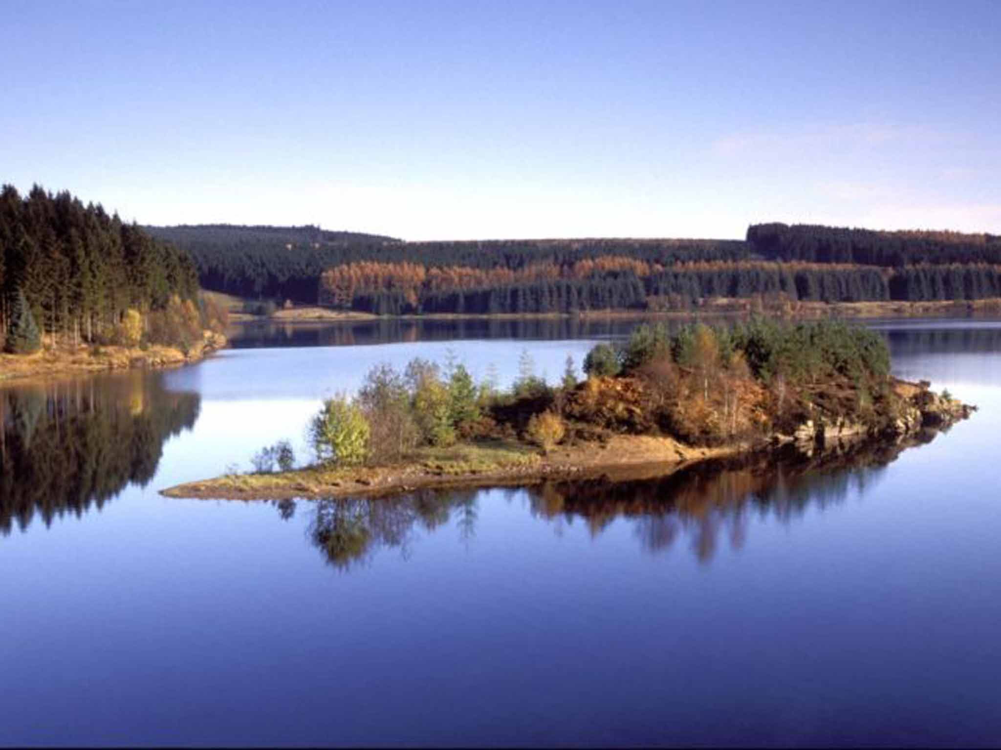
For some time now the Forestry Commission has sought to soften its methods and plant more native trees, such as oak, rowan and birch. The reservoir at the heart of this forest, Kielder, is not a natural lake, but the flooded upper North Tyne River Valley, that's home to England's largest hydro-electric plant.
I begin my descent, passing the summit paraphernalia of satellite dishes, golf balls, and transmission masts, and one altogether more stylish building. Completely out of keeping with its neighbours is a weather shelter for walkers. Known as Specere, it was designed by the architect David Adjaye and built in a triangular shape to provide shelter from the prevailing westerlies. Looking through the shelter's panels, the cloud thwarts my hopes of picking out the Solway Firth. Due south, I can see the top half of Kielder Water.
I follow the way markers back to the castle. The friendly café has tables in the courtyard of the castle, and I munch a slice of local Northumbrian cake, as the raindrops make their forecast appearance. I duck inside and watch recorded feeds from the three osprey nests that Kielder hosts. The chicks all survived this year, and are currently somewhere in west Africa. All being well they should return here in spring.
Much later, with the clock touching midnight, the skies do clear. By that time, I'm sitting on the balcony of my log cabin by the water's edge of Kielder. For a few minutes, the stars emerge one by one, then in their hundreds. I promise to return and walk from Deadwater Fell in the dead of night.

Travel essentials
OS Map: OL42 Kielder Water and Forest
Distance: Six miles/10km
Time: Three to four hours
Directions: The route to Deadwater Fell from Kielder Castle is well way-marked with red posts and signs. Be careful to follow the signs for the Deadwater Walk trail, and not the red mountain bike trail signs, which sometimes overlap.
Getting there
The nearest railway stations are Haltwhistle and Carlisle, served by Northern and ScotRail trains (08457 484950; nationalrail.co.uk).
Staying there
Mark Rowe stayed at Leaplish, where a four-person cabin costs from £332 per week (leaplish.co.uk).
More information

Join our commenting forum
Join thought-provoking conversations, follow other Independent readers and see their replies
Comments