True north: could Greenland get back on the airline map?
The man who pays his way

Your support helps us to tell the story
From reproductive rights to climate change to Big Tech, The Independent is on the ground when the story is developing. Whether it's investigating the financials of Elon Musk's pro-Trump PAC or producing our latest documentary, 'The A Word', which shines a light on the American women fighting for reproductive rights, we know how important it is to parse out the facts from the messaging.
At such a critical moment in US history, we need reporters on the ground. Your donation allows us to keep sending journalists to speak to both sides of the story.
The Independent is trusted by Americans across the entire political spectrum. And unlike many other quality news outlets, we choose not to lock Americans out of our reporting and analysis with paywalls. We believe quality journalism should be available to everyone, paid for by those who can afford it.
Your support makes all the difference.Copenhagen is further north than Newcastle; Los Angeles is further south than Crete. The two cities are 5,600 miles apart. So what happens when you draw a line between the pair? That all depends on the map you use.
Mercator’s projection is a fair attempt to represent the earth’s surface in two dimensions, as if it was the skin of an orange carefully peeled and then flattened. On a map like that, a straight line from the Danish capital to California’s largest city crosses northern England and Northern Ireland. It skims the southern coast of Nova Scotia, then makes landfall in the US just north of Boston. The line briefly crosses the southernmost tip of Canada, which intrudes on the US close to Detroit, then cuts across Chicago and, like Route 66, aims from there to LA.
Were you to fly between the two cities, though, your journey would be completely different – and rewards the investment in a window seat with a view across the top of the world. The pilot begins the 11-hour trip by aiming west-north-west, not west-south-west, missing Britain altogether. The direct track passes north of Shetland (sit on the left for a view of the islands, weather permitting) and clips the far north of Iceland. A full hour is spent north of the Arctic Circle, crossing the solid ice-sheet that permanently shrouds most of Greenland. Then it makes a tour of northern Canada’s greatest hits: jigsaw-puzzle-shaped Baffin Island, Hudson Bay and Churchill, Manitoba – “polar bear capital of the world”. The flight path crosses only one US city of note, Salt Lake City, and in the last hour aims south-south-west to LA.
That is the Great Circle route: the shortest path between two points on the surface of the planet. Pilots, passengers and airline accountants like them because they save time and fuel. With so much long-haul aviation taking place in northern hemisphere, so-called “polar routes” are the way to go.
Earlier this month, a British Airways plane from Heathrow to Tokyo returned to base when it was just beyond the halfway point, well above the Arctic Circle in far northern Siberia. The fact that the Boeing was perfectly able to fly another six hours back the way it had come to Heathrow (because of what the airline called a “minor technical fault”) shows the capabilities of modern planes. But in the early jet age, a non-stop journey such as Copenhagen to California was impossible. Which is why the Scandinavian airline, SAS, came up with a spectacular solution involving a US Air Force base in south-west Greenland. The Americans first built a runway at the head of the island’s largest fjord during the Second World War, so that aircraft being ferried to Europe could refuel. They called it Bluie West Eight, being slightly easier to pronounced than Sondre Stromfjord or Kangerlussuaq – the Danish and Greenlandic names respectively.
During the Cold War, Bluie West Eight was in the frosty front line: thousands of miles closer to Moscow and Leningrad than any base in the US, under six hours as the B52 bomber flies from the Russian capital. But SAS, one of the great pioneers of long-haul aviation, negotiated to use the airfield to open up the fast track between Europe and the West Coast. It became known as SFJ.
With a decaying two-billion-year-old volcano at the east end and a wall of rock to the north and south, it’s an exciting place to land and take-off.
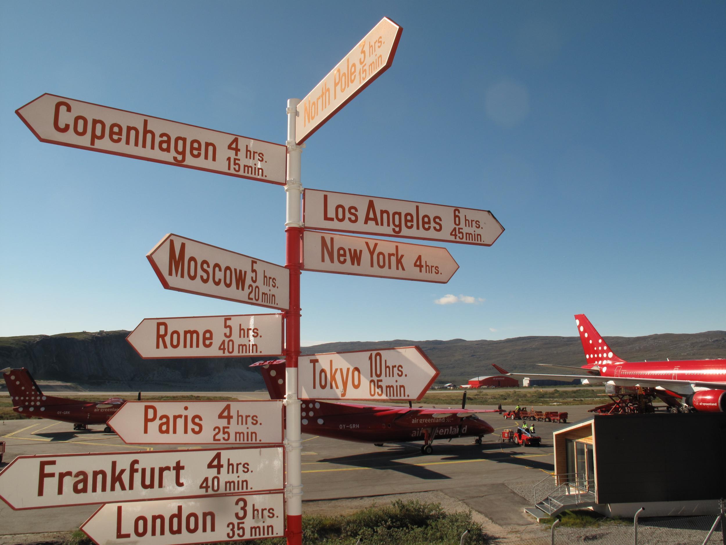
To show the short-cut in all its glory, the airline commissioned a signpost that put the air base at the centre of the world: London and New York four hours or less, and the North Pole just three hours 15 minutes away.
As jet technology improved, SFJ fell off the world aviation map. Today, it is the hub for Air Greenland, but the only two international destinations are Copenhagen and Reykjavik. Iceland’s capital has created its own niche as a North Atlantic crossroads, using the ex-military base at Keflavik to offer passengers from Birmingham, Manchester and Glasgow quick connections to New York and Toronto. Two airlines, Icelandair and Wow Air, compete to exploit Reykjavik's geographic advantages, and offer adventurous travellers the chance of a sub-Arctic stopover. But SFJ is much more spectacular, and offers a taste of the true north – with that ice sheet just half-an-hour away along the longest road in the entire country.
When oil next soars in price, making long-haul flights much more expensive and incentivising refuelling stops, Greenland will be in line for an aviation revival.
Join our commenting forum
Join thought-provoking conversations, follow other Independent readers and see their replies
Comments