How to use Google Maps on your smartphone when you don't have a connection
The feature could make getting lost in a city a thing of the past
Your support helps us to tell the story
From reproductive rights to climate change to Big Tech, The Independent is on the ground when the story is developing. Whether it's investigating the financials of Elon Musk's pro-Trump PAC or producing our latest documentary, 'The A Word', which shines a light on the American women fighting for reproductive rights, we know how important it is to parse out the facts from the messaging.
At such a critical moment in US history, we need reporters on the ground. Your donation allows us to keep sending journalists to speak to both sides of the story.
The Independent is trusted by Americans across the entire political spectrum. And unlike many other quality news outlets, we choose not to lock Americans out of our reporting and analysis with paywalls. We believe quality journalism should be available to everyone, paid for by those who can afford it.
Your support makes all the difference.There's nothing more frustrating than being lost with no mobile connection in an area you don't know.
If the map on your smartphone loads at all, it's usually very slow, or gets your location completely wrong.
Google has found a way around those problems with their 'offline areas' feature, which allows users to download detailed maps to their phones, meaning they can search for places and get directions without needing to have a data or WiFi connection.
It's fairly easy to do, but the downloaded maps can be fairly large - so make sure you're connected to WiFi and there's enough space on your phone before beginning.
Open Google Maps, select 'offline areas' from the toolbar on the left and choose the map you want
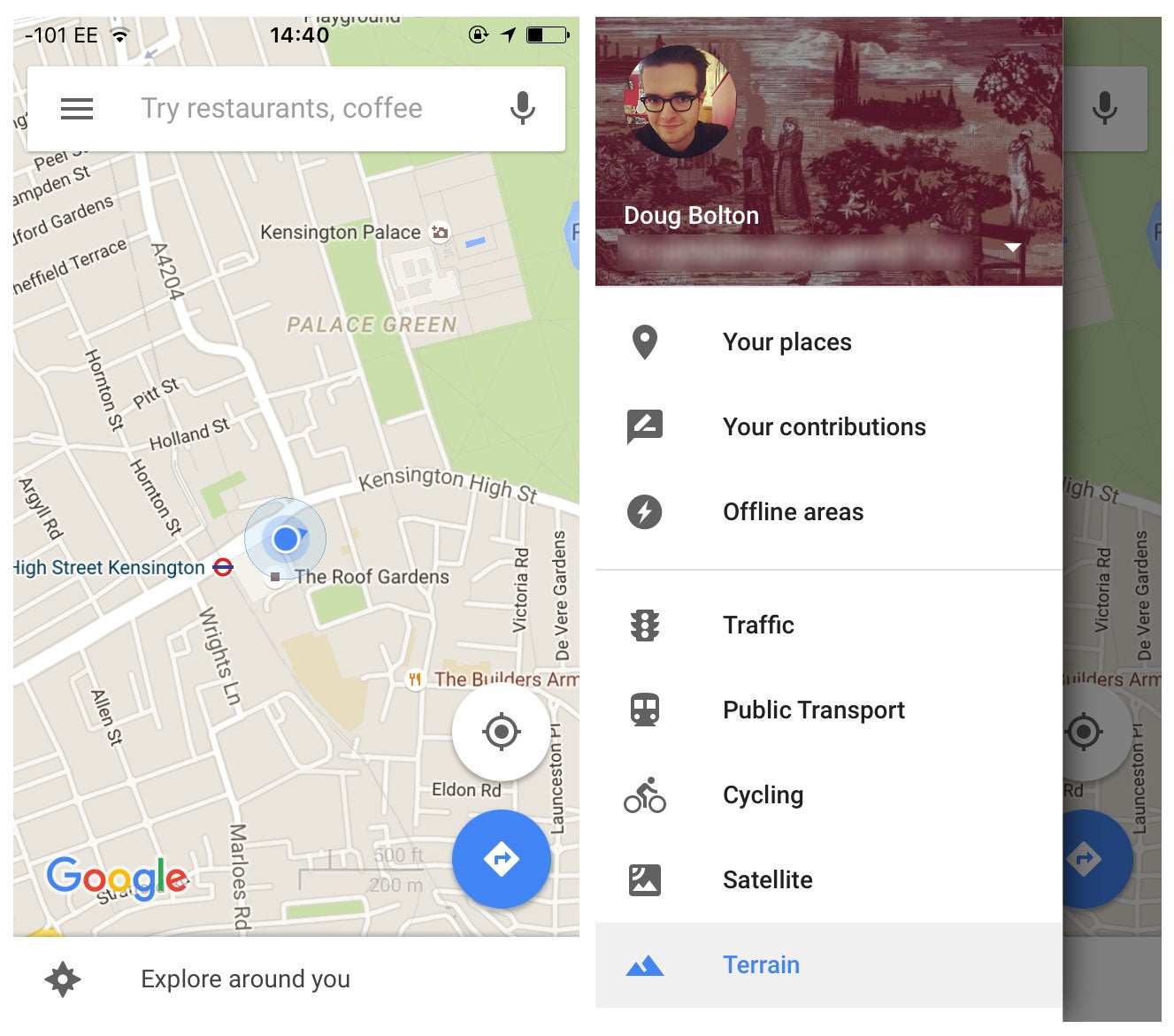
Press the '+' button in the bottom-right, and choose the area of the map you want to download
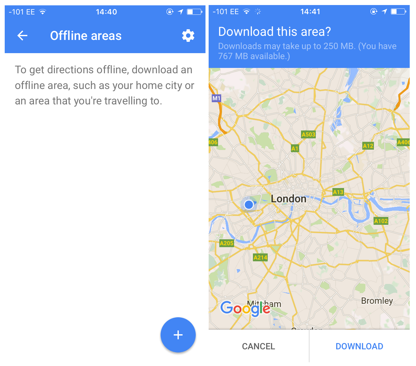
Downloaded maps can be a maximum of 250MB or 120,000 square kilometres in area, so you won't be able to get the whole of the UK, but central London fit comfortably in the constraints. The feature is designed to help out people who regularly travel through areas with poor data coverage, or for travellers visiting foreign cities - it's not meant to be a total replacement for connected navigation.
Name it and wait for it to download
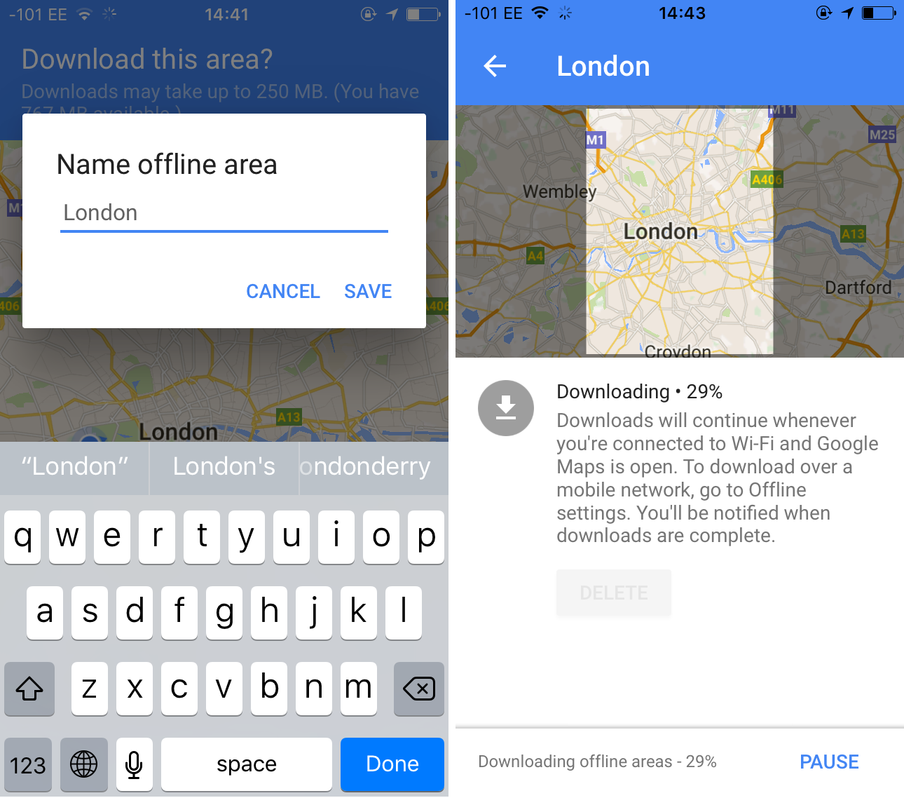
The name should be fairly self-explanatory if you're downloading a whole city, but it might be a good idea to give them distinct labels if you download lots of small maps to save on space.
Finished!
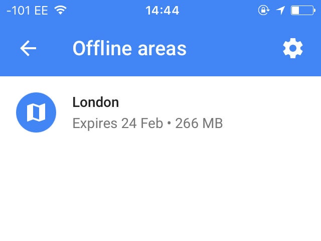
The downloaded map should work seamlessly within the app, so you won't have to open it up separately if you need to navigate without a connection.
You can also update the map every so often, so you're not caught unaware by a sudden road closure or new route. It's set to stay on your phone for up to 30 days, before deleting itself to free up space.
Join our commenting forum
Join thought-provoking conversations, follow other Independent readers and see their replies
Comments