Stay up to date with notifications from The Independent

Notifications can be managed in browser preferences.

Satellite images show shocking destruction caused by Turkey earthquakes

Detailed satellite images give a bird’s-eye view Turkish towns before and after the earthquakes hit, and of relief efforts.

Joseph Rachman
Tuesday 07 February 2023 17:51 EST
Comments
Turkey earthquake: Video shows devastation as third quake hits country in 24 hours

Your support helps us to tell the story

From reproductive rights to climate change to Big Tech, The Independent is on the ground when the story is developing. Whether it's investigating the financials of Elon Musk's pro-Trump PAC or producing our latest documentary, 'The A Word', which shines a light on the American women fighting for reproductive rights, we know how important it is to parse out the facts from the messaging.

At such a critical moment in US history, we need reporters on the ground. Your donation allows us to keep sending journalists to speak to both sides of the story.

The Independent is trusted by Americans across the entire political spectrum. And unlike many other quality news outlets, we choose not to lock Americans out of our reporting and analysis with paywalls. We believe quality journalism should be available to everyone, paid for by those who can afford it.

Your support makes all the difference.

Satellite images of three Turkish towns reveal the extent of the devastation caused by the worst earthquakes to hit the country in decades.

The region was hit by two major quakes measuring 7.8 and 7.5 on the Richter scale at 4.17 am and 1.24pm local time on 6 February.

Extensive rescue operations are underway as emergency workers race against time to find survivors in affected areas of Turkey and Syria.

The death toll has already topped 7,300 but experts fear that the final number could be as high as 20,000.

Up 23 million people across both countries may be directly affected, including 1.4 million children, according to estimates by the World Health Organisation (WHO). Thousands of children are feared dead by Unicef.

“It’s now a race against time. Every minute, every hour that passes, the chances of finding survivors alive diminishes,” said Tedros Adhanom Ghebreyesus, the WHO’s director general, speaking in Geneva.

The earthquakes are the worst to hit Turkey since 1939 when one of the same magnitude killed around 30,000 people.

New satellite images show the extent of the destruction.
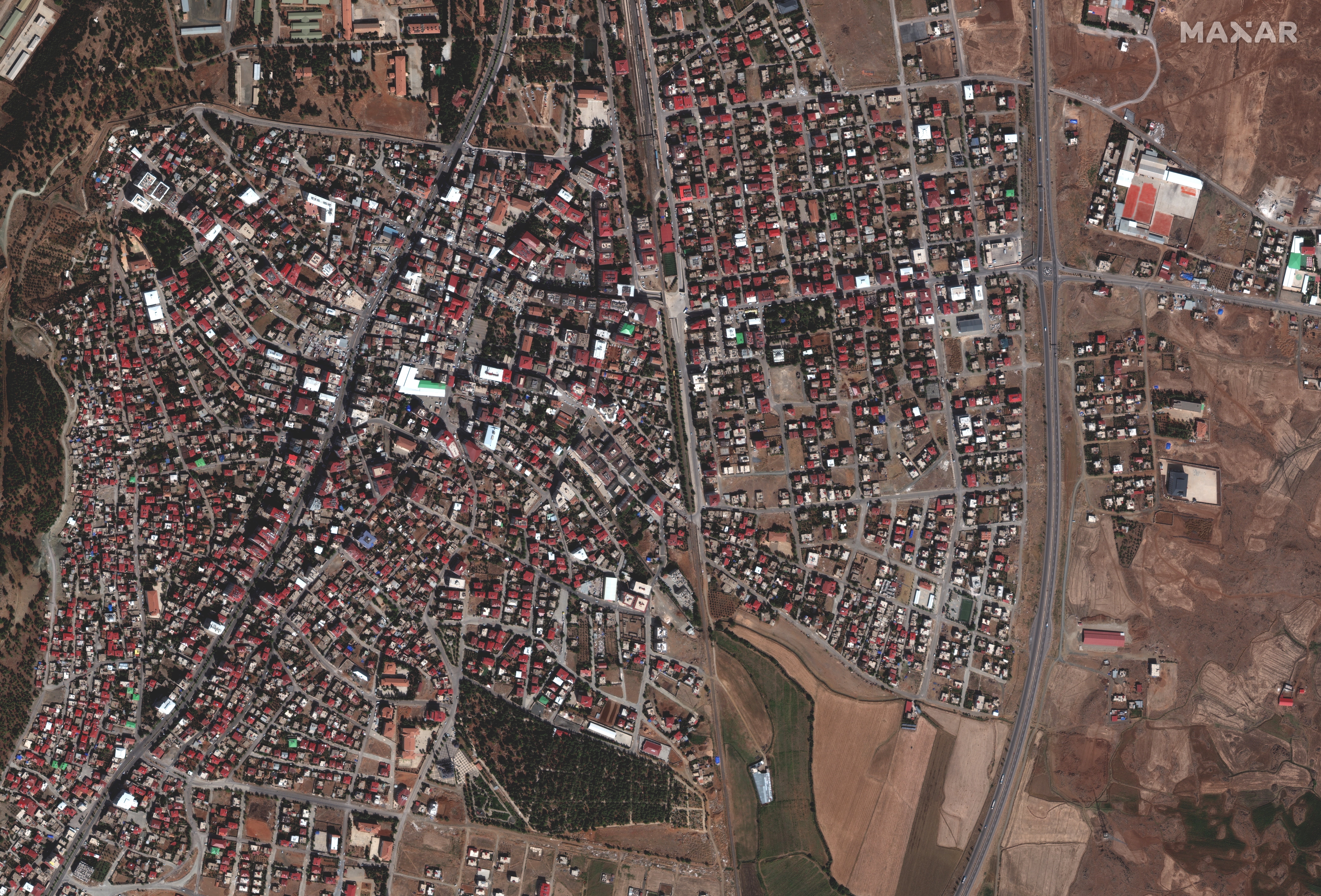
Overview of Islahiye, Turkey before earthquake./Satellite image ©2023 Maxar Technologies
Overview of Islahiye, Turkey before earthquake./Satellite image ©2023 Maxar Technologies (Satellite image ©2023 Maxar Technologies)
Overview of Islahiy Turkey after the earthquake 7 February 2023.
Overview of Islahiy Turkey after the earthquake 7 February 2023. (Satellite image ©2023 Maxar Technologies.)

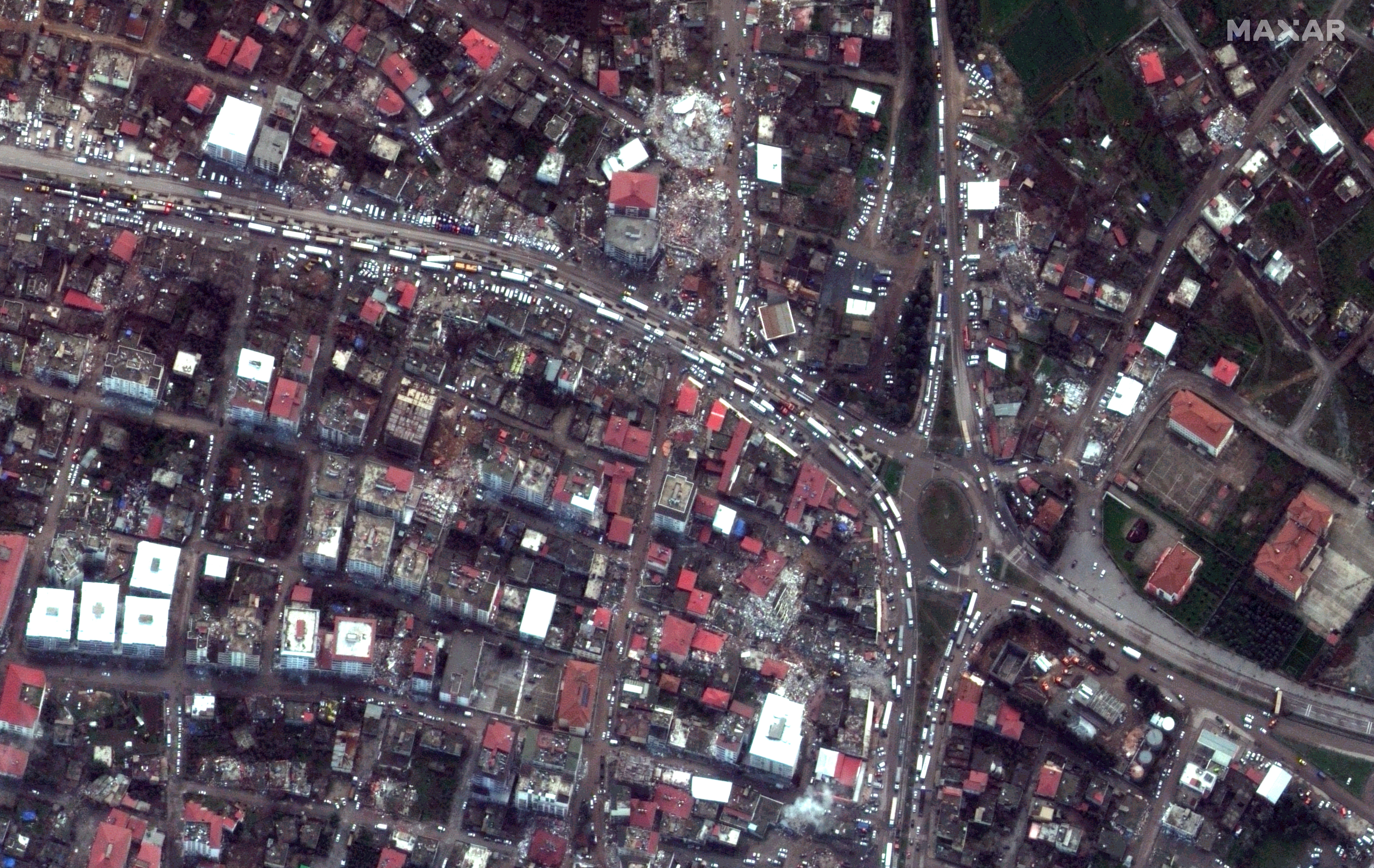
The images show detailed bird’s-eye views of three Turkish towns, Islahiye, Nurdağı and Düziçi after the earthquake struck.
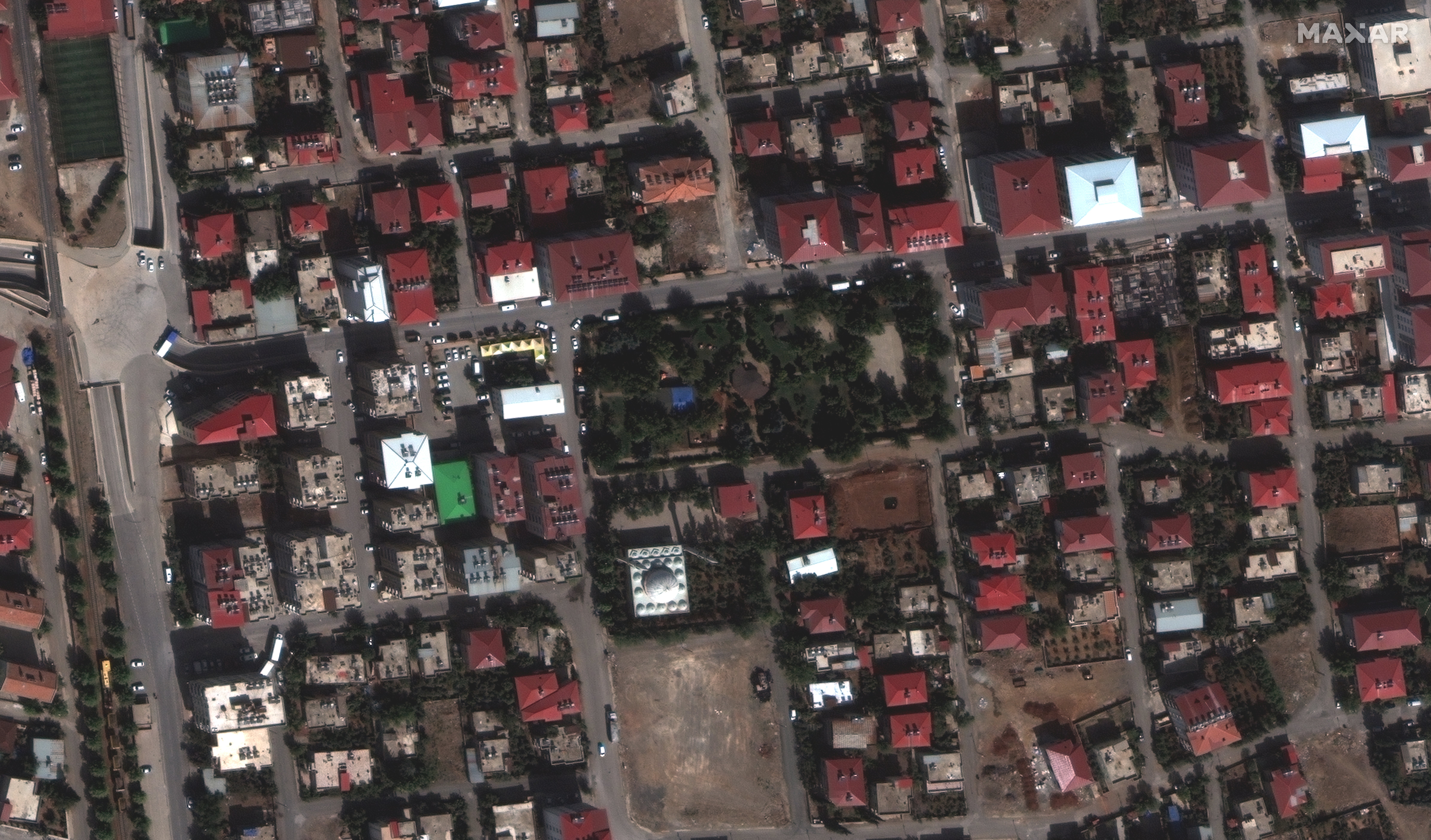
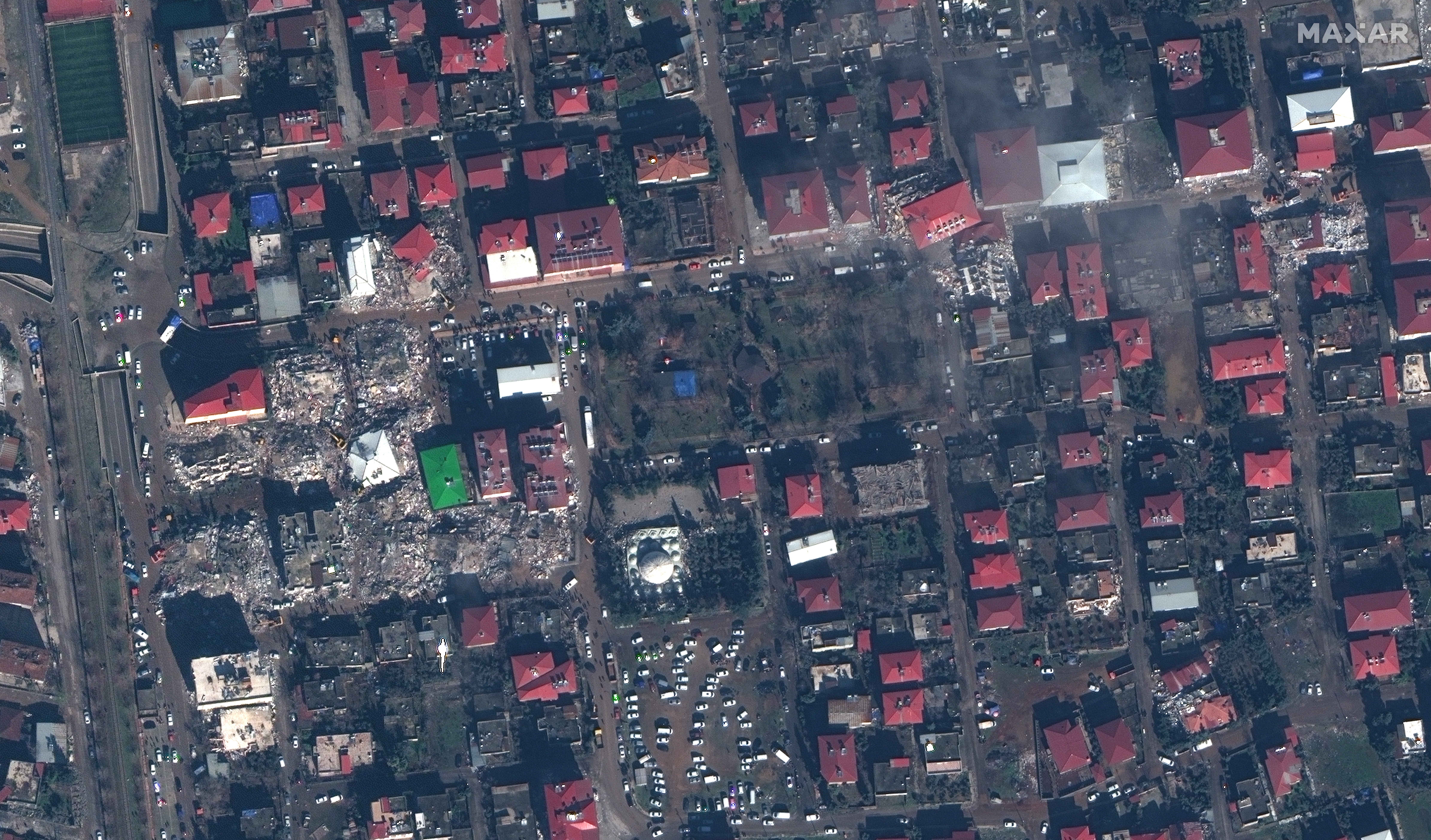
Buildings downtown Islahiye, Turkey before earthquake.
Buildings downtown Islahiye, Turkey before earthquake. (Satellite image ©2023 Maxar Technologies.)
Collapsed buildings and rescue operations in downtown Islahiye, Turkey after earthquake.
Collapsed buildings and rescue operations in downtown Islahiye, Turkey after earthquake. (Satellite image ©2023 Maxar Technologies.)

Images of the first two towns before the earthquakes struck allow for side-by-side comparisons of the towns before and after, emphasising the scale of the destruction. White emergency tents can be seen clustered along the roads and the few areas clear of debris.
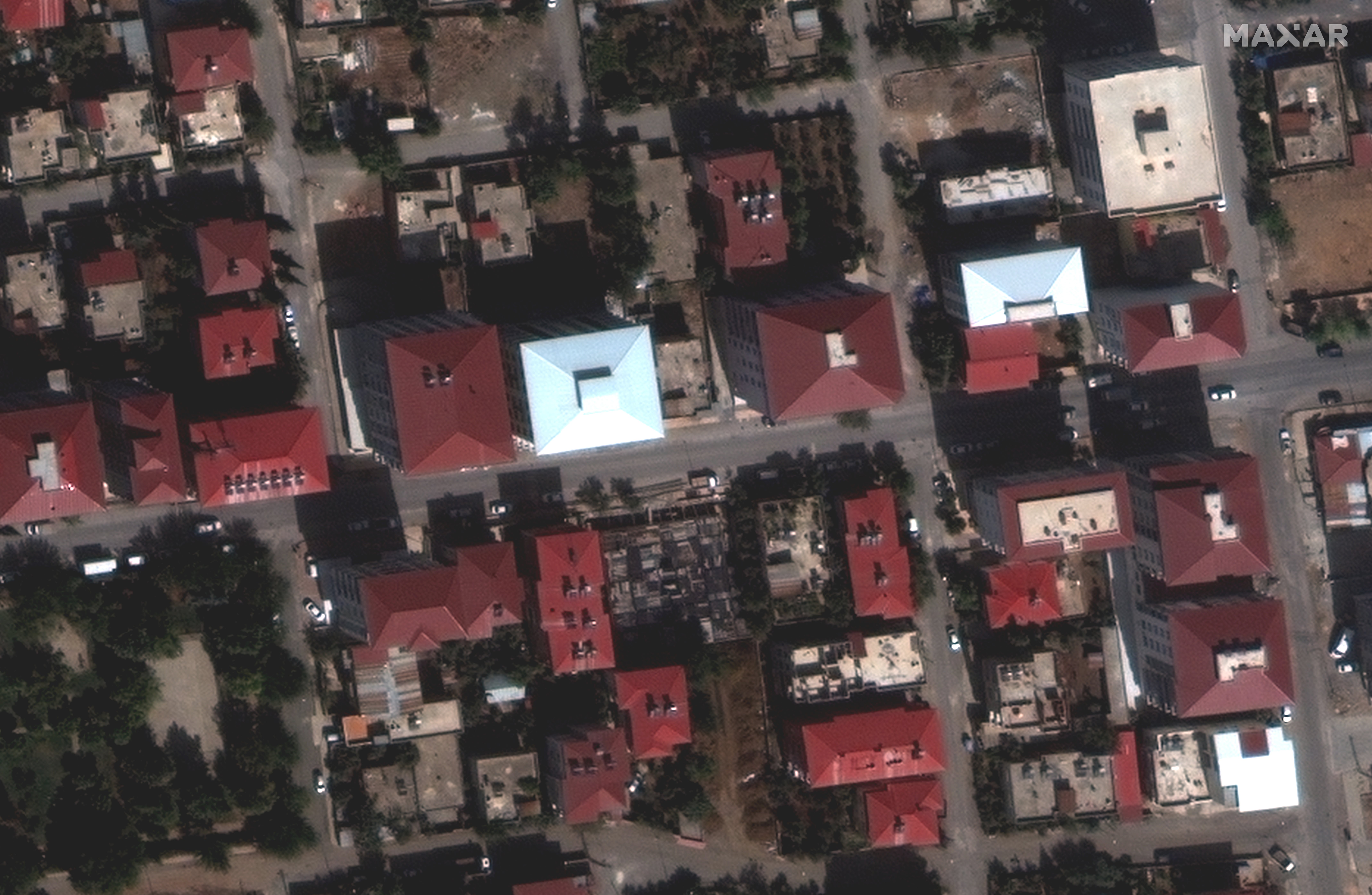
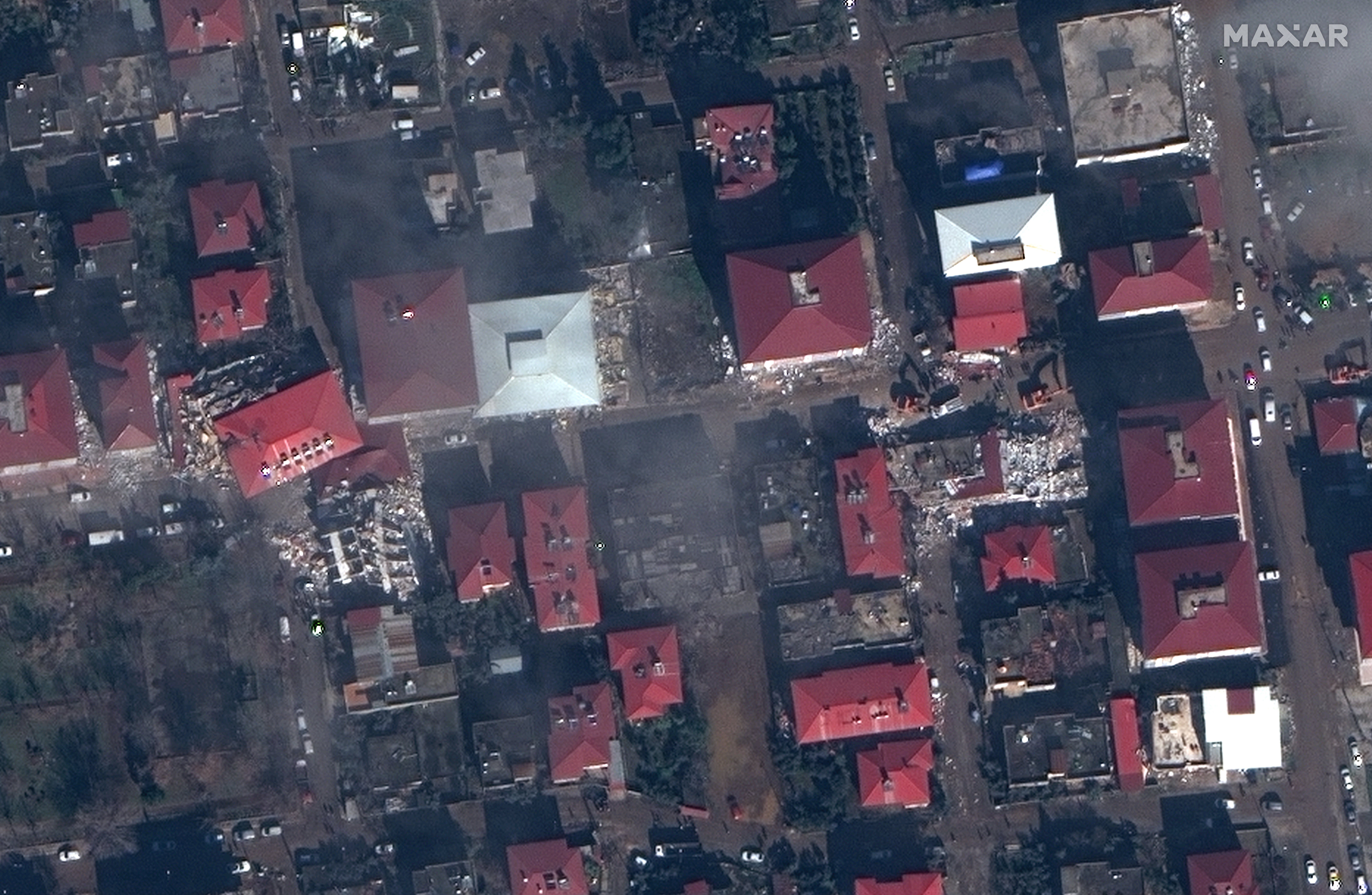
A close up view of buildings in Islahiye, Turkey before earthquake.
A close up view of buildings in Islahiye, Turkey before earthquake. (Satellite image ©2023 Maxar Technologies.)
A close up view of buildings in Islahiye, Turkey after the earthquake.
A close up view of buildings in Islahiye, Turkey after the earthquake. (Satellite image ©2023 Maxar Technologies.)

In another image, emergency tents can be seen set up outside the local hospital in Islahiye. However, reports on the ground say that hospitals are being overwhelmed as casualties come in faster than aid.
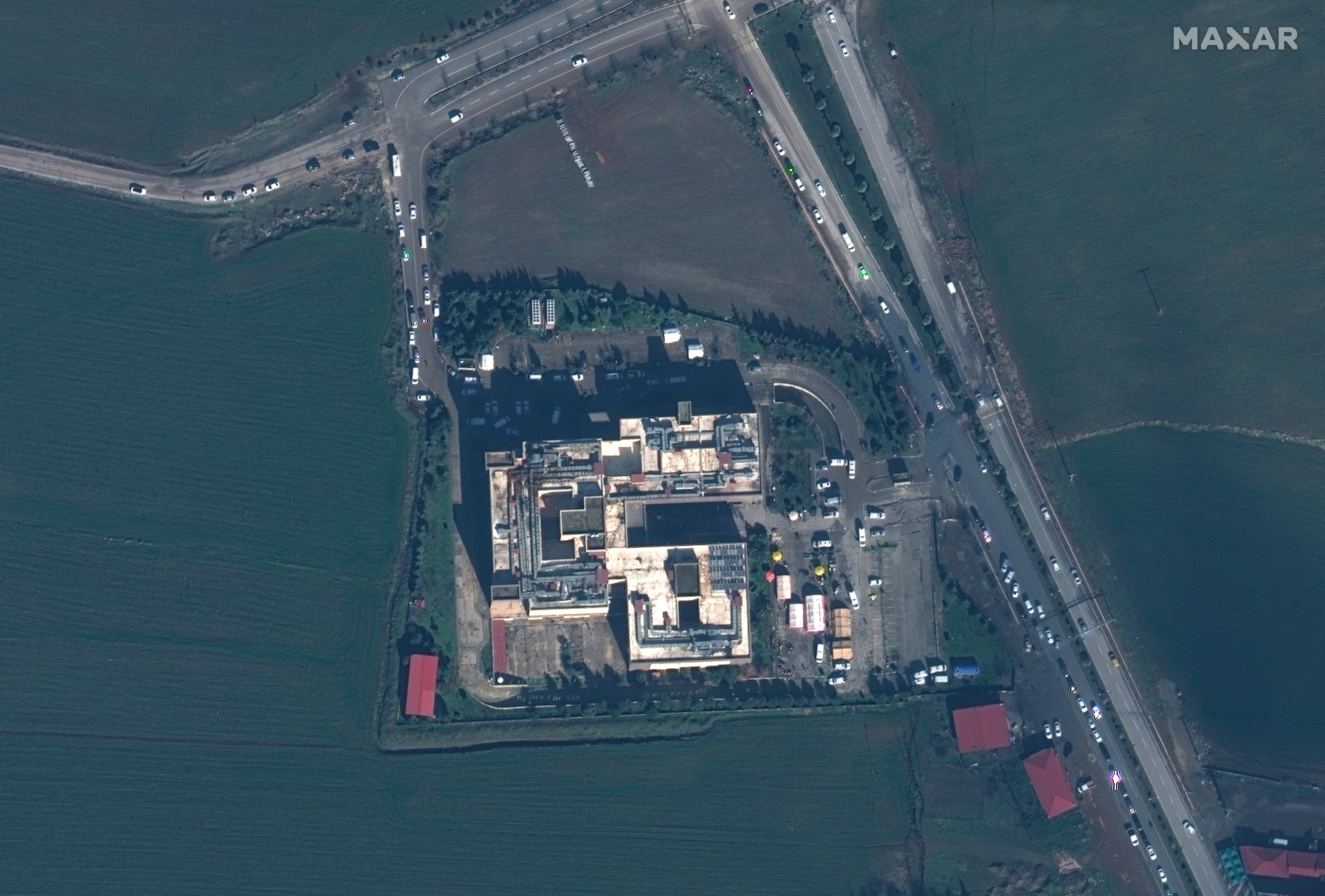
Islahiye hospital with emergency tents after earthquake.
Islahiye hospital with emergency tents after earthquake. (Satellite image ©2023 Maxar Technologies.)

In the town of Nurdagi, what appears to be a residential area looks to have been hit. Houses and whole blocks of flats have either collapsed or been seriously damaged.
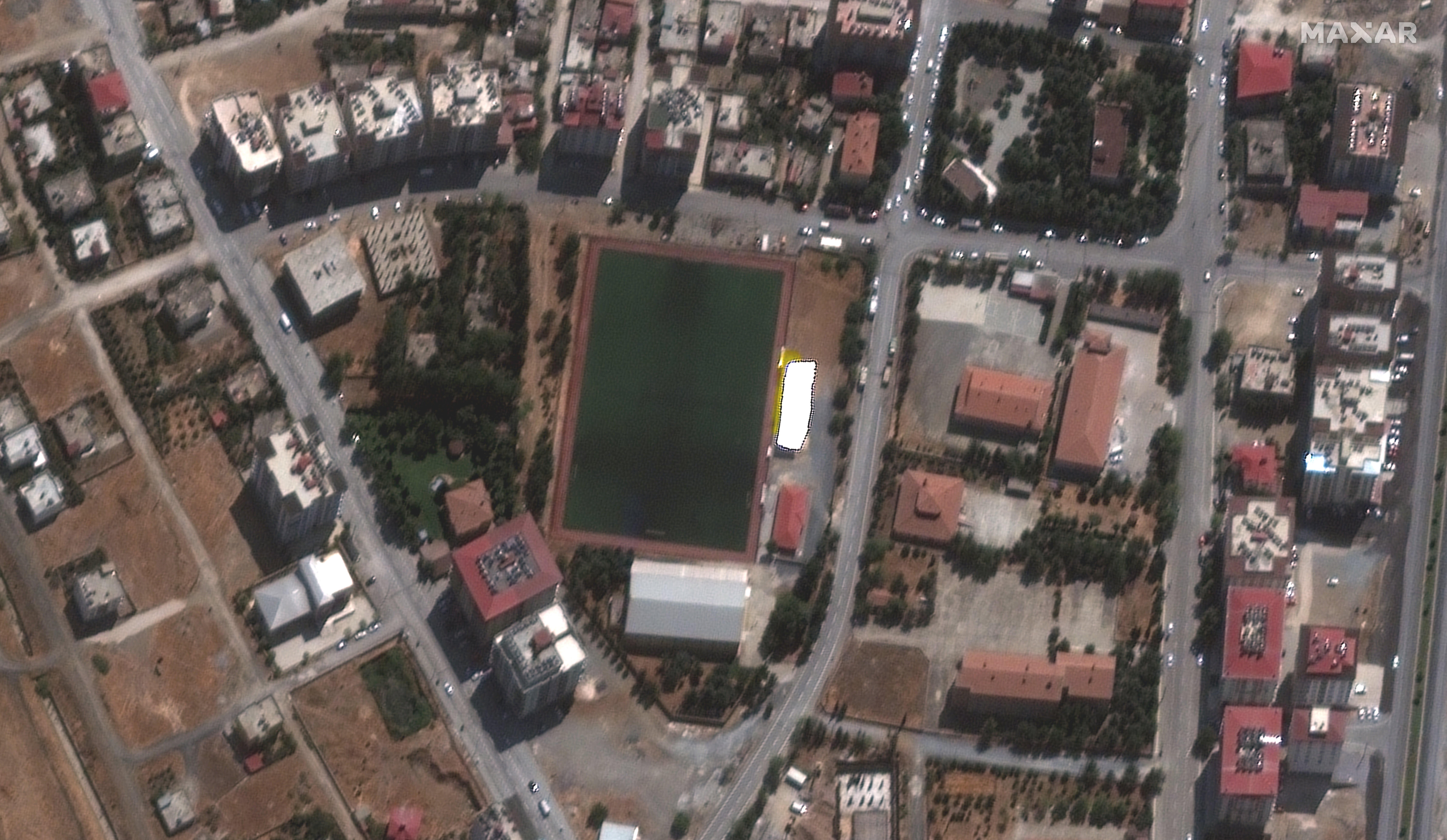
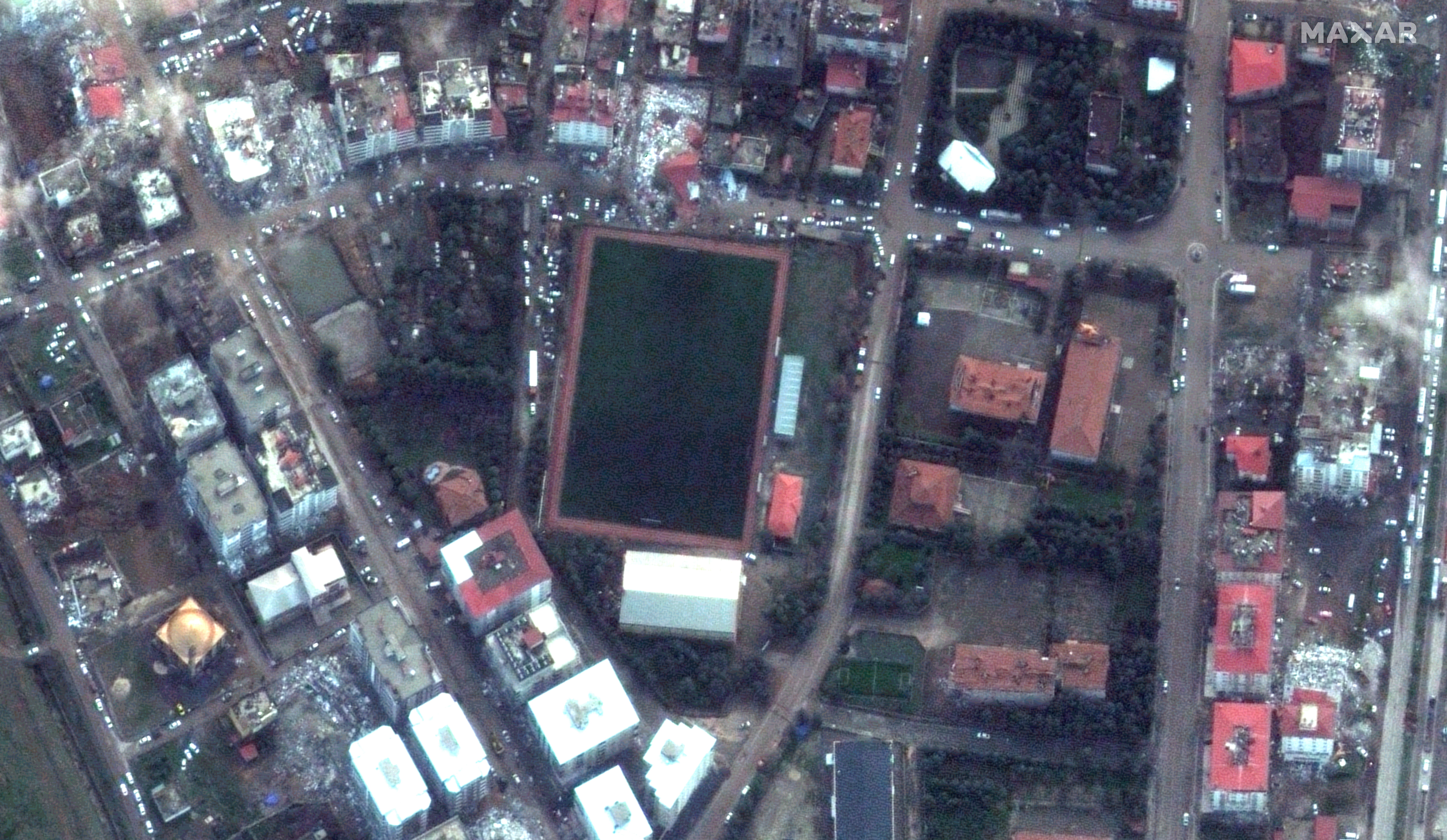
Nurdagi, Turkey before the earthquake.
Nurdagi, Turkey before the earthquake. (Satellite image ©2023 Maxar Technologies.)
Nurdagi, Turkey after earthquake, 7 February 2023.
Nurdagi, Turkey after earthquake, 7 February 2023. (Satellite image ©2023 Maxar Technologies.)

Debris from buildings is scattered across downtown Nurdagi.
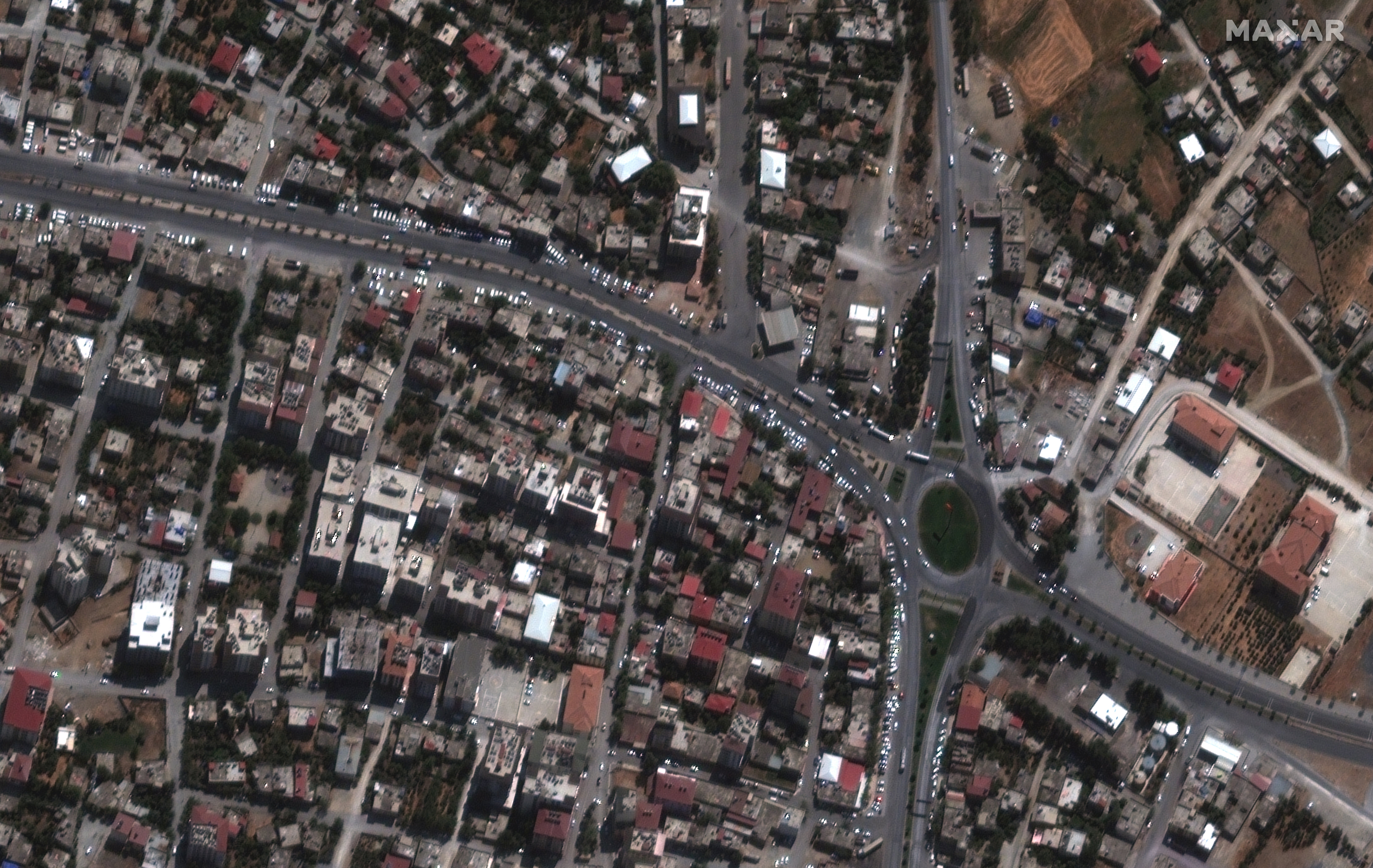
Downtown Nurdagi before the earthquake, Turkey.
Downtown Nurdagi before the earthquake, Turkey. (Satellite image ©2023 Maxar Technologies.)
Downtown Nurdagi after earthquake, 7 February 2023.
Downtown Nurdagi after earthquake, 7 February 2023. (Satellite image ©2023 Maxar Technologies.)

The images were taken by satellites owned by Maxar Technologies, a space technology company headquartered in Colorado, USA. While clouds and poor weather continue to affect the area, Maxar was able to capture these images that shed light on what’s happening on the ground.
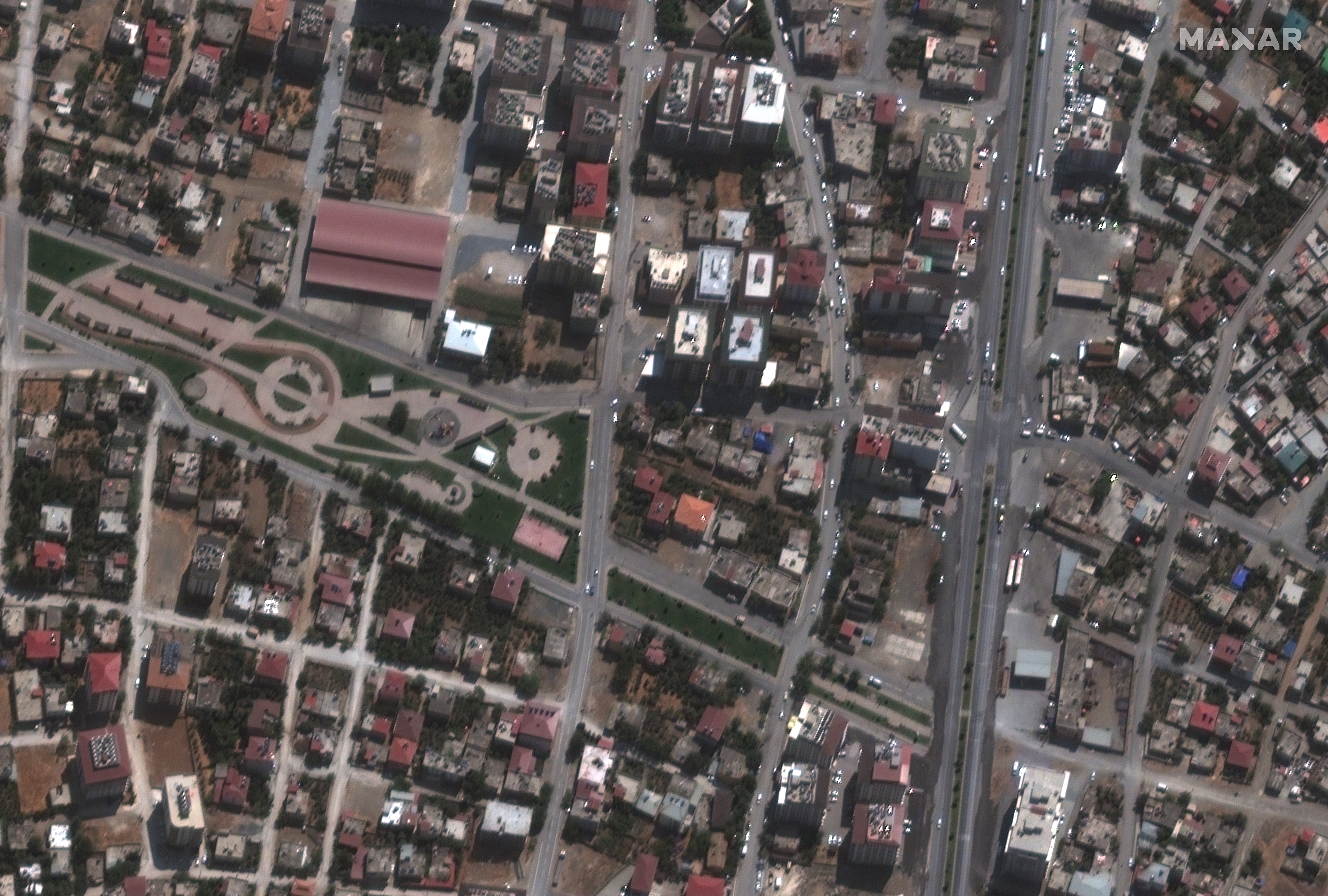
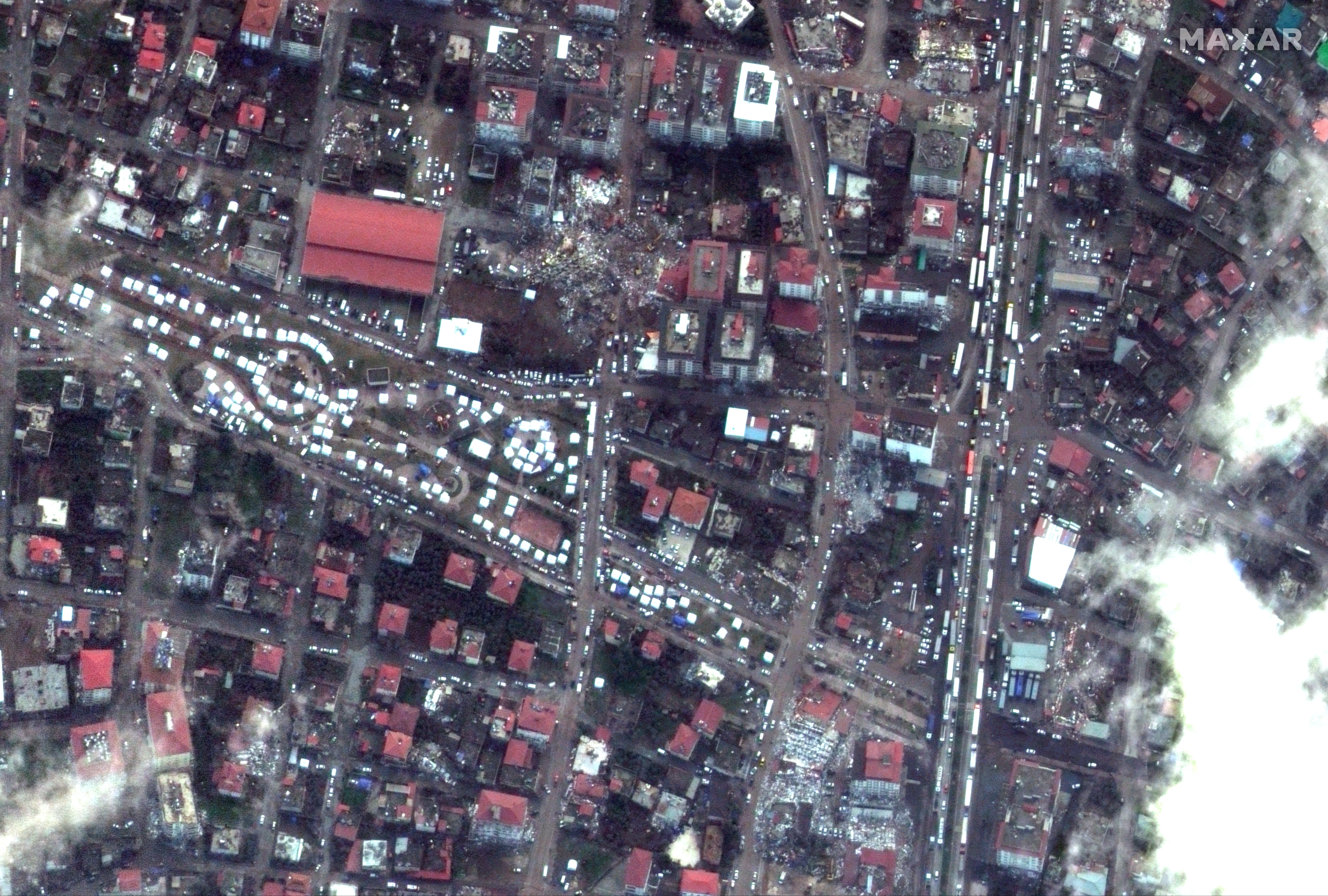
Buildings in Nurdagi, Turkey before the earthquake.
Buildings in Nurdagi, Turkey before the earthquake. (Satellite image ©2023 Maxar Technologies.)
White emergency tents and damaged buildings Nurdagi, Turkey 7 Ferbuary 2023.
White emergency tents and damaged buildings Nurdagi, Turkey 7 Ferbuary 2023. (Satellite image ©2023 Maxar Technologies.)

Maxar is continuing to monitor the region and will provide new updates as soon as they have additional imagery and information.
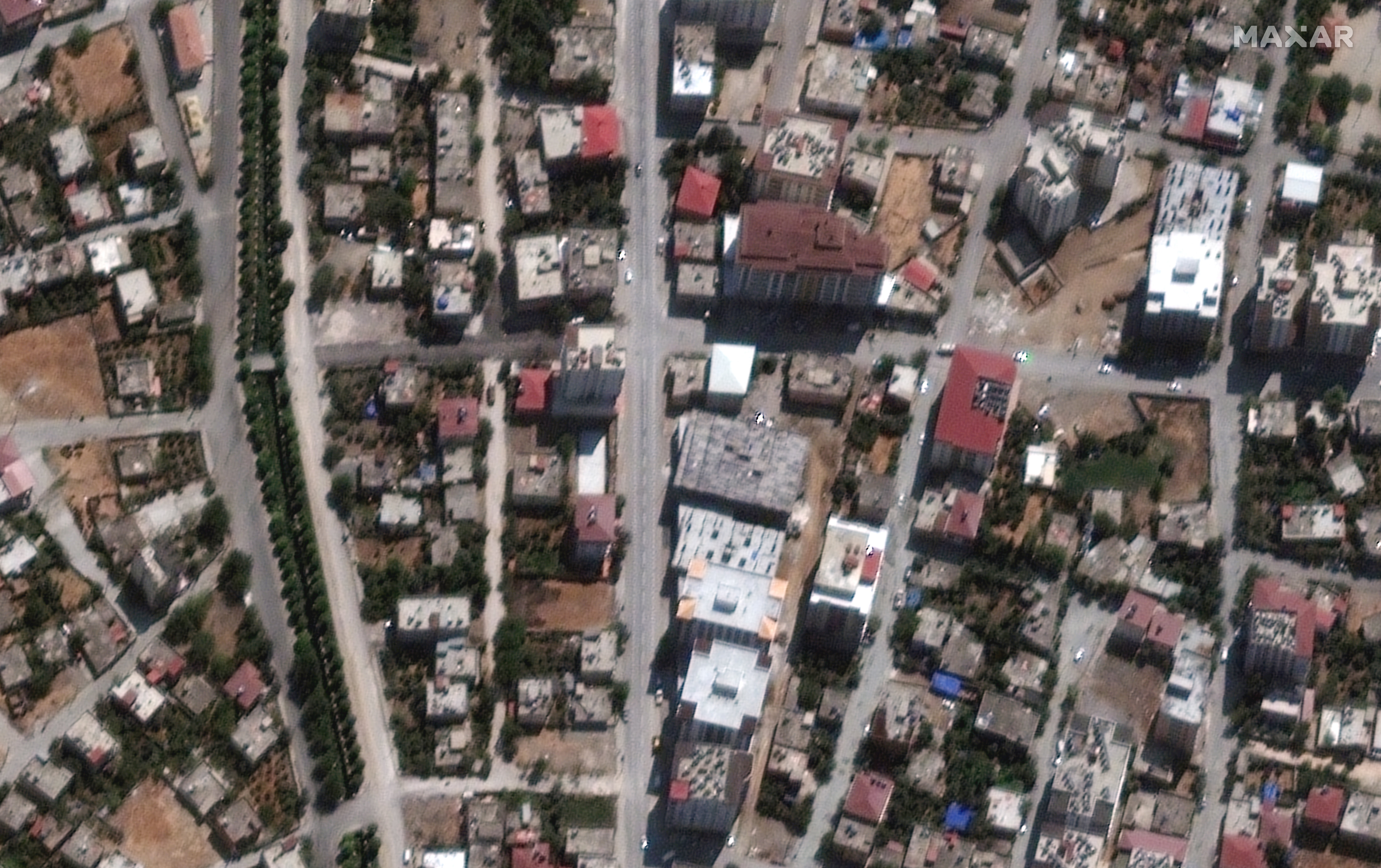
A residential area in Nurdagi before the earthquake.
A residential area in Nurdagi before the earthquake. (Satellite image ©2023 Maxar Technologies.)
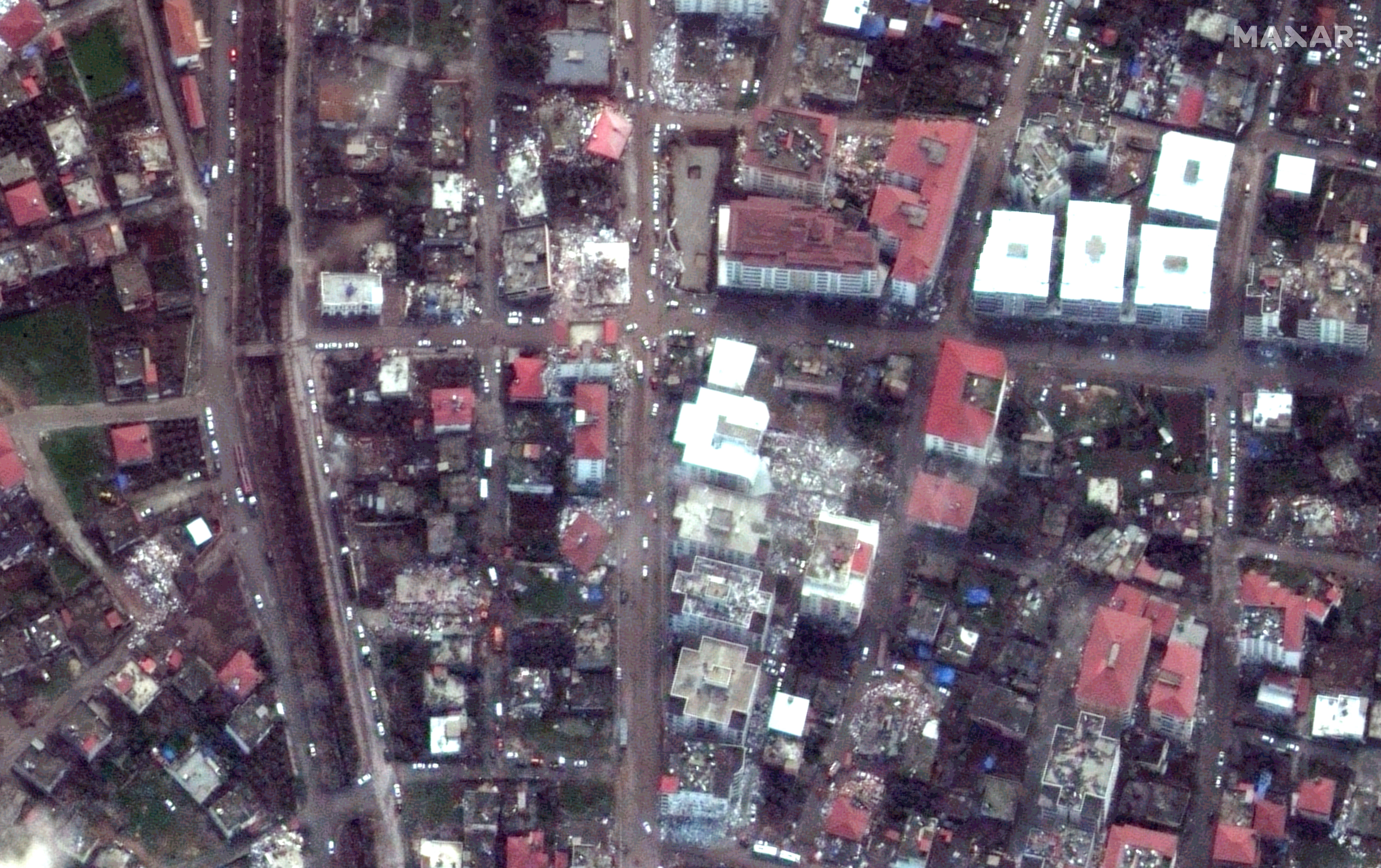
Destroyed residential building in Nurdagi, Turkey.
Destroyed residential building in Nurdagi, Turkey. (Satellite image ©2023 Maxar Technologies.)

Join our commenting forum

Join thought-provoking conversations, follow other Independent readers and see their replies

Comments
Thank you for registering

Please refresh the page or navigate to another page on the site to be automatically logged inPlease refresh your browser to be logged in