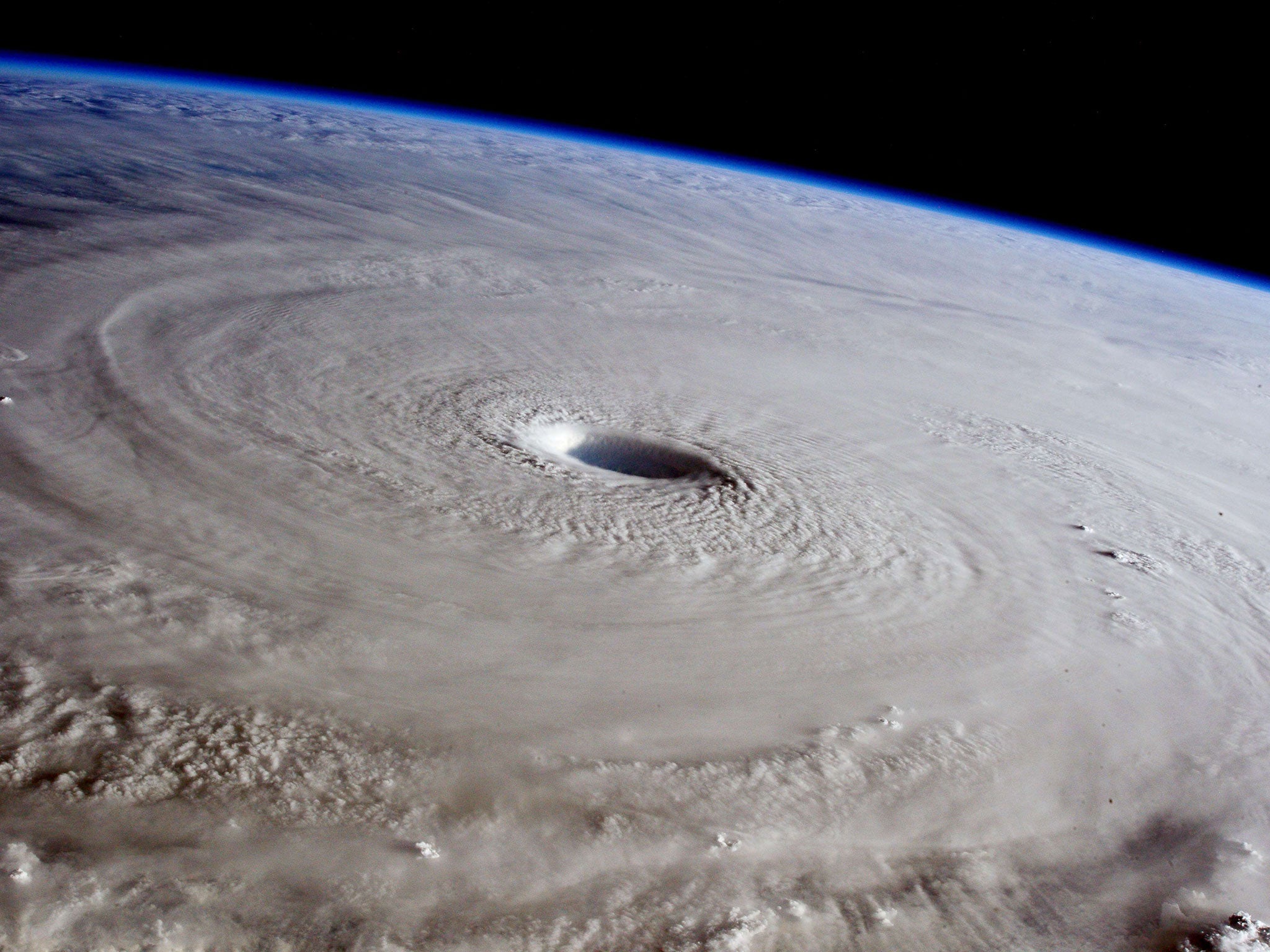
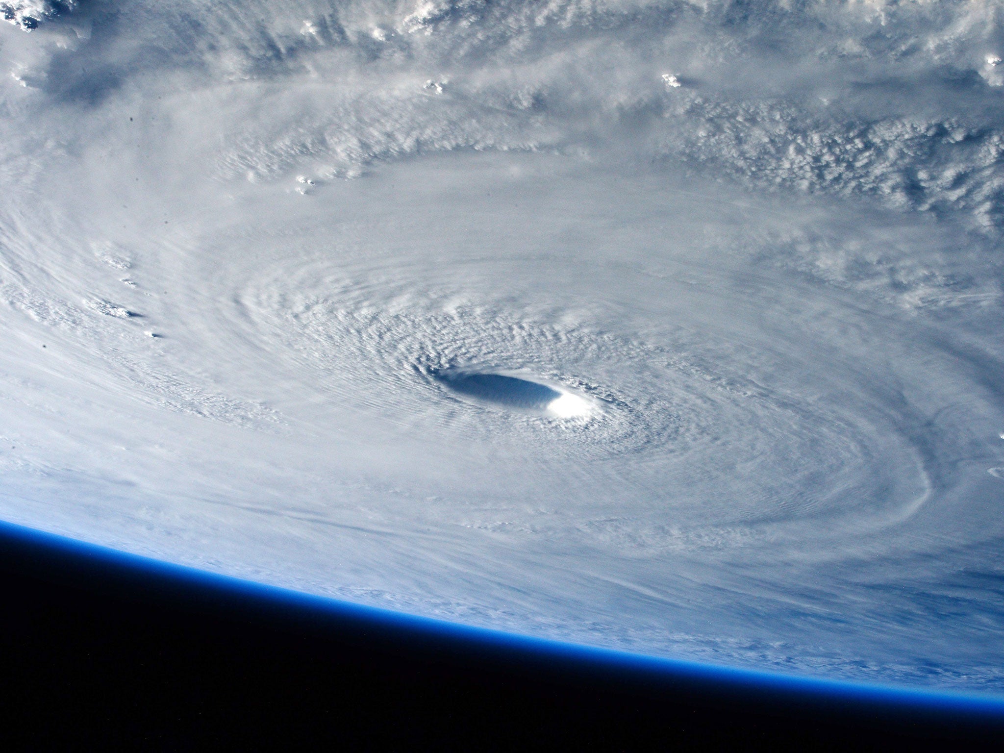
Typhoon Maysak: Dramatic images from space show true scale of deadly typhoon as it heads towards the Philippines
Warnings of landslides and storm surges have been issued in the Philippines

Your support helps us to tell the story
From reproductive rights to climate change to Big Tech, The Independent is on the ground when the story is developing. Whether it's investigating the financials of Elon Musk's pro-Trump PAC or producing our latest documentary, 'The A Word', which shines a light on the American women fighting for reproductive rights, we know how important it is to parse out the facts from the messaging.
At such a critical moment in US history, we need reporters on the ground. Your donation allows us to keep sending journalists to speak to both sides of the story.
The Independent is trusted by Americans across the entire political spectrum. And unlike many other quality news outlets, we choose not to lock Americans out of our reporting and analysis with paywalls. We believe quality journalism should be available to everyone, paid for by those who can afford it.
Your support makes all the difference.Dramatic images taken from the International Space Station show the true scale and power of a super typhoon blamed for the deaths of four people on islands in the western Pacific.
Warnings of possible landslides and storm surges have been issued in the Philippines, as Typhoon Maysak was set to hit eastern coastal areas over the weekend.
Officials have said the typhoon has weakened since reaching Philippine waters – and was expected to further lose strength as it approached the coast.


As of Thursday morning, the typhoon, situated about 569 miles north east of Borongan city, was carrying winds of 109mph and gusts of up to 124mph as it moved at about a rate of 12mph, Esperanza Cayanan, an officer of the government's weather bureau, said.
Forecasters have said storm surges of up to 10ft were possible on the eastern coast, with moderate to heavy rains expected within a 124 mile radius of the eye of the typhoon.
Rescue teams and relief goods have been prepared for when the typhoon makes landfall, which was expected on Saturday evening or early Sunday, according to an Associated Press report.
A low-level storm warning was expected to be issued today for the country's eastern provinces.
Cayanan said it was possible it could be downgraded to a storm or tropical depression as it weakened while crossing the land.
About 20 major typhoons pass through the Philippines each year, with the storms becoming increasingly fierce more recently, Reuters has reported.
In December last year it was reported that at least 21 people died after Typhoon Hagupit swept across the area.
Fearful of a repeat of the Super Typhoon Haiyan in November the previous year, which saw 7,300 people killed, the Philippine government evacuated thousands ahead of the storm.
They also placed the army on alert and distributed food and medical supplies to remote areas.
Additional reporting by AP and Reuters
Join our commenting forum
Join thought-provoking conversations, follow other Independent readers and see their replies
Comments