Satellite images of North Korea show landslides caused by hydrogen bomb test
Test causes a 6.3 magnitude tremor, followed moments later by a 4.1 magnitude quake

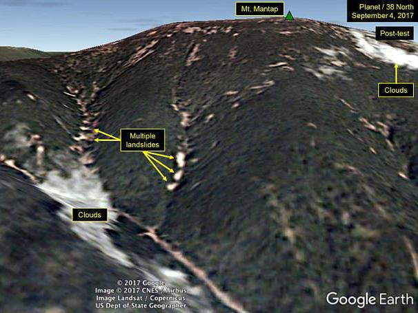
Kim Jong-un’s hydrogen bomb test triggered a series of landslides in North Korea, new satellite images suggest.
They were generated at the Punggye-ri military testing site where the secretive communist state conducted an underground detonation in tunnels below Mount Mantap over the weekend.
The country’s sixth nuclear test caused “more numerous and widespread” disturbance than their previous five tests, according to analysis group 38 North, who released the images earlier this week.
The test caused a 6.3 magnitude tremor, followed moments later by a 4.1 magnitude quake.
They led to fears that a rock over the test site had caved in, although 38 North said the images appeared to confirm this was not the case.
The group did say the images suggest disturbances had taken place “beyond” the test site of Punggye-ri.

It is thought the power range of the bomb was between 50 to 120 kilotons, at least three times the size of the bomb dropped on Hiroshima by the US at the end of the World War Two.
The test also led to warnings that the test site could be at risk of collapse with Chinese scientist, Wang Naiyan, telling the South China Morning Post that Pyongyang risked blowing the top off Mt Mantap with increasingly large bombs.
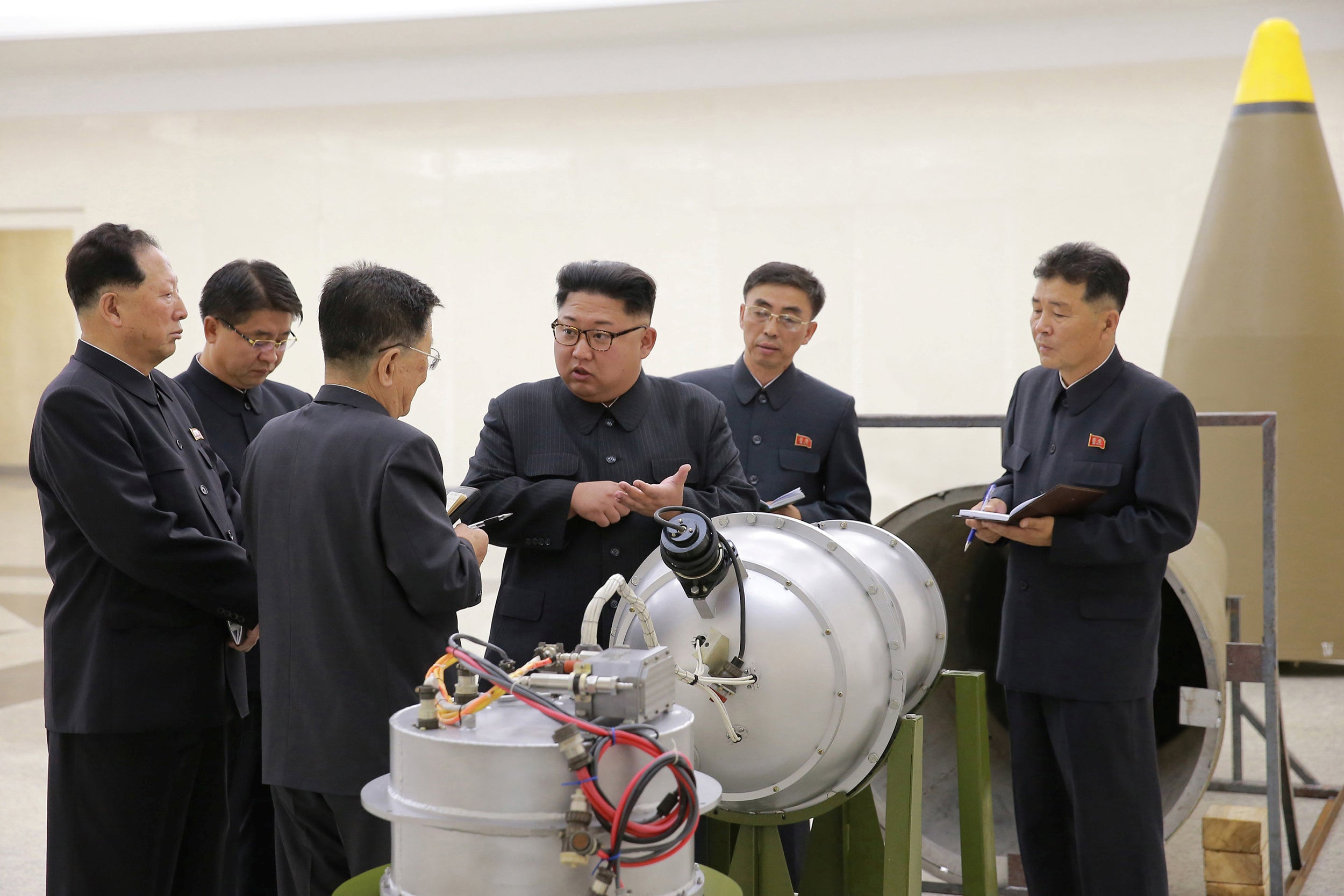
Pyongyang claimed the test was of an advanced hydrogen bomb to be loaded onto a missile.
International pressure has begun to mount over North Korea’s nuclear testing as a number of world leaders condemned the detonation.
Earlier this week the US urged the UN Security Council to impose tougher measures against the country and called for a vote on fresh sanctions.
Donald Trump announced an agreement for the US to sell South Korea and Japan a "substantially increased" amount of military equipment in an attempt to counter Kim Jong-Un.
In a phone call Theresa May also told the US leader that she agreed with the need for “swift” measures to tackle the threat posed by North Korea.
Join our commenting forum
Join thought-provoking conversations, follow other Independent readers and see their replies
Comments
Bookmark popover
Removed from bookmarks