Nepal earthquake: Deadly 7.3 magnitude quake was aftershock to disaster on 25 April
Geologists said more earthquakes could strike as plates continue clashing

Your support helps us to tell the story
From reproductive rights to climate change to Big Tech, The Independent is on the ground when the story is developing. Whether it's investigating the financials of Elon Musk's pro-Trump PAC or producing our latest documentary, 'The A Word', which shines a light on the American women fighting for reproductive rights, we know how important it is to parse out the facts from the messaging.
At such a critical moment in US history, we need reporters on the ground. Your donation allows us to keep sending journalists to speak to both sides of the story.
The Independent is trusted by Americans across the entire political spectrum. And unlike many other quality news outlets, we choose not to lock Americans out of our reporting and analysis with paywalls. We believe quality journalism should be available to everyone, paid for by those who can afford it.
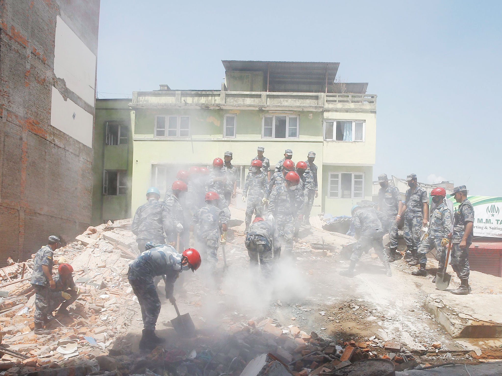
Your support makes all the difference.The earthquake that killed at least 42 people in Nepal today was an aftershock to the disaster that left 8,000 dead more than two weeks ago, geologists have said.
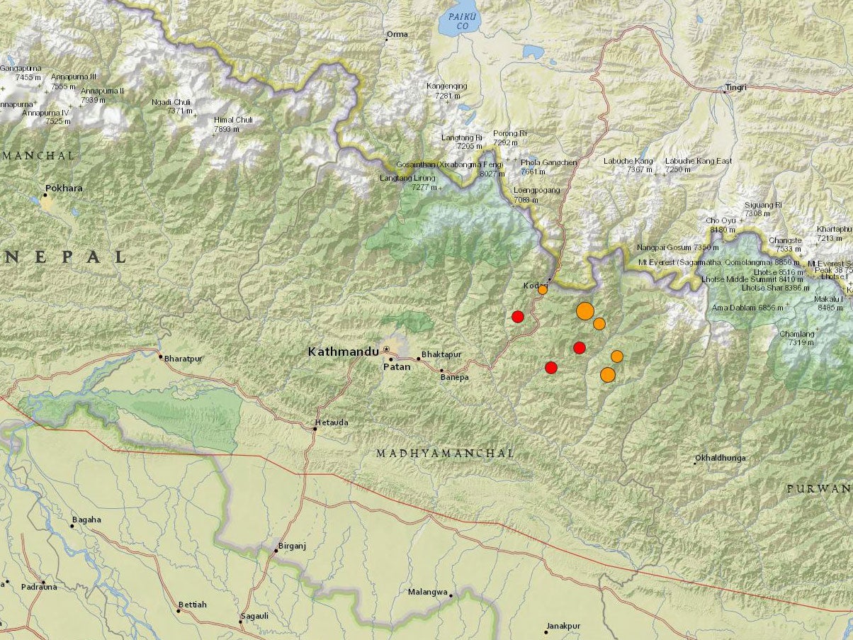
The epicentre, near the base camp for Mount Everest, was less than 100 miles away from that of its predecessor on 25 April.
Scientists at the US Geological Survey said it was one of around 100 aftershocks stronger than magnitude three recorded since the previous earthquake.
At least nine more tremors measuring up to 6.3 on the Richter scale followed it on Tuesday along the same fault line, spreading further panic.

An aftershock is any earthquake following a larger event, called a mainshock, in roughly the same location.
While Tuesday’s earthquake struck with a magnitude of 7.3, toppling buildings and triggering landslides, the devastation did not equal that wrought by the magnitude 7.8 event that preceded it.
That disaster flattened entire rural villages and collapsed large buildings and historical monuments with the force of the shaking.
At least 8,046 people were killed and 17,800 injured, with almost 400 people still missing in the rubble.
Millions of people who lost their homes were still living in temporary shelters when the second earthquake hit, after foreign aid poured into Nepal and British soldiers joined aid agencies from around the world to help the relief effort.
The latest quake, at around 8am BST (12.35 local time), could be felt as far away as India, Tibet and Bangladesh.
Terrified crowds fled buildings in Kathmandu, which was already badly damaged, and in Delhi, offices were evacuated as the earth shook and high rises swayed from side to side.
US Geological Survey recorded the epicentre near the Himalayan town of Namche Bazar at a shallow depth of about 19 km (12 miles).
In its analysis, the agency described the 12 May event as the “largest aftershock to date” from the 25 April earthquake.
Also known as the Gorkha earthquake, its epicentre was 93 miles (150 km) to the west.
It resulted from continuing movement along the fault line between the Indian and Eurasian tectonic plates.
Caused by “thrust faulting”, the earthquake occurred as the Indian plate continues converging with its Eurasian neighbour at a rate of 45mm a year.
The Indian plate is pushing beneath as the other slides on top and the action is making the Himalayan mountain range, which were formed because of the collision, higher every year.
A spokesperson for the US Geological Survey said the movement would continue to generate "numerous earthquakes" and make Nepal "one of the most seismically hazardous regions on Earth".
The agency said that although the epicentre of Tuesday’s earthquake was plotted as a point, it was more accurately described as a “slip” along a fault.
Seismic events of that size usually happen along areas 35 miles (55km) long and 19 miles (13km) wide.
The earthquake on April 25 happened along approximately 75 miles (120km) of plate boundaries, 50 miles (80km) wide.
The underground disturbance it caused stretched eastwards from the epicentre, towards the badly damaged capital of Kathmandu, and the latest earthquake happened towards the eastern end of that line.

Before the start of 2015, only four earthquakes larger than six on the Richter scale had happened in the region in 100 years.
The largest, the 1934 Nepal-Bihar earthquake, struck with a magnitude of eight and caused around 10,600 deaths.
It ruptured a large section of the fault to the south of Tuesday’s earthquake and severely damaged Kathmandu.
A magnitude 6.9 earthquake near the border of Nepal and India also killed almost 1,500 people in 1988.
Join our commenting forum
Join thought-provoking conversations, follow other Independent readers and see their replies
Comments