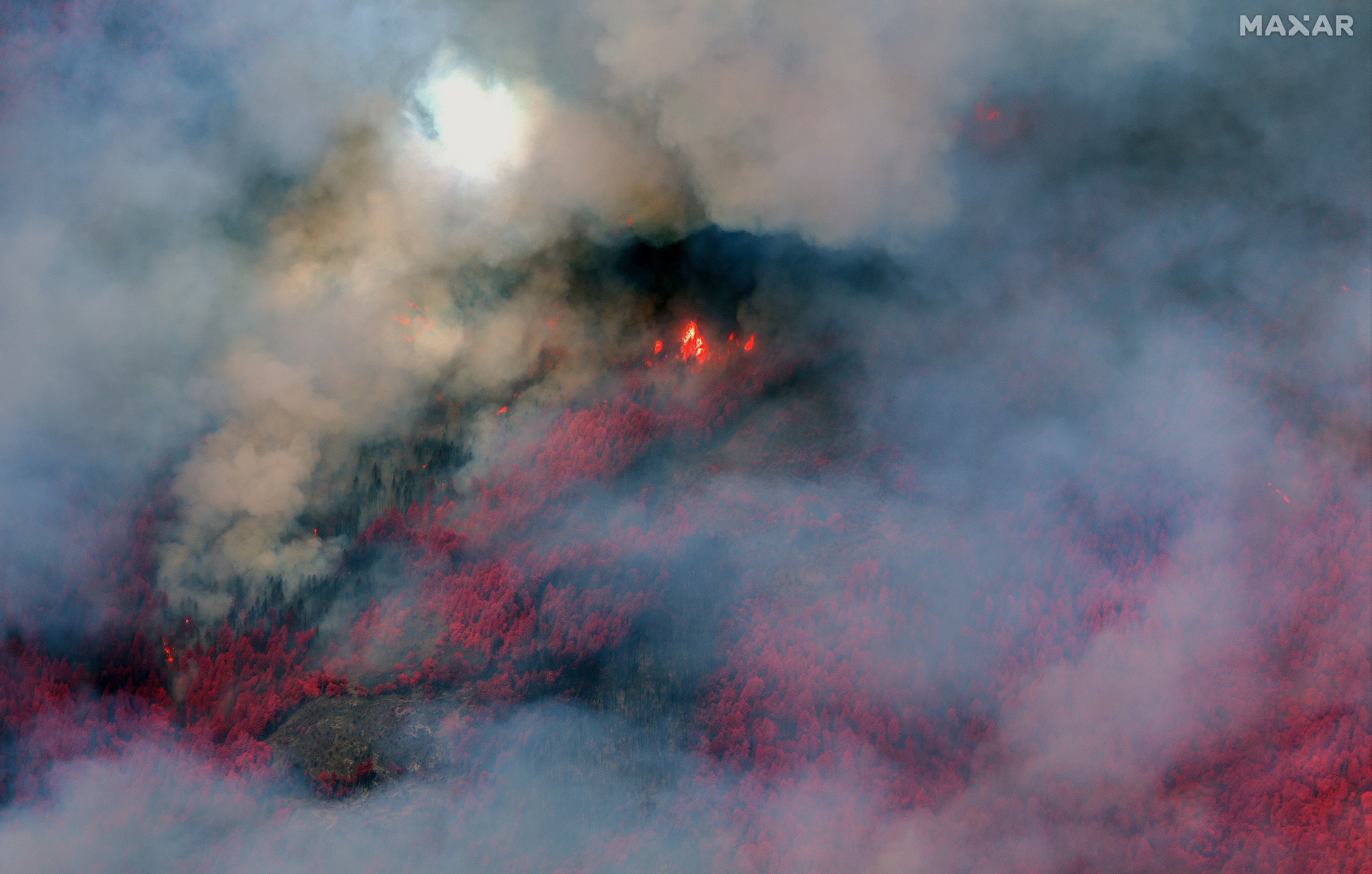
Shocking satellite photos show the extent of damage from the Chico wildfire in California
The Park Fire blaze is now the fourth-largest fire in California’s recorded history
Your support helps us to tell the story
From reproductive rights to climate change to Big Tech, The Independent is on the ground when the story is developing. Whether it's investigating the financials of Elon Musk's pro-Trump PAC or producing our latest documentary, 'The A Word', which shines a light on the American women fighting for reproductive rights, we know how important it is to parse out the facts from the messaging.
At such a critical moment in US history, we need reporters on the ground. Your donation allows us to keep sending journalists to speak to both sides of the story.
The Independent is trusted by Americans across the entire political spectrum. And unlike many other quality news outlets, we choose not to lock Americans out of our reporting and analysis with paywalls. We believe quality journalism should be available to everyone, paid for by those who can afford it.
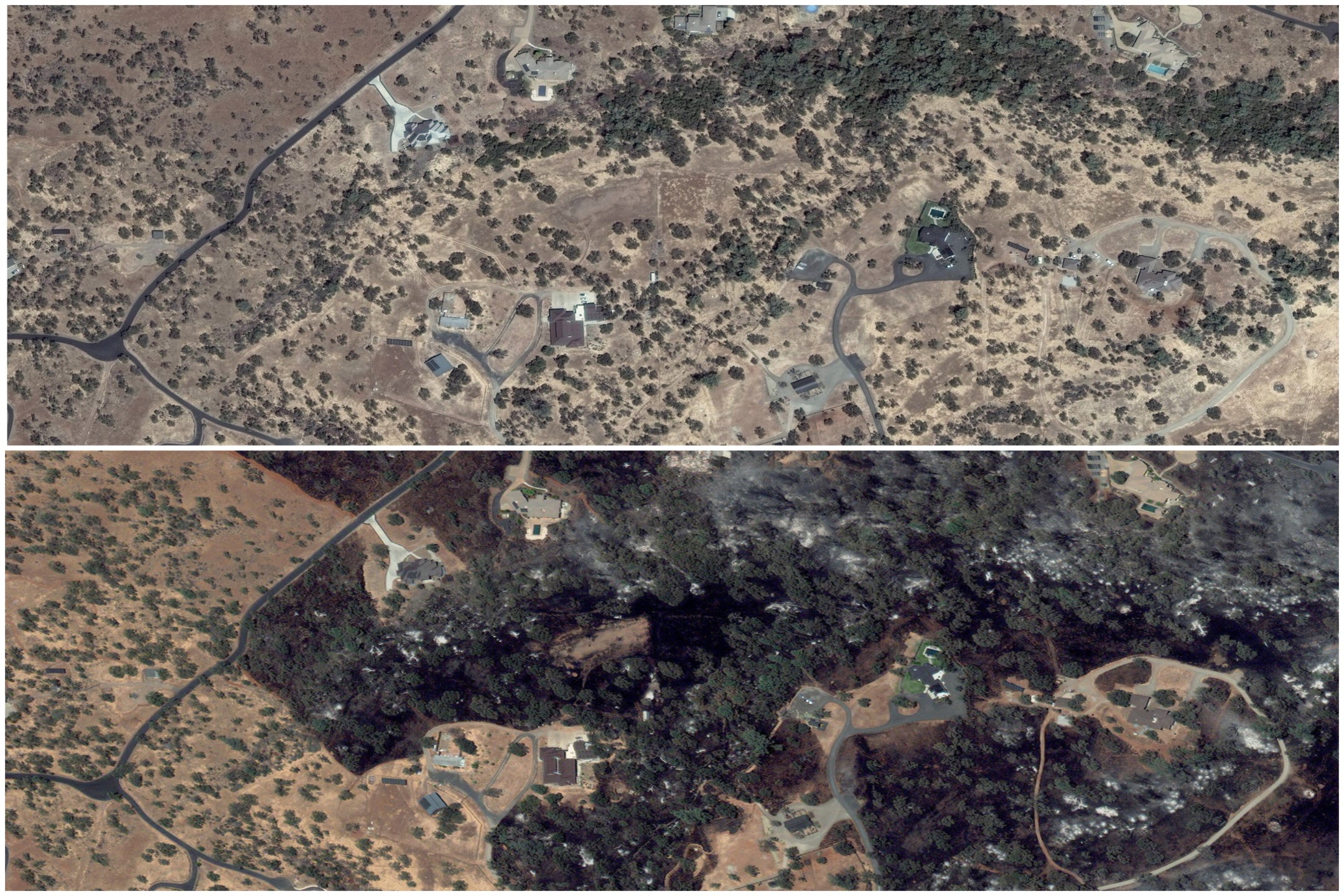
Your support makes all the difference.Before and after satellite images have captured the shocking extent of damage from California’s Park Fire which has already burned more than 420,000 acres in the state.
The fire started two weeks ago when a man, identified as Ronnie Dean Stout II, allegedly pushed a burning car into a gulley. Stout II was later arrested for willful and malicious arson and faces up to 20 years in prison if convicted.
The blaze is the fourth-largest fire in California’s recorded history. It is currently 34 percent contained and has left 636 structures destroyed in Butte and Tehama counties.
The images, captured by Maxar Technologies, show the fire’s impact from space.
The Northern California fire has continued to spread due to hot and dry conditions, with authorities warning that the fire could go on for months. Over 6,000 people have been assigned to fight the blaze, including fire personnel from Texas.

“It will continue to burn actively, moving to the north and east, ascending slopes with critically dry fuel,” officials said in an incident summary this week.
The photos below show the before and after of a section of the fire in Chico on Richardson Springs Road. The first image was taken on July 21 and the second on July 26. The second photo shows acres of scorched earth and homes in the mountain community.
The Park Fire is located about a dozen miles from Paradise, where the Camp Fire, the deadliest wildfire in California history, occurred in 2018. Eighty-five people died from the flames.

According to the Los Angeles Times, some families moved closer to Chico after the Paradise fire only to be displaced from their homes once again. At least 4,261 people have been evacuated in connection with the Park Fire. So far, there have been no reported fatalities. Meanwhile, California officials continue to battle 10 other fires.
On Wednesday, thick smoke will keep temperatures cooler and increase humidity over parts of the fire. Humidity levels are expected to increase later in the week.

Join our commenting forum
Join thought-provoking conversations, follow other Independent readers and see their replies
Comments