Mystery of plane spotted at bottom of Minneapolis lake solved
A Google Maps spokeswoman has suggested there is a simple explanation to the conundrum
Your support helps us to tell the story
From reproductive rights to climate change to Big Tech, The Independent is on the ground when the story is developing. Whether it's investigating the financials of Elon Musk's pro-Trump PAC or producing our latest documentary, 'The A Word', which shines a light on the American women fighting for reproductive rights, we know how important it is to parse out the facts from the messaging.
At such a critical moment in US history, we need reporters on the ground. Your donation allows us to keep sending journalists to speak to both sides of the story.
The Independent is trusted by Americans across the entire political spectrum. And unlike many other quality news outlets, we choose not to lock Americans out of our reporting and analysis with paywalls. We believe quality journalism should be available to everyone, paid for by those who can afford it.
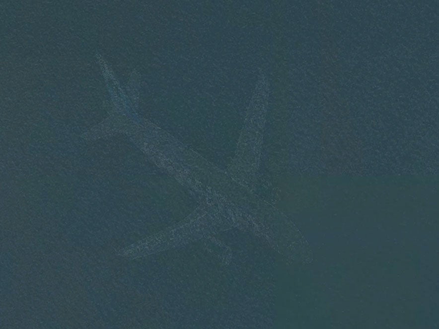
Your support makes all the difference.The mystery behind a ghostly image, seemingly showing a passenger plane “submerged” in a US lake on Google Maps, has been solved.
Pictures of a plane, which appeared to have sunk to the bottom of Lake Harriet in Minneapolis, puzzled authorities after they emerged on Google’s satellite map.
Officials appeared to have no record of a plane crash in the area and were unaware there was a wreck in the lake.
However, before the image began to spark mass conspiracy theories, a Google Maps spokeswoman suggested there was a simple explanation to the conundrum.
Due to the way Google’s satellite imagery is created it is most likely the picture of the lake was taken at the same time as a plane was flying over it, causing the two objects to merge.
Susan Cadrecha, a spokeswoman for Google maps, told The Minneapolis Star-Tribune: "In short, each satellite image you see on the map is actually a compilation of several images.
"Fast-moving objects like planes often show up in only one of the many images we use for a given area."
Lake Harriet is around five miles from Minneapolis-St Paul Airport, where more than 400,000 planes land and take off each year. It is also under the airport’s flight path making Google’s theory even more plausible.
Other Google satellite images also appear to show planes in mysterious locations.
An image of a passenger plane sitting in a New York playground has been spotted by Untapped Cities, and another image of a plane can been seen in the Atlantic Ocean near Long Beach, New York, according to Gawker.
Join our commenting forum
Join thought-provoking conversations, follow other Independent readers and see their replies
Comments