Hurricane strengthening for second hit at US coast
As Florida braces for further onslaught, large parts of Europe are also suffering from unusual weather patterns

Your support helps us to tell the story
From reproductive rights to climate change to Big Tech, The Independent is on the ground when the story is developing. Whether it's investigating the financials of Elon Musk's pro-Trump PAC or producing our latest documentary, 'The A Word', which shines a light on the American women fighting for reproductive rights, we know how important it is to parse out the facts from the messaging.
At such a critical moment in US history, we need reporters on the ground. Your donation allows us to keep sending journalists to speak to both sides of the story.
The Independent is trusted by Americans across the entire political spectrum. And unlike many other quality news outlets, we choose not to lock Americans out of our reporting and analysis with paywalls. We believe quality journalism should be available to everyone, paid for by those who can afford it.
Your support makes all the difference.Mississippi declared a state of emergency last night and Louisiana prepared for evacuations as Hurricane Katrina appeared to gather force for a second devastating strike at the US coast.
After wreaking havoc across southern Florida on Friday, leaving seven dead, Katrina was picking up strength over the warm waters of the Gulf of Mexico and could return as soon as tomorrow.
The storm was upgraded to a category three "major hurricane" in the course of the day, meaning it carried winds of more than 120mph. There are fears it could bounce back as a category four - a hurricane of potentially catastrophic intensity with winds of 130mph.
Alarmed residents have barely had time to clear up damage inflicted by Hurricane Dennis last month and Hurricane Ivan last September.
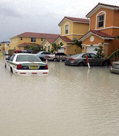
Four of Friday's victims were killed by flying trees when Katrina ripped across Florida's southern tip on Friday. Thousands of trees were uprooted and 50 homes were flooded.
Ending a week of extreme weather worldwide, the storm was expected to swing northwards on a course heading somewhere between the southern Florida Panhandle and the Louisiana coast. In the line of attack are the city of New Orleans and oil and gas installations. Some oil drilling platforms in the Gulf of Mexico have already been evacuated.
Florida has been pummelled by six powerful hurricanes since last August, in what forecasters describe as an "unusually active season". Environmental campaigners say the turbulence is a result of global warming disrupting world weather patterns.
Katrina is the 11th storm of the Atlantic hurricane season, which began on 1 June. That is seven more than are usually whipped up by this stage of the season in the Atlantic, Caribbean and Gulf of Mexico, the US's National Hurricane Centre said. The season ends on 30 November.
Katrina's advance is being watched closely in Europe, which has been assaulted by weather extremes unknown for generations, from south-eastern Europe's tumultuous rainstorms, killing 43, to tinder-dry Portugal, where 11 new fires flared yesterday despite weeks of desperate firefighting.
Hardest hit was Romania, where 31 died, many of whom drowned when water engulfed their homes. Austria, Germany, Bulgaria and Switzerland reported 12 dead, with vast areas under water. Fears remain that floodwaters could cause the river Danube to burst its banks and present further hazards.
In the small Swiss town of Thun, the local football stadium was destroyed, a loss given international prominence by the club's qualification last week for the Champions League, in which it will take on Arsenal. Thun's players helped recovery efforts by handing out food parcels on the town's streets.
Experts seeking an explanation point to the irregularity of the jet stream, the wriggling ribbon of fast-moving wind that drives Europe's weather from the Atlantic. A convulsive kink last week whipped turbulence into Eastern Europe, and locked Iberia in its pocket of hot tranquillity.
"But the jet stream is a permanent feature, it always wanders around, that's nothing new," said Wayne Elliott, a weather forecaster from the Meteorological Office in Exeter.
"The jet stream moves north in summer, south in winter, and the important thing is that it didn't come as far south as was expected last autumn. That's why the rains failed in Iberia, and why northern Europe is unsettled.
"Such behaviour is consistent with predictions by scientists who argue the climate is changing. Global warming could be the key."
WWF goes further. "Global warming has started to exacerbate the frequency and intensity of meteorological catastrophes," a spokesman for the environmental group said on Friday. "Politicians must curb [carbon dioxide] emissions now."
Join our commenting forum
Join thought-provoking conversations, follow other Independent readers and see their replies
Comments