Mapped: Tracking Hurricane Milton’s path as it makes landfall in Florida
Milton made landfall on Wednesday as ‘one of the most destructive hurricanes on record’ for the region
Hurricane Milton slammed into Florida’s Gulf Coast on Wednesday night, bringing devastating winds, life-threatening storm surges and flash floods to communities already battered by Hurricane Helene.
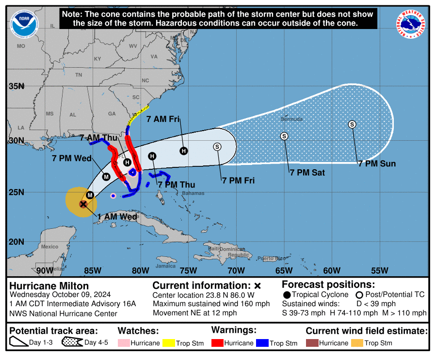
Milton weakened to a Category 3 hurricane before landfall, down from a Category 5.
The cyclone had maximum sustained winds of 120mph as it made landfall at 8.30pm near Siesta Key, the National Hurricane Center said, sparing Tampa.
Siesta Key is a prosperous strip of white sand beaches home to 5,500 people about 70 miles south of Tampa.
The hurricane pounded the coast with ferocious winds of over 100mph and heavy rain, producing a series of tornadoes around the state.
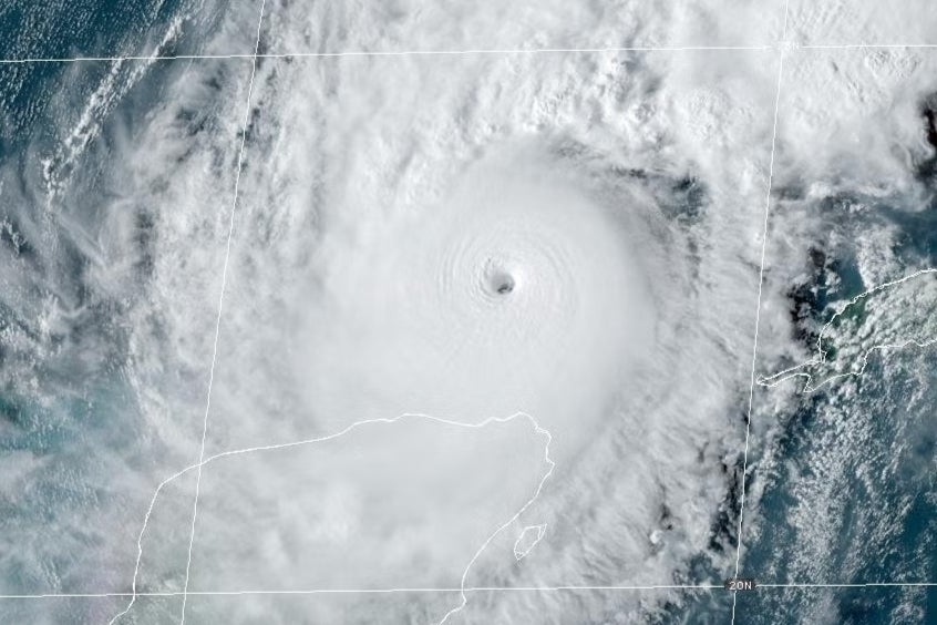
Milton had rapidly intensified from a Category 1 to a Category 5 hurricane on Monday with sustained winds surpassing 180mph. It slowed to a Category 4 on Tuesday morning then restrengthend.
Wind speeds increased by 90mph in under 24 hours, making it one of the most rapidly intensifying and strongest Atlantic storms ever recorded.


The hurricane made landfall less than two weeks after Hurricane Helene slammed into Florida’s Big Bend, killing more than 220 people and causing hundreds of billions of dollars worth of damage across the Southeast.
Floridians were forced to brace for the new “extremely dangerous” storm even with recovery efforts still ongoing after the previous hurricane.
After it made landfall, Milton was downgraded to a Category 2 storm. It was expected to grow in size, but wind speeds were anticipated to drop, according to NHC director Dr Michael Brennan.
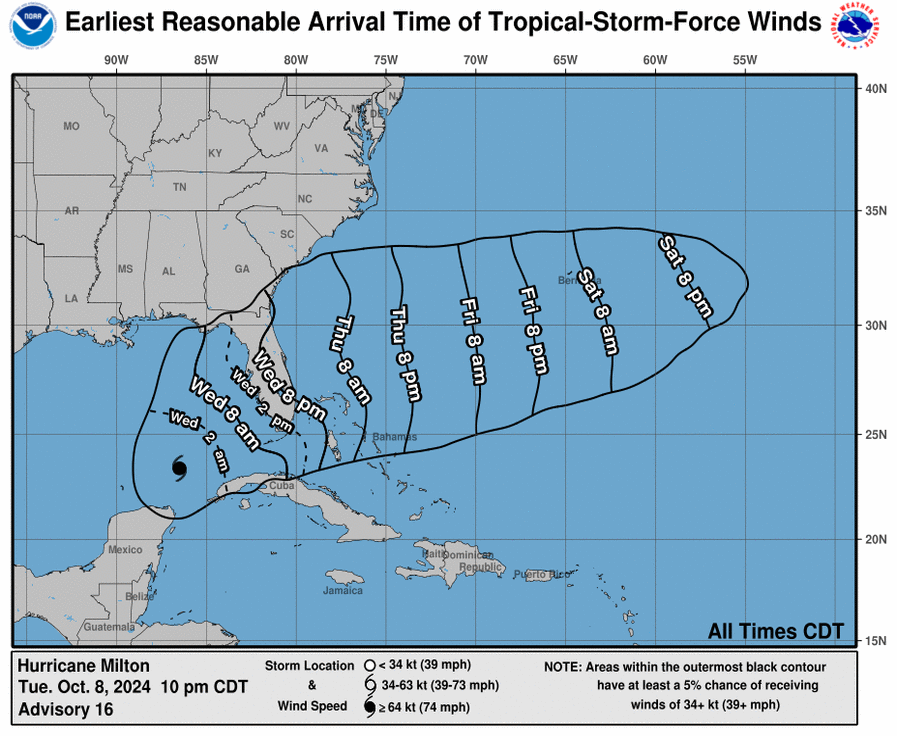
The storm is expected to move to the east coast of Florida over the Atlantic Ocean on Thursday afternoon.
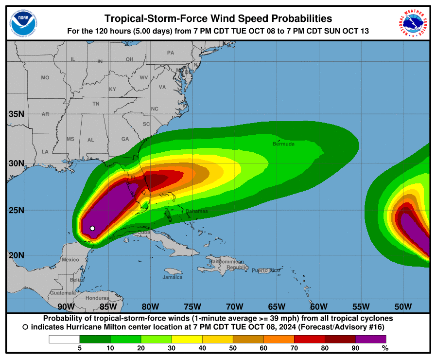
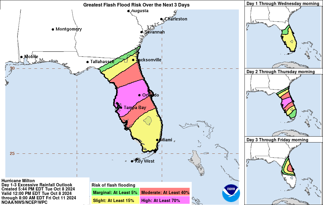
Up to 18 inches of rainfall is expected to be dumped across portions of the Sunshine State’s peninsula and the Florida Keys through to Thursday evening, with heavy downpours forecast to cause “catastrophic” and “life-threatening” flash floods, the NHC warned.
Already some regions are seeing record breaking “devastating rainfall”, the NHC said.
Much of Florida’s west coast from the south up to the Big Bend region was under a storm surge watch on Wednesday morning, with peak surge predicted to reach up to 15 feet in Tampa Bay and the and Egmont Key.
Millions of Floridians have been ordered to evacuate, with Tampa Mayor Jane Castor telling CNN that if residents choose to “stay in one of those evacuation areas, you’re gonna die.”
In a Tuesday briefing, President Joe Biden warned Milton “could be the worst storm to hit Florida in over a century,” and urged residents in its path to “evacuate now”. The Biden Administration approved an emergency declaration on Monday after pledging “life-saving resources in advance of the storm” the day prior.
Florida Governor Ron DeSantis issued a warning to Floridians on Tuesday that “time is running out” for them to evacuate, adding that Hurricane Milton could leave an “indelible mark” on the communities it tracks over.
DeSantis said that 37,000 linemen will be on hand to help restore power, with mass blackouts expected across the state. A “debris removal mission” is ongoing with more than 1,200 truckloads of waste left from Hurricane Helene disposed of from hard-hit areas.
He added that gas stations are running out of fuel “quicker than they would otherwise” but assured “there is no fuel shortage”.
Join our commenting forum
Join thought-provoking conversations, follow other Independent readers and see their replies
Comments
Bookmark popover
Removed from bookmarks