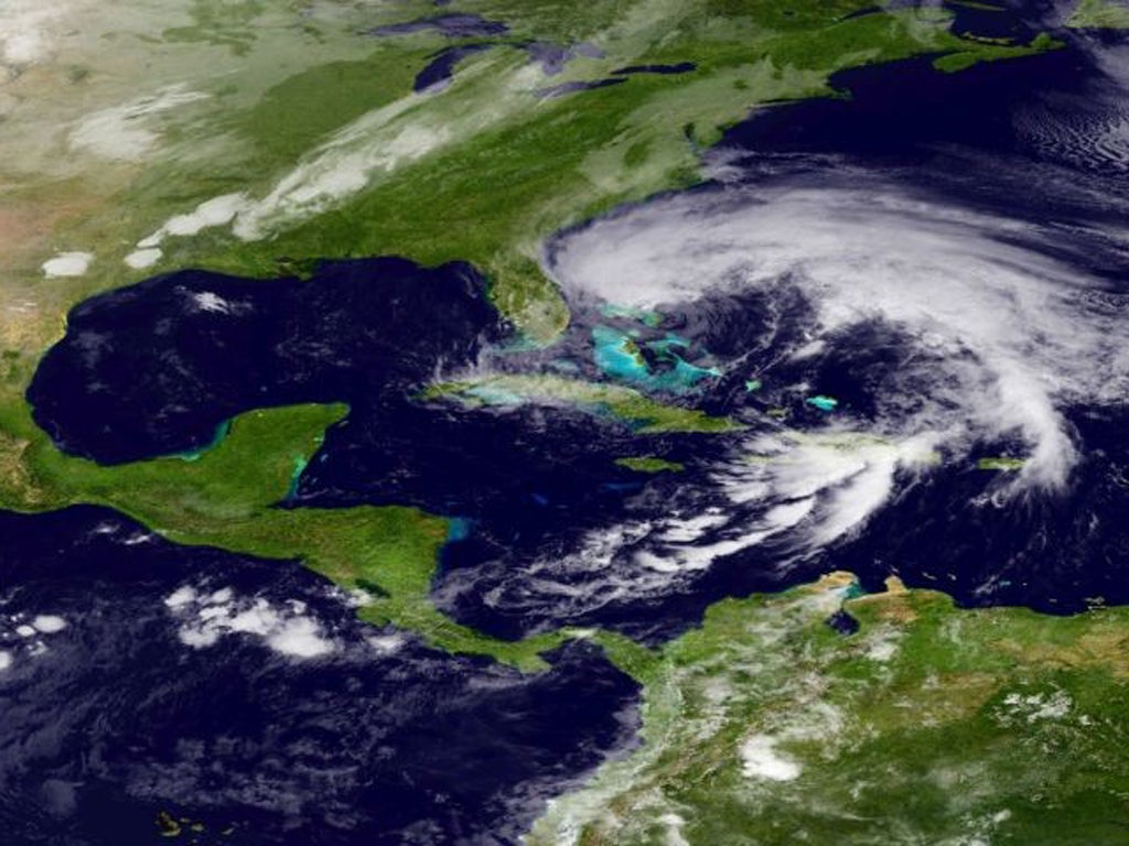
'Frankenstorm' could wreak $1bn in damage on US east coast

Federal and local authorities, along with utilities across the north-eastern United States, are gearing up for a visit from a Halloween weather monster dubbed the ‘Frankenstorm’ that could inflict $1bn worth of damage as it brings gale-force winds, heavy rain, costal flooding and possibly snow next week.
Forecasters predict that a confluence of weather events could blast the area as early as Sunday, with the densely populated New York and New Jersey region currently projected to be hit the hardest. The coming together of Hurricane Sandy, which caused at least 21 deaths as it swept over the Caribbean, and an early winter storm from the west, buffeted by a blast of cold arctic air from the north, could leave the coastal region wreathed in rain and snow all the way up to Halloween on Wednesday.
The bad weather could travel as far inland as Ohio. The New York Governor, Andrew Cuomo, said residents should keep a close eye on TV and radio for warnings about the storm. “I have directed state agencies and New York’s emergency operations personnel to begin preparations,” he said.
Upstate, officials in Greene County were reported to be deploying generators as they prepared for power outages. In Connecticut, parts of which were devastated by Hurricane Irene earlier this year, Governor Dannel Malloy said: “Although we are not certain the storm will impact the state, we need to be prepared.”
Meanwhile, power companies were making sure they had enough staff on hand to deal with the likely fallout. The Baltimore Gas and Electric Co put its workers on standby as it made plans to bring in additional out-of-state crews, according to The Associated Press, while the Potomac Edison pore firm in Maryland has begun denying holiday requests. Similar moves are afoot at other utilities across the region. Storm-preparations were also reported to be underway at oil refineries along the Atlantic seaboard.
National Weather Service meteorologist Paul Kocin said the storm could be a record breaker. “[It] has the potential to have about as large an impact as anything we’ve ever seen,” he told the Los Angeles Times, adding that the coming storm “definitely has the potential for at least $1bn” in damage.
Join our commenting forum
Join thought-provoking conversations, follow other Independent readers and see their replies
Comments
Bookmark popover
Removed from bookmarks