Ben Carson's campaign makes US map with five states in wrong locations
The error comes during Geography Awareness Week in the US

Happy Geography Awareness Week! Recognizing that "too many young Americans are unable to make effective decisions, understand geo-spatial issues, or even recognize their impacts as global citizens," National Geographic created this annual observance to "raise awareness to this dangerous deficiency in American education."
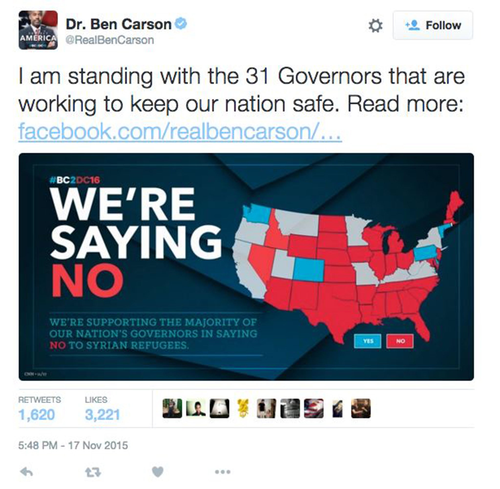
Ben Carson's presidential campaign inadvertently underscored this point when it took to social media to share a map of the United States in which five New England states were placed in the wrong location. The campaign deleted the Twitter and Facebook posts Wednesday morning after media outlets and social media users pointed out the error.
Here's Carson's tweet

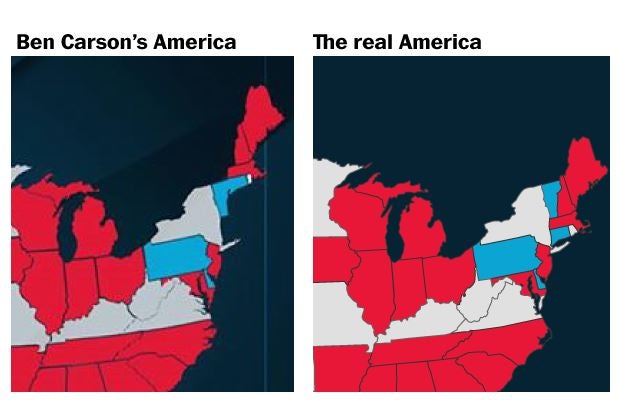
And here's a side-by-side comparison of the Carson campaign map with a map showing where the states actually belong.

As you can see, in Carson's map the states of Connecticut, Rhode Island, Massachusetts, New Hampshire and Maine are moved northeast by about 150 miles or so. Vermont and New York now have hundreds of miles of new beachfront property. Massachusetts shares a border with Canada. Maine straddles what is now the Gulf of Saint Lawrence.
Also, if you look closely at the mid-Atlantic area, you'll see that Virginia's portion of the Delmarva Peninsula is colored red to match Maryland, rather than gray with the rest of Virginia.
This is probably little more than a simple mishap by a graphic designer who's having a Really Bad Day. (The campaign did not respond to a request for comment.) But Carson's campaign has plenty of company when it comes to geography troubles. A study last year found that a majority of Americans couldn't place Ukraine on a map, for instance. And many of them were way, way off. Then there was the time CNN placed Hong Kong in Brazil during a newscast. Vox recently collected "27 hilariously bad maps that explain nothing."
A 2006 survey commissioned by National Geographic found that six in 10 young Americans couldn't find Iraq on a map of the Middle East, and half couldn't place New York on a map of the United States. Geographic literacy matters for "navigating the international economy or understanding the relationships among people and places that provide critical context for world events," the survey concluded.
"The United States lags behind the rest of the world in both the quality and quantity of every aspect of geography education," National Geographic writes in its Geography Awareness Week materials.
Washington Post
Join our commenting forum
Join thought-provoking conversations, follow other Independent readers and see their replies
Comments
Bookmark popover
Removed from bookmarks