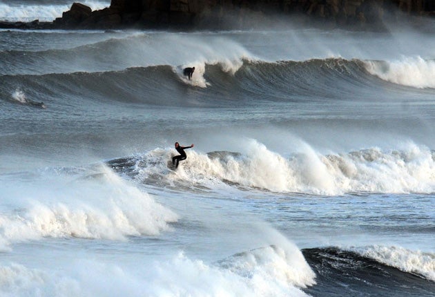
Autumn blows in with a vengeance
Heavy rain and high winds hit large areas of Britain

Your support helps us to tell the story
From reproductive rights to climate change to Big Tech, The Independent is on the ground when the story is developing. Whether it's investigating the financials of Elon Musk's pro-Trump PAC or producing our latest documentary, 'The A Word', which shines a light on the American women fighting for reproductive rights, we know how important it is to parse out the facts from the messaging.
At such a critical moment in US history, we need reporters on the ground. Your donation allows us to keep sending journalists to speak to both sides of the story.
The Independent is trusted by Americans across the entire political spectrum. And unlike many other quality news outlets, we choose not to lock Americans out of our reporting and analysis with paywalls. We believe quality journalism should be available to everyone, paid for by those who can afford it.
Your support makes all the difference.Normal autumnal service was resumed yesterday as heavy rain, high winds and flooding conspired to bring the balmy Indian summer crashing to a rude end.
Severe weather warnings were issued in Wales, Northern Ireland, Scotland and much of south-west England as they received as much as two weeks' worth of rain in a few hours.
Wales, North-east England, and northern and east Scotland were the worst hit, with two inches of rain falling, while high winds battered the areas with gusts of up to 60mph. Southern areas got off comparatively lightly but still received more than half an inch of rain in the space of three hours.
"There's been a lot of wet and windy weather, the like of which we haven't seen this autumn until now. It's back to normal after a couple of very mild months," said Byron Chalcraft, a Met Office forecaster.
He said temperatures have begun falling and are likely to remain in the region of 11C to 13C during the daytime for much of the week, noticeably down on the high teens that were widespread last week. Overnight lows of 4C are anticipated in parts. "It will feel a lot cooler," he added.
More than 90 flood alerts were issued by the Environment Agency across most of England and Wales as a succession of rivers and streams threatened to burst their banks. A spokesman for the Mid and West Wales Fire Service said that it had received more than 180 calls and dealt with 100 different incidents. Thirteen people has been rescued in five separate emergencies caused by flooding.
Meanwhile, eastern areas, including Aberdeenshire, Tayside, Angus and Perthshire, saw the worst of the rain in Scotland. Several roads had to be closed because of flooding and rail services between Aberdeen and Edinburgh were suspended. Forth Coastguard said it had helped evacuate people from their homes in Stonehaven and St Andrews after rivers burst their banks.
Rob Hutchinson, a forecaster for MeteoGroup, said the change in temperatures across the UK will be a "shock to the system" after last week's clear skies and warm sunshine.
Ken Hunt of the Environment Agency warned that, while many of the flood alerts were quickly downgraded, the ground will remain sodden for some days so there will be a heightened risk of flooding should more rain sweep in.
Join our commenting forum
Join thought-provoking conversations, follow other Independent readers and see their replies
Comments