Heavy wind and rain expected as Europe heatwave pushes low-pressure system to UK
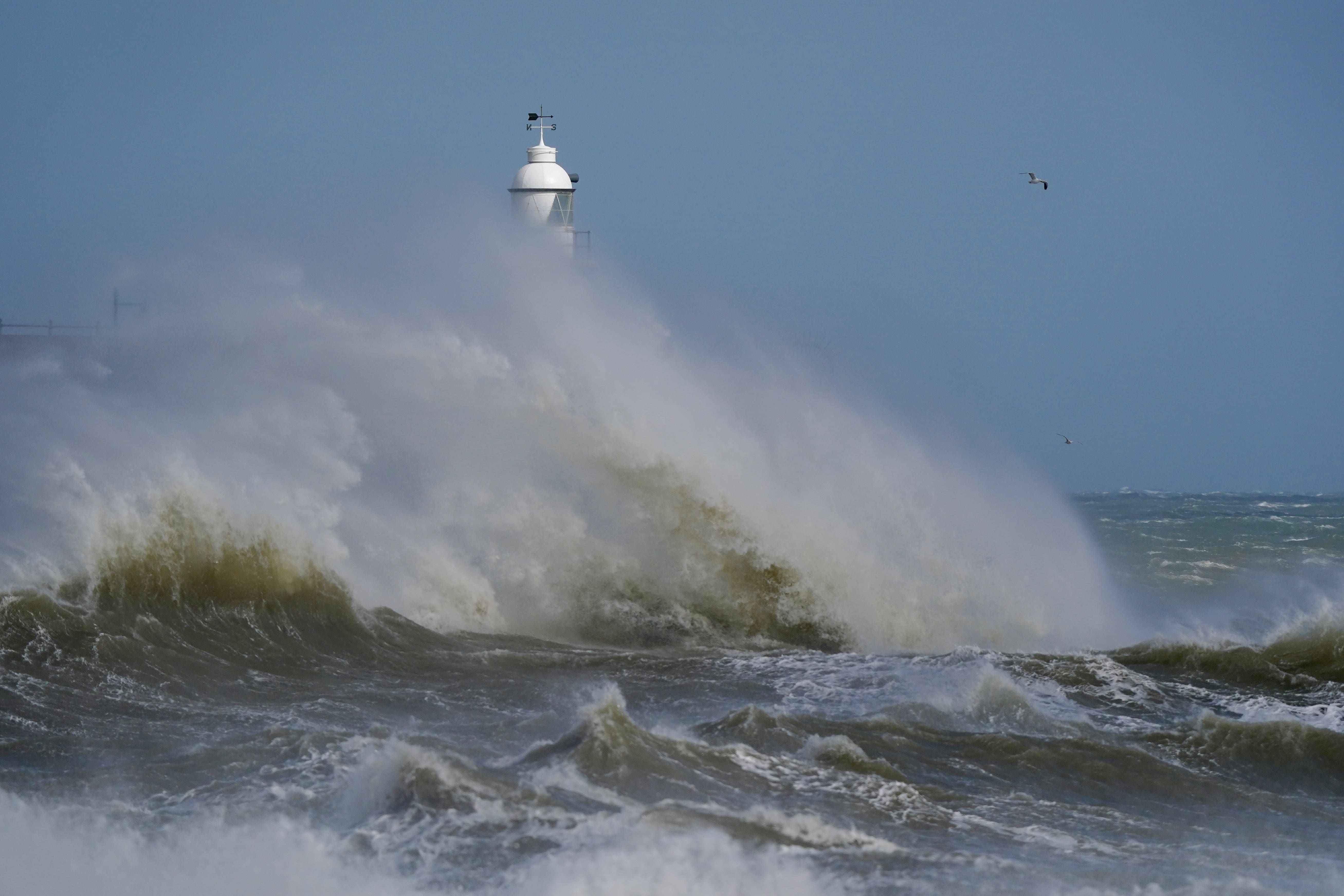
People should expect delays to road, rail, air and ferry transport as well as potential power cuts, large waves and damage to trees over the weekend.
Your support helps us to tell the story
From reproductive rights to climate change to Big Tech, The Independent is on the ground when the story is developing. Whether it's investigating the financials of Elon Musk's pro-Trump PAC or producing our latest documentary, 'The A Word', which shines a light on the American women fighting for reproductive rights, we know how important it is to parse out the facts from the messaging.
At such a critical moment in US history, we need reporters on the ground. Your donation allows us to keep sending journalists to speak to both sides of the story.
The Independent is trusted by Americans across the entire political spectrum. And unlike many other quality news outlets, we choose not to lock Americans out of our reporting and analysis with paywalls. We believe quality journalism should be available to everyone, paid for by those who can afford it.
Your support makes all the difference.Sweltering temperatures in Europe are directing low-pressure systems towards the UK and will lead to 55mph gusts and heavy rain this weekend.
A yellow Met Office wind warning is in place across south-west England and Wales until Friday evening, before another one covering large swathes of central and southern England comes in on Saturday morning.
They warn people to expect delays to road, rail, air and ferry transport as well as potential power cuts, large waves and damage to trees.
Forecasters believe the Cerberus heatwave, named by the Italian Meteorological Society after the three-headed monster from Dante’s Inferno, which has taken hold across holiday hotspots in the Mediterranean, could be behind the wet and windy weather.
Rebekah Sherwin, an expert meteorologist from the Met Office’s global forecasting team, said: “The southern shift of the jet stream that has pushed the high pressure southwards across this region has also led to low-pressure systems being directed into the UK, bringing more unsettled and cooler weather here than we experienced in June when the jet stream was at a more northerly latitude.”
As part of the current low-pressure system over the UK, a “band of persistent rain” and strong gusts will move across large swathes of the country from Friday.
Forecaster Alex Deakin said: “We’ll be watching heavy showers zipping through on the gusty winds but those winds could cause some problems, gusts across the Midlands, eastern and southern England likely to reach 45, maybe 50, perhaps even 55mph in some locations.
“Nothing spectacular about those winds were we in autumn or winter but for this time of year that is unusually strong and as a result could cause some disruption.
“There’ll be heavy showers to boot. Now those strong winds mean the showers will at least tend to move through fairly quickly but they could drop a lot of rain in a short space of time (or) even turn into thunderstorms in places.”
Temperatures will widely be in the high teens or low 20s, which is average for the time of year.
Sunday is expected to be less windy but showers will continue for parts of northern England, Scotland and Northern Ireland, with a risk of thunder, while further south will see a mix of sunny spells and showers.