‘Tornado’ hits town as strong winds batter the UK
Parks, bridges and tourist attractions across the UK were closed on Monday due to the windy weather conditions.
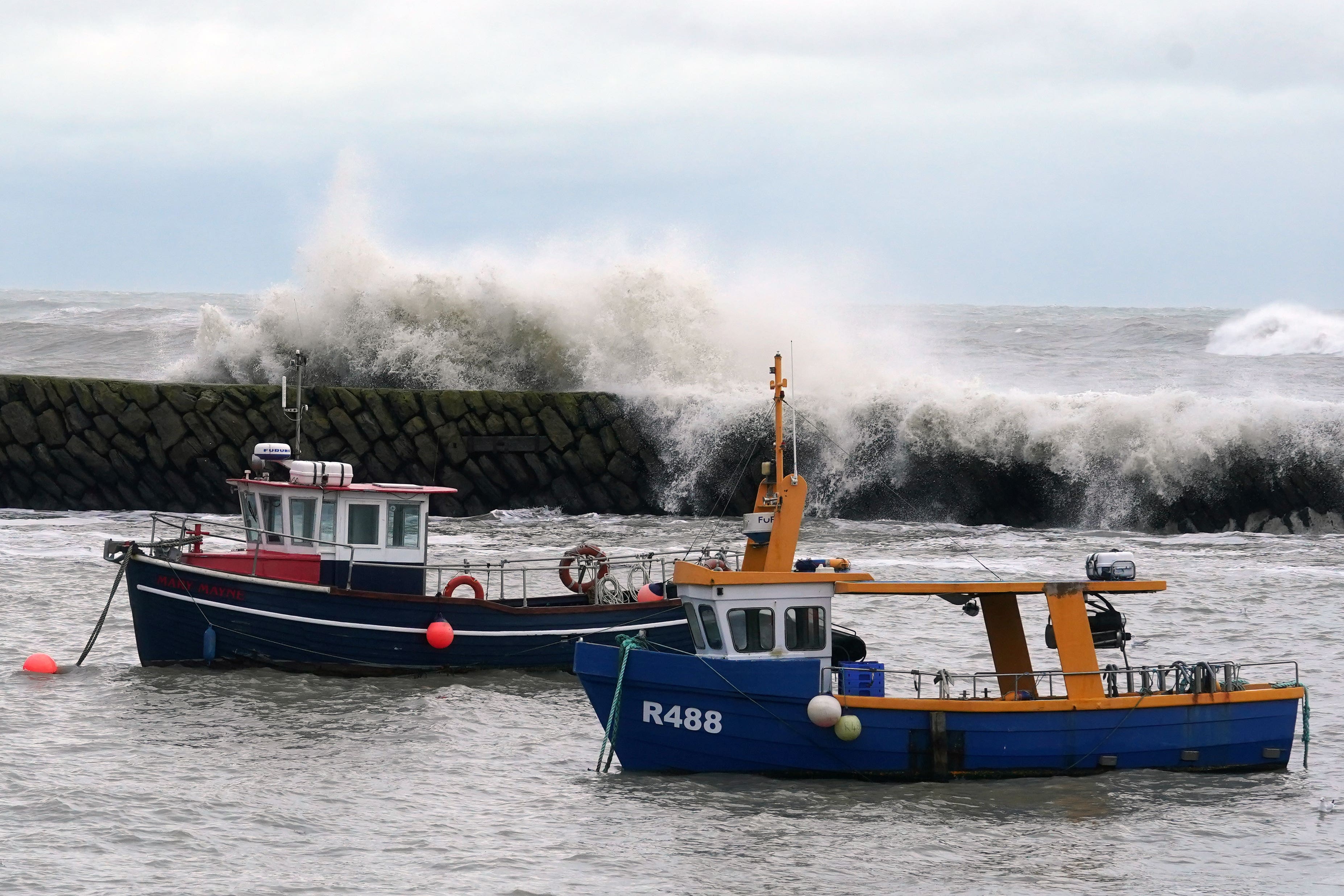
A tornado appeared to hit a town in Staffordshire on Monday as strong winds battered much of England, Wales and Northern Ireland.
Police said they had attended the scene at St Giles Road, Newcastle-under-Lyme, just before 7.45am on Monday morning after the strong gusts which damaged roofs.
Pictures shared online appeared to show damaged fences and debris scattered across the street.
The Met Office said it was not possible to verify if the strong gusts in Staffordshire were a tornado, adding that the winds forecast this morning “had some potential” to create them.
Stephen Dixon, Met Office spokesperson, said: “Tornadoes do happen in the UK and they’re generally short-lived in nature, but around 30 a year are reported on average.
“Today there have been some reports of some particularly impactful winds.
“The fronts that were moving southwards this morning had some potential for some short-lived tornadoes within them, but we would need to assess the impact.”
The Met Office website defines a tornado as a “rapidly rotating column of air that reaches the base of a storm cloud and the Earth’s surface”.
Bridges, parks and National Trust sites across the UK were forced to close due to the windy conditions.
The M48 Severn Bridge was closed in the early hours of Monday morning in both directions as a result of the high winds, with road users advised to use the M4 Prince of Wales Bridge as an alternative route.
In Yorkshire, the Humber Bridge was forced to close to wind-vulnerable vehicles including motorhomes, cars with roof boxes, motorcycles and high-sided heavy goods vehicles.
Parks were shut across London including sections of Hampstead Heath, West Ham park and playgrounds in Regents Park, Greenwich Park and Hyde Park.
Kew Gardens, also in London, announced on social media that it would not be opening on Monday due to “adverse weather conditions”.
Tourist attractions including parts of Dover Castle and Ainsdale Beach in Southport were also forced to close.
The Met Office issued a yellow warning for wind at 6.25am on Monday which covers the whole of Northern Ireland, Wales and England as far north as Cumbria until 10pm the same day.
Gusts of up to 45mph are expected inland and exposed coastal areas could see winds of up to 55mph with heavy rain showers.
On Monday, temperatures are expected to be below average for this time of year, peaking at between 11C and 12C in southern England and between 8C and 11C in the north, with rain showers expected up until Friday, the Met Office said.
Over the weekend, the forecaster is expecting some high pressure which could lead to drier weather.
Mr Dixon said: “By the time we get to the weekend, there’s a signal for higher pressure to build in from the south-west which would settle things down in terms of rainfall totals.
“We’ve obviously seen a very wet few weeks and months indeed for the UK, but by the time we get to Saturday and into Sunday we’re looking at high pressure building in from the west, which would see a reduction in those rainfall totals and some much needed dry weather for some areas.”
The forecaster has warned that windy conditions are likely to cause delays to road, rail, air and ferry transport as well as a possible short-term loss of power.
The Met Office has advised those looking to travel on Monday to check road conditions if driving or public transport timetables and amending plans if necessary.
Those on the coast should be aware of large waves and take care if walking near cliffs, the forecaster said.
Bookmark popover
Removed from bookmarks