Met Office warns rain will lash UK with more than 140 flood alerts issued
Flood alerts issued across England and Wales as wet and windy week anticipated across UK
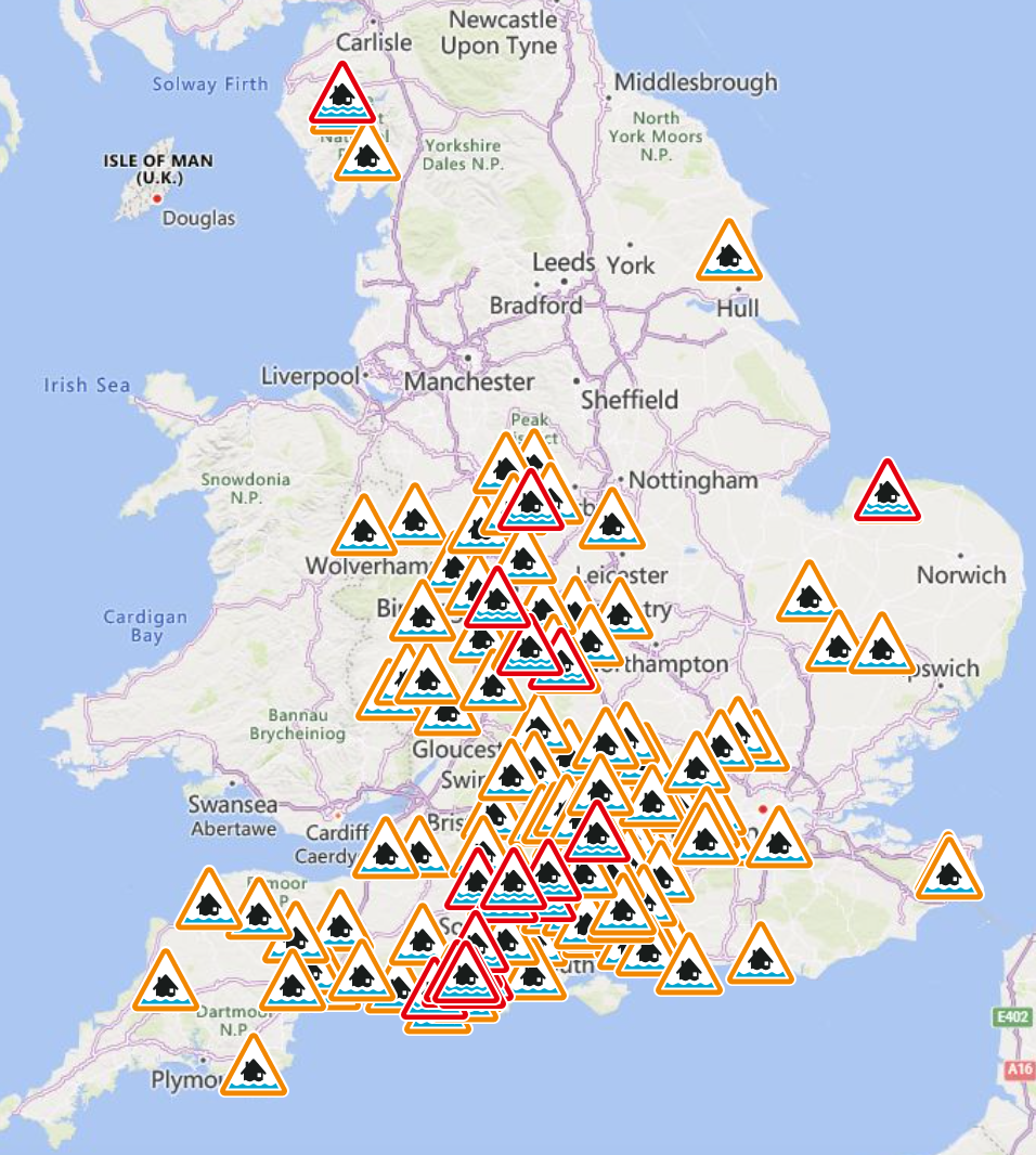
People have been urged to brace for possible flooding in more than 140 areas in England and Wales, as the Met Office forecasts yet more rain will lash the UK in the coming days.
The Environment Agency and Natural Resources Wales have issued 20 flood warnings, ranging from near Warminster, Dorchester and Salisbury in the south, to Warwick, Birmingham, Keswick and Carmarthen further north.
A further 122 flood alerts – meaning flooding is possible – are in force across England and Wales, mostly in southern and central regions.

The Met Office had issued a weather warning across Swansea and the surrounding area until 6am on Sunday, as forecasters cautioned that 50mm of rain – close to the city’s monthly average of 68mm for March – could fall in places, with 20 to 30mm expected more widely.
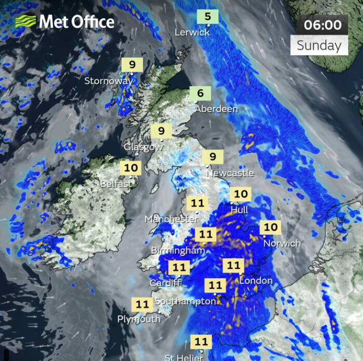
The national forecaster warns that more rain will fall over the course of Sunday, albeit with some sunny spells and relatively mild temperatures of up to 17°C in the southeast.
“Outbreaks of rain across much of England and Wales, and Shetland will gradually clear eastwards,” the Met Office predicts. “Otherwise there will be sunny spells, but with showers, especially across central parts of England, Northern Ireland and other northwestern areas later.”
While much of the rain is expected to clear overnight, further downpours are forecast in Northern Ireland on Sunday evening.
Sunday will see “a brief dry and brighter interlude for most of us, but it won’t last”, said Met Office meteorologist Craig Snell.

“Another weather system is arriving later on Monday and this will maintain this rather changeable pattern that we have been experiencing.”
Frequent rain and brisk winds dominate the forecasts for the week ahead, with all parts of the UK set to be caught in the downpours.
Murlough in Northern Ireland saw the worst of the rainfall on Saturday, with 27.6mm recorded as falling in 24 hours – equating to more than a third of its monthly average. Lerwick, in Shetland, saw the most sunshine, with 9.1 hours of rays.
Join our commenting forum
Join thought-provoking conversations, follow other Independent readers and see their replies
Comments
Bookmark popover
Removed from bookmarks