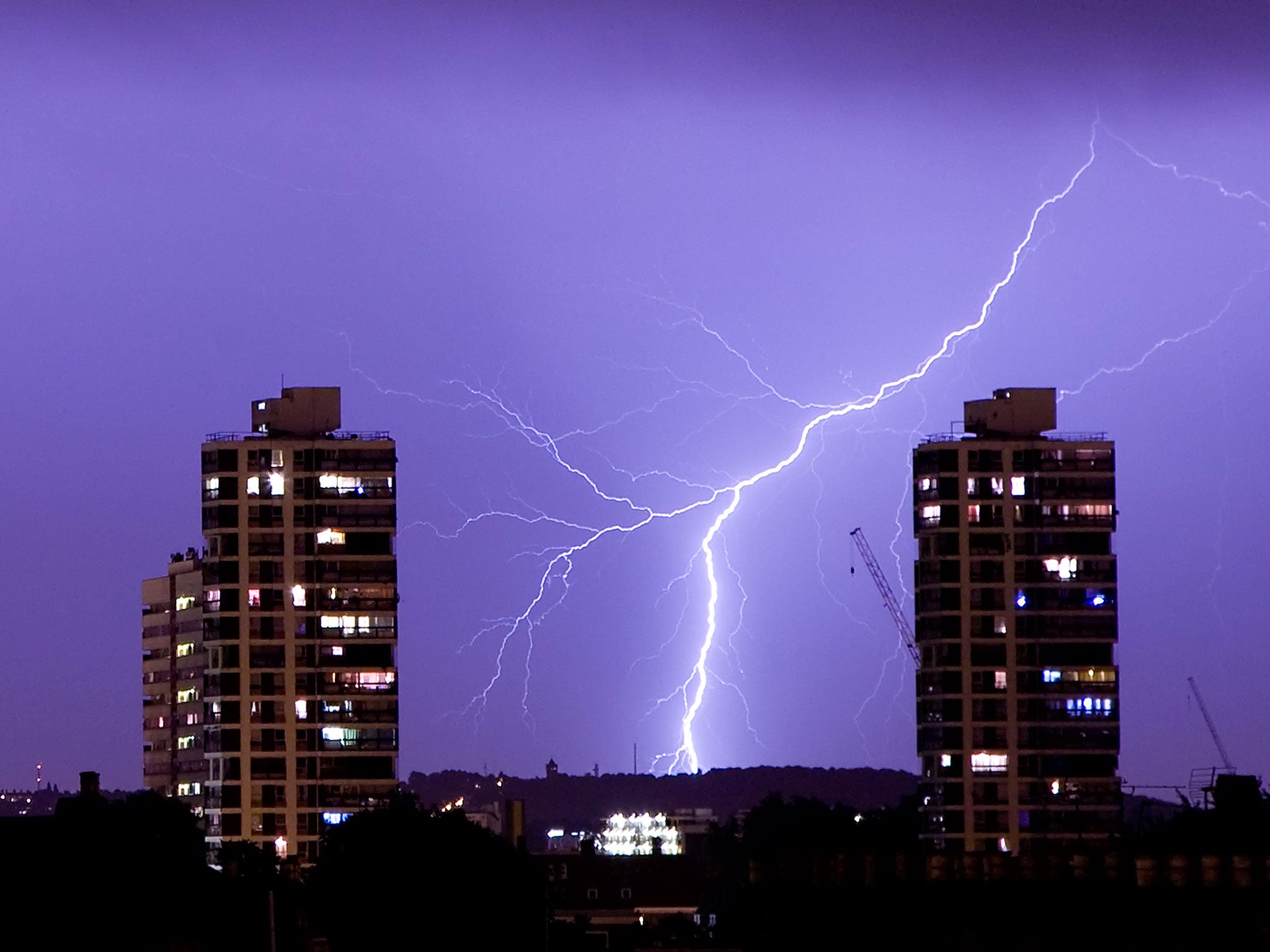
UK weather: Heatwave cut short by thunder and lightning, with warm temperatures likely to return to southern and eastern areas by Friday
Experts also put a dampener on reports that July will end with record-high temperatures
Your support helps us to tell the story
From reproductive rights to climate change to Big Tech, The Independent is on the ground when the story is developing. Whether it's investigating the financials of Elon Musk's pro-Trump PAC or producing our latest documentary, 'The A Word', which shines a light on the American women fighting for reproductive rights, we know how important it is to parse out the facts from the messaging.
At such a critical moment in US history, we need reporters on the ground. Your donation allows us to keep sending journalists to speak to both sides of the story.
The Independent is trusted by Americans across the entire political spectrum. And unlike many other quality news outlets, we choose not to lock Americans out of our reporting and analysis with paywalls. We believe quality journalism should be available to everyone, paid for by those who can afford it.
Your support makes all the difference.The extreme weather which saw scorching temperatures being washed away by thunderstorms is unlikely to return in the coming days, according to experts.
As is the nature of changeable British summers, days after forecasters recorded the hottest July day on record the heat had ushered in thunderstorms and lightning across the country.
And over the next few days, the weather will become benign and temperatures will return to average levels, Met Office meteorologist Mark Wilson told The Independent.
Experts also poured cold water over reports that the UK will be dealing with the hottest temperature ever recorded at the end of July, as Mr Wilson and his colleague Steven Keats said this was impossible to predict so far in advance.
On Monday, temperatures will return to the July average as a band of rain will push in from the West of the UK, affecting mainly western and northern areas, before hitting the south east on Tuesday.
By the end of the week, northern and western parts will see breezy, rainy conditions, while the south and the east will enjoy drier, sunnier weather.
And by Friday, the south could be once again basking in the sun, as mercury could hit the high 20s, although this prediction may yet change, said Mr Wilson.
Addressing reports that the temperatures will reach record highs, Mr Wilson said it is not scientifically possible to give that much detail so far in advance.
“We can give a rough overview with our 30 day forecast,” he said.
Mr Keats explained that the summer is set to be "fairly typical" with some rain and sunshine, and dry warm spells followed by cooler, wetter spells.
Join our commenting forum
Join thought-provoking conversations, follow other Independent readers and see their replies
Comments