Weather warnings over strong winds and heavy rain days after flooding
Up to 80mm of rain could fall in some areas on Sunday, the Met Office said.
Your support helps us to tell the story
Our mission is to deliver unbiased, fact-based reporting that holds power to account and exposes the truth.
Whether $5 or $50, every contribution counts.
Support us to deliver journalism without an agenda.

Louise Thomas
Editor
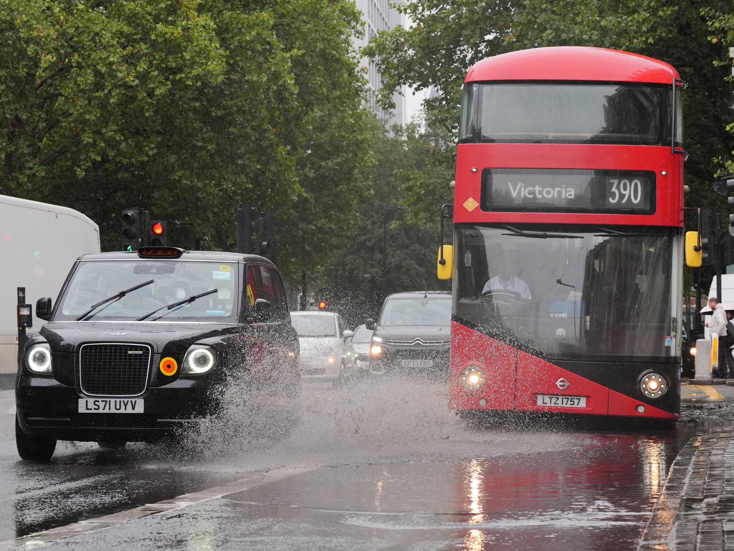
Weather warnings have been issued as strong winds and heavy rain are set to batter the UK just days after some areas were hit by flooding.
A yellow rain warning has been issued by the Met Office – meaning further heavy rain is likely to cause some travel delays and flooding – covering much of southern England and South Wales between 4pm on Sunday and 9am on Monday.
Between 20-30mm of rain could be seen within the warning area over nine to 12 hours on Sunday, and 50-80mm could fall in some localised places on higher ground, the Met Office said.
Becky Mitchell, Met Office meteorologist, said it was “not a huge amount of rain” but because of the recent weather “river levels are quite high and grounds are quite saturated”, so more flooding could develop.
The Environment Agency had 48 flood warnings, indicating flooding is expected, and 90 flood alerts, where flooding is possible, in place across England on Saturday morning.
Meanwhile, a yellow warning for wind is also predicted to cause disruption across south-west England and Wales between 9am on Sunday until the end of the day.
Gusts of between 50-60mph could be seen, with large waves, trees brought down, travel disruption and some power cuts according to Ms Mitchell.
There could potentially be further rain warnings issued for Monday, but it is forecast to be drier later in the week, she added.
Temperatures are currently below average, with a number of areas seeing frost across the UK on Friday night.
The Met Office said temperatures this weekend will be 3-4C below average, and on Sunday they will be in the low double figures, the forecaster said.
It comes after areas across England suffered heavy rain and localised flooding in recent days, with commuters facing widespread disruption on road and rail services.
According to the Met Office, some counties in southern and central England have already had more than 250 per cent of their average September rainfall.
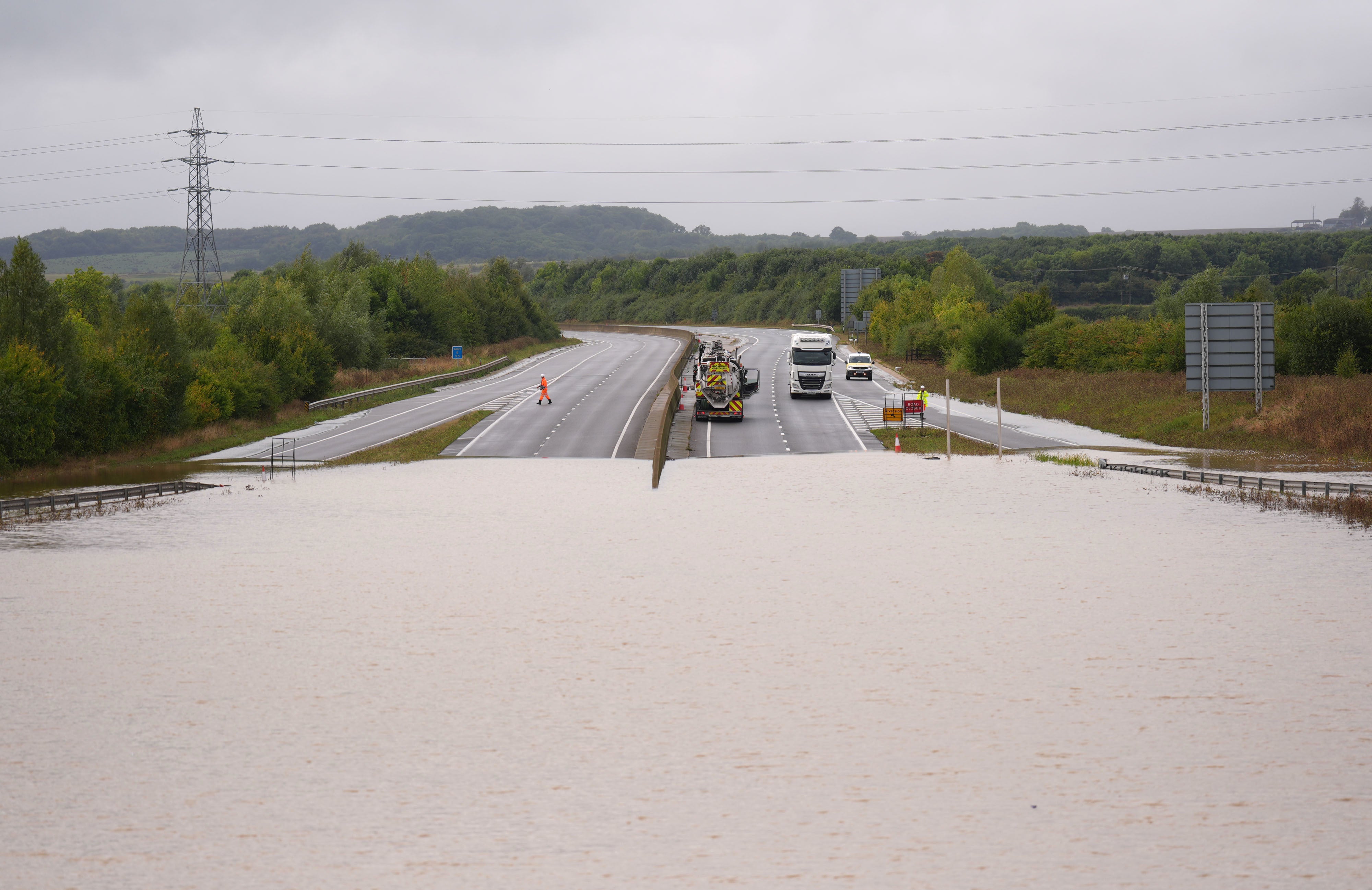
Parts of the country had more than the monthly average rainfall on Monday and there were further downpours on Wednesday, Thursday and Friday.
About 650 properties were flooded in Bedfordshire, Northamptonshire and the home counties, according to the Environment Agency, which estimated around 8,200 properties had been protected.
Rail services between Shrewsbury in Shropshire and Wolverhampton in the West Midlands were cancelled on Friday after severe flooding at Wellington station and a tree on the line earlier.
The pitch at the SEAH Stadium in Wellington, home to Telford United football club, was completely flooded on Thursday evening.
The Marston Vale line in Bedfordshire, which operates services between Bedford and Bletchley, is suspended until Monday because of standing water on the track.
Subscribe to Independent Premium to bookmark this article
Want to bookmark your favourite articles and stories to read or reference later? Start your Independent Premium subscription today.