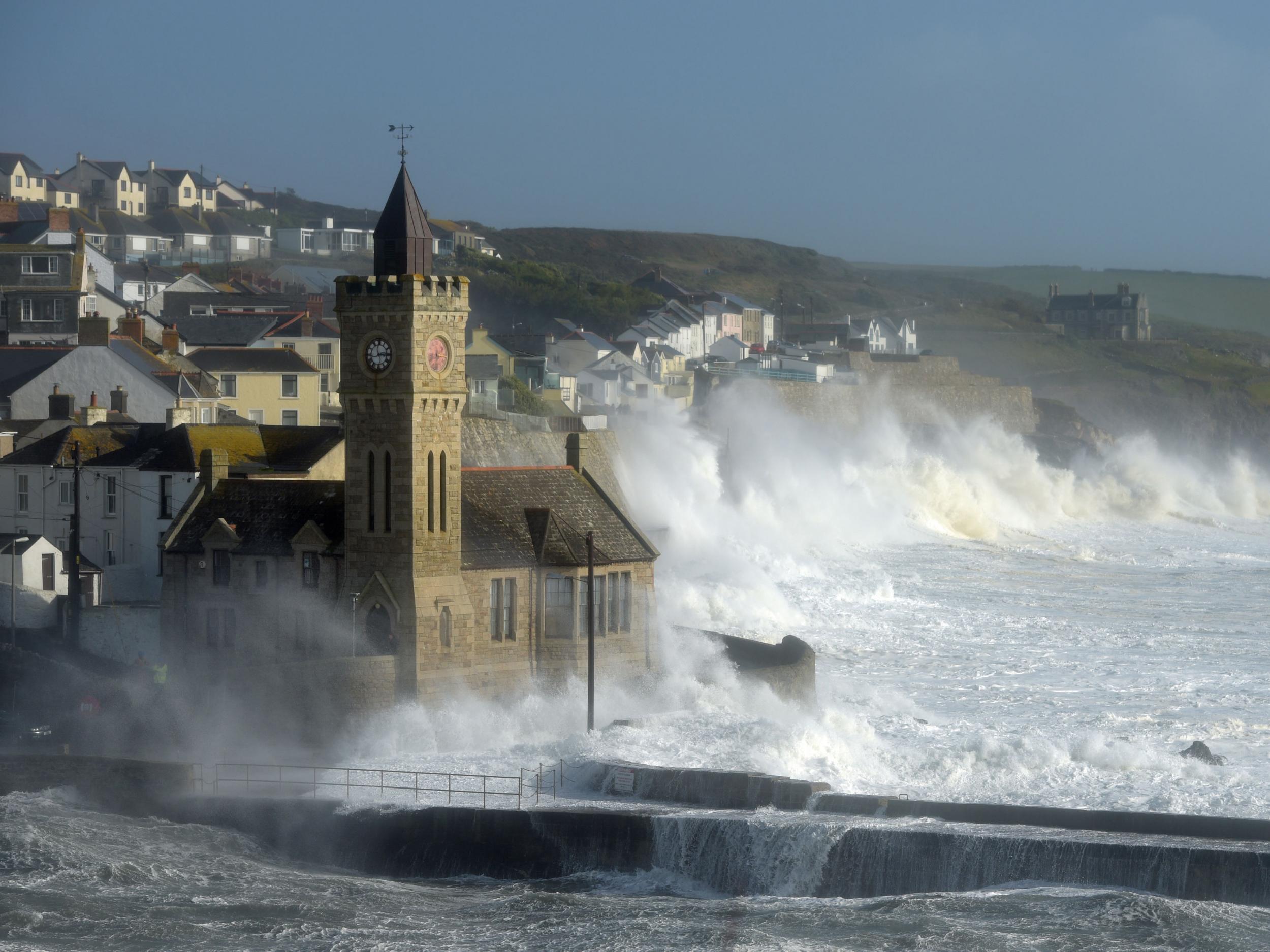
Storm Brian: UK 'weather bomb' to bring heavy rain and gale-force winds
‘Explosive cyclogenesis’ is underway, and that means wind, rain and dangerous waves in coastal areas

Your support helps us to tell the story
From reproductive rights to climate change to Big Tech, The Independent is on the ground when the story is developing. Whether it's investigating the financials of Elon Musk's pro-Trump PAC or producing our latest documentary, 'The A Word', which shines a light on the American women fighting for reproductive rights, we know how important it is to parse out the facts from the messaging.
At such a critical moment in US history, we need reporters on the ground. Your donation allows us to keep sending journalists to speak to both sides of the story.
The Independent is trusted by Americans across the entire political spectrum. And unlike many other quality news outlets, we choose not to lock Americans out of our reporting and analysis with paywalls. We believe quality journalism should be available to everyone, paid for by those who can afford it.
Your support makes all the difference.A “weather bomb” is forecast to batter the British Isles over the weekend, bringing heavy rain and gale-force winds, becoming the second named storm of the season.
Storm Brian, currently over the mid Atlantic, will “undertake explosive cyclogenesis” over the next 24 hours, according to the Met Office, meaning the low pressure cyclonic weather system will see a further rapid collapse in pressure.
The remnants of the cyclone will first hit the Republic of Ireland, less than a week after Hurricane Ophelia swept across the country at speeds of 96 miles per hour, killing three and causing widespread damage.
But strong winds and heavy rain will also hit Wales, the North West of England and the south coast.
A yellow wind warning has been issued and gusts of wind are expected to be in excess of 50 miles per hour. In coastal areas, the Met Office estimates gusts of around 70 miles per hour.
The strongest winds will hit the south west of Ireland and Wales early on Saturday morning, before heading east across the south of England.

The Met Office said the definition of a weather bomb was low pressure that deepens rapidly to 24 millibars (2400 hectopascals) in 24 hours.
The strong winds will also coincide with high tides “bringing the potential for dangerous waves”, according to Met Office meteorologist Aiden McGivern.
“Those wind speeds can cause impacts to transport and power supplies, and the potential for dangerous waves also brings risks to coastal routes and communities, as well as the potential for flooding of homes.”
Mr McGiven added: “It’s important that those who will be affected are aware of the risks. That’s why we name these storms and that’s why we issue weather warnings.”
Ahead of the storm, a yellow warning for heavy rain has been issued for Northern Ireland.
Ireland’s weather service, Met Eireann, described Hurricane Ophelia as the most powerful storm on record to have been so far east across the Atlantic.
It also whipped up Saharan dust which caused the sky to darken and turn yellow across southern parts of the UK on Monday, while the sun appeared deep red.
Despite Storm Aileen hitting the UK last month, and Ophelia earlier this week, Brian is the second rather than third named storm of the year, as Ophelia was named as a hurricane.
Join our commenting forum
Join thought-provoking conversations, follow other Independent readers and see their replies
40Comments