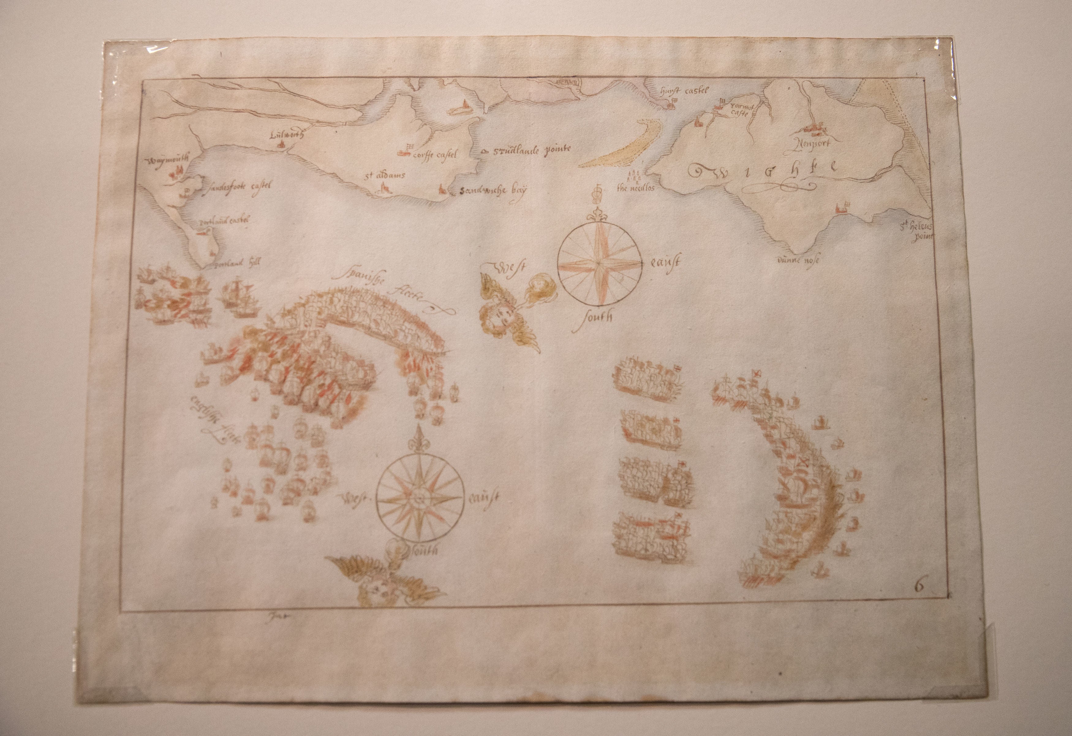
Hand-drawn Elizabethan maps of Spanish Armada saved for UK through crowdfunding campaign
Items believed to be oldest surviving depictions of famous naval battles

Your support helps us to tell the story
From reproductive rights to climate change to Big Tech, The Independent is on the ground when the story is developing. Whether it's investigating the financials of Elon Musk's pro-Trump PAC or producing our latest documentary, 'The A Word', which shines a light on the American women fighting for reproductive rights, we know how important it is to parse out the facts from the messaging.
At such a critical moment in US history, we need reporters on the ground. Your donation allows us to keep sending journalists to speak to both sides of the story.
The Independent is trusted by Americans across the entire political spectrum. And unlike many other quality news outlets, we choose not to lock Americans out of our reporting and analysis with paywalls. We believe quality journalism should be available to everyone, paid for by those who can afford it.
Your support makes all the difference.Ten Elizabethan-era maps depicting the Spanish Armada have been saved for the nation and will stay in the UK after a museum’s fundraising campaign amassed £600,000 to purchase the set.
The hand-drawn maps were sold to a foreign collection in July but an export ban was imposed to keep them in the UK. The National Museum of the Royal Navy (NMRN) in Portsmouth then raised the funds to buy them in just eight weeks.
Caroline Dinenage, the culture minister, imposed an overseas sales embargo on the ink and watercolour maps until January and urged museums and institutions to raise money to purchase them.
NMRN’s funding consisted of grants of £212,800 from the National Heritage Memorial Fund and £200,000 from the Art Fund with the remainder raised from donations from the public.
Professor Dominic Tweddle, the museum's director general, thanked the NMRN’s funding partners and the public for "digging deep in extremely difficult times, to save these treasures".
The maps date back to the year after the historic naval battle of 1588 and are believed to be the earliest surviving representations of the naval battles.
They were drawn by an unknown draughtsman, possibly from the Netherlands and have not left the UK since they were drawn.
In a statement, the museum said: "These armada maps present a defining moment in England's national and naval history.
"They depict in real time a navy defending England's shores against invasion by the 16th century's imperial super-power of Spain, with each map detailing the position in the Channel of individual ships in the English and Spanish fleets.
"The defeat of the armada and the 16th century's superpower was a turning point in forging England's complex identity as it developed into the modern age.
"The maps offer the opportunity to explore the role of the navy throughout history as a protector of an island nation."
The 1588 battle, where 66 English ships defeated a Spanish fleet double its size, is considered to be one of the most pivotal battles in history.
Join our commenting forum
Join thought-provoking conversations, follow other Independent readers and see their replies
Comments