UK weather: High anxiety among jet stream watchers

Your support helps us to tell the story
From reproductive rights to climate change to Big Tech, The Independent is on the ground when the story is developing. Whether it's investigating the financials of Elon Musk's pro-Trump PAC or producing our latest documentary, 'The A Word', which shines a light on the American women fighting for reproductive rights, we know how important it is to parse out the facts from the messaging.
At such a critical moment in US history, we need reporters on the ground. Your donation allows us to keep sending journalists to speak to both sides of the story.
The Independent is trusted by Americans across the entire political spectrum. And unlike many other quality news outlets, we choose not to lock Americans out of our reporting and analysis with paywalls. We believe quality journalism should be available to everyone, paid for by those who can afford it.
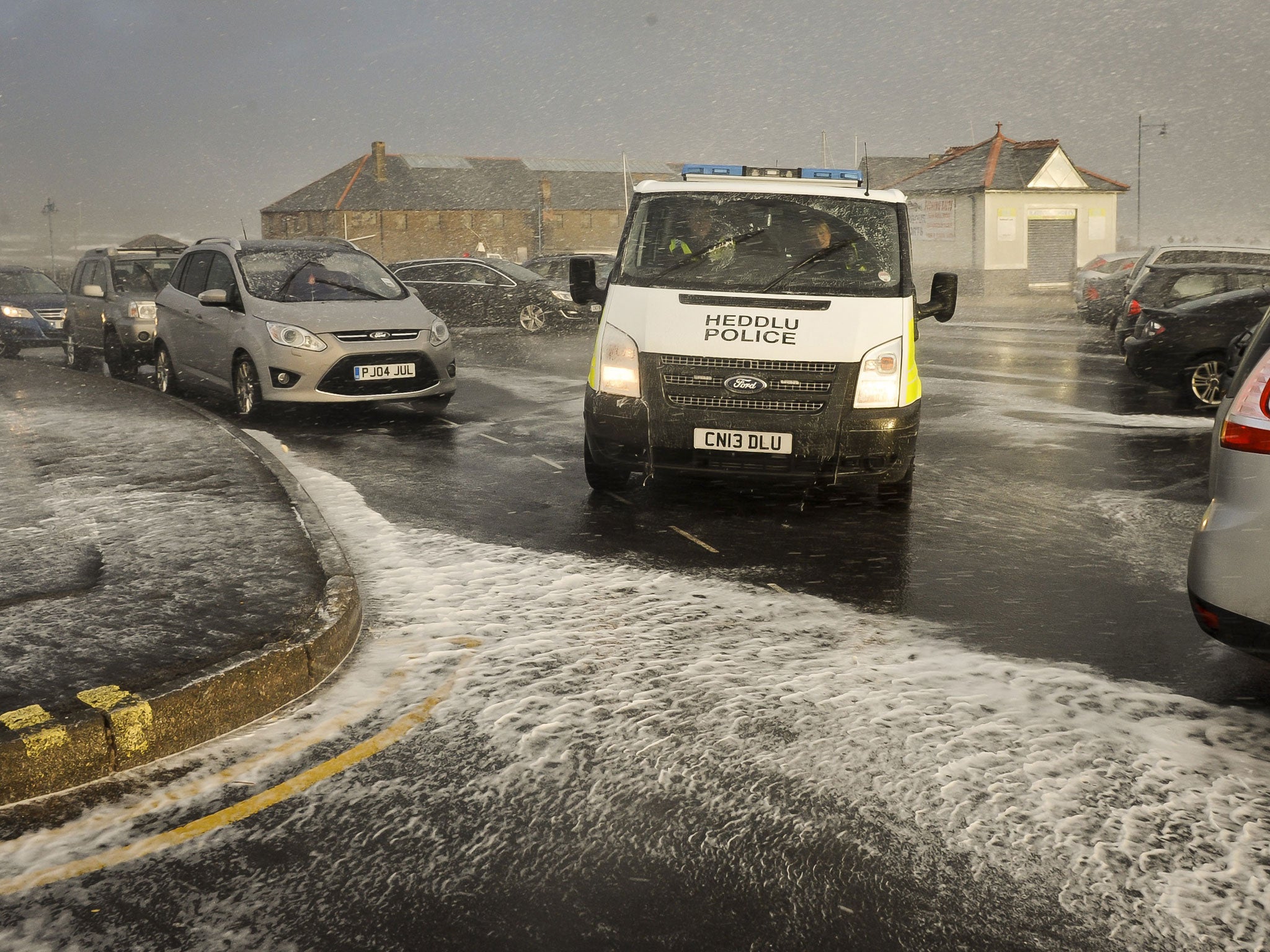
Your support makes all the difference.It travels around the world at up to 200mph, at altitudes of between five and seven miles. It controls Britain's weather and can make or break a summer holiday. But something is happening to the jet stream that could explain why Britain has experienced a conveyor belt of storms dumping huge amounts of rain onto flood-battered parts of the country.
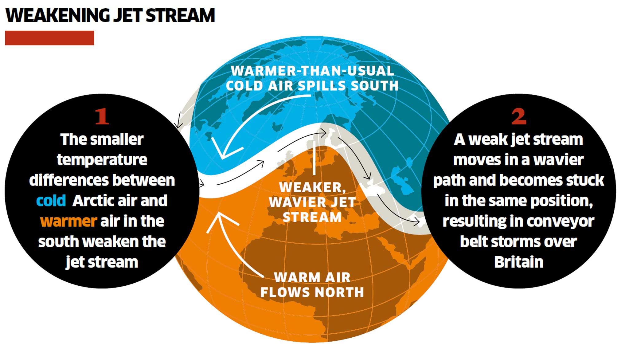
Scientists are increasingly convinced that the jet stream is stuck in a position that has thrown warm, moisture-laden air from the Atlantic over Britain for weeks at a time. Some climate researchers believe it is affected by warmer-than-usual conditions in the Arctic. The result is that the ribbon of air is blocked in a "standing wave", causing temperatures to plunge in the US and storms to wreak havoc in the UK.
"The jet stream is what generates our weather, steers our weather... it basically controls the weather all around the mid-latitude areas except the tropics," Professor Jennifer Francis of Rutgers University in Brunswick, New Jersey, told the American Association for the Advancement of Science.
"It's been in a very persistent pattern shooting pretty straight across the Atlantic bringing a lot of moisture, a lot of energy and a lot of storms directly into the UK."
The jet stream flows from west to east around the northern hemisphere and is driven by the temperature difference between intensely cold Arctic air and relatively warmer air at lower latitudes. But when this temperature difference is less marked, the jet stream becomes slower and tends to wander off course, Professor Francis explained.

"The temperature difference between the Arctic and lower latitudes is one of the main sources of fuel for the jet stream. It's what drives the winds, and because the Arctic is warming so fast, that temperature difference is getting smaller, and so the fuel for the jet stream is getting weaker," she said. "When it gets into this pattern those big waves tend to stay in the same place for some time. The pattern we've seen in December and January has been one of these very wavy patterns.
"It doesn't mean that every year the UK is going to be in a stormy pattern," Professor Francis added. "Next year you could have very dry conditions, and for that to be persistent." What was unusual, she said, was the persistence of a pattern for a long time.
"You can't say that flooding is going to happen more often. Next year may be dry, but whatever you get is going to last longer."
Britain is not the only place to feel this effect. Alaska this winter has experienced some of the warmest temperatures on record and, for the first time, rain rather than snow has fallen on the northern slopes of the Alaskan mountains in December, she said.
At the same time, the jet stream has dipped southwards over California, causing a blocking effect that has prevented storms from moving in from the Pacific. The result is a severe winter drought, Professor Francis explained.
"It's consistent with our hypothesis about what's been happening over the past couple of decades with the Arctic warming so rapidly," she said.
Temperature records show that the Arctic is one of the fastest warming regions on Earth, experiencing average temperature increases of more than 4C over the past 30 years. The volume of sea ice in the Arctic is currently at one of the lowest levels ever for this time of year. Although several factors can affect the jet stream, the only one that appears to be changing dramatically is the temperature difference between the Arctic and more southerly latitudes. The observations fit in with the computer predictions of what can happen to the jet stream, Professor Francis said.
"I can't say at this point that it is the most likely explanation. It's still such a brand new line of research. I think it's certainly one of the most likely explanations," she said.
Join our commenting forum
Join thought-provoking conversations, follow other Independent readers and see their replies
Comments