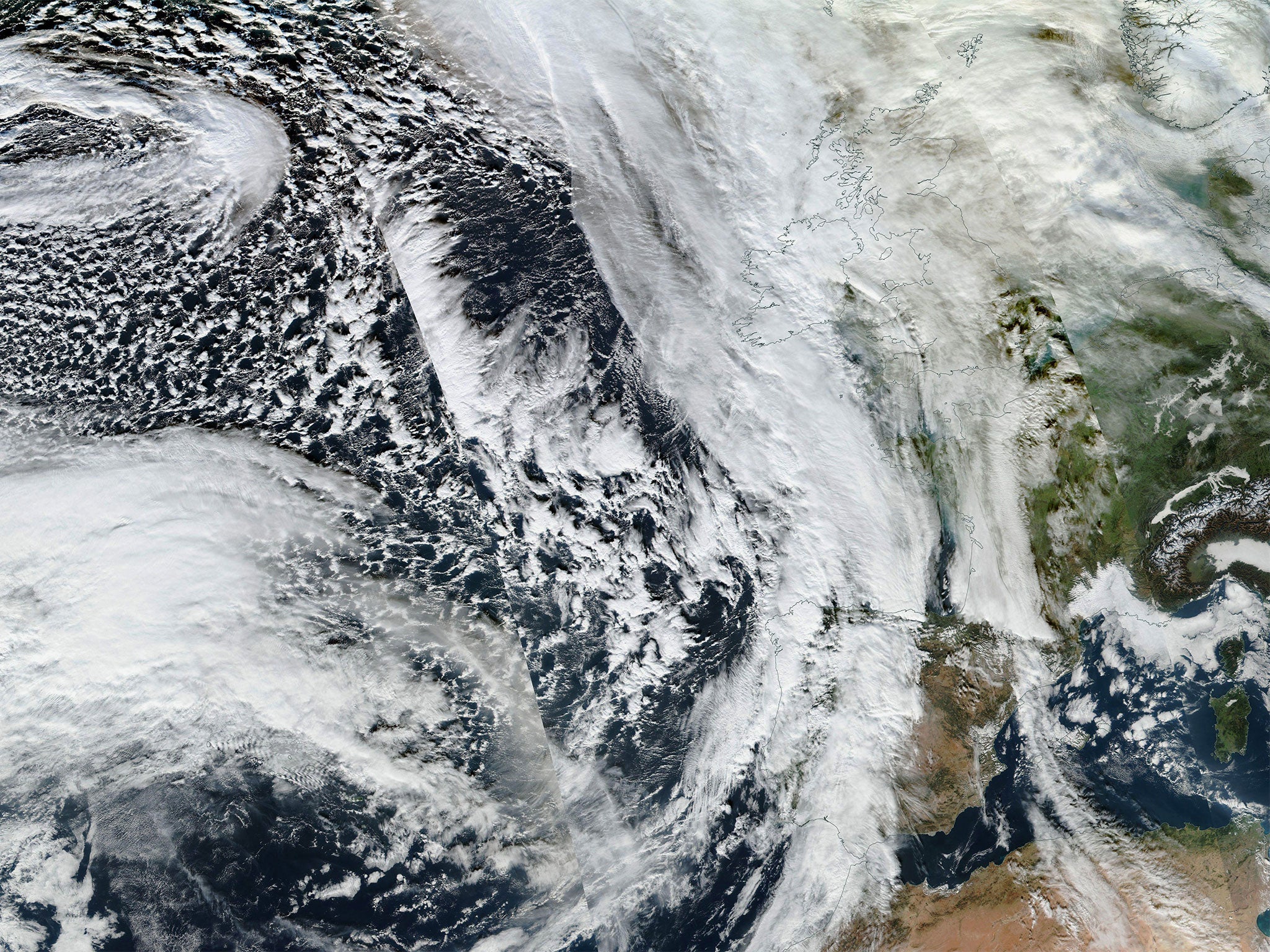
Storm Frank: Freak weather to hit UK and could make North Pole 50F hotter than normal
One commentator described the temperature changes as being ‘as odd as witnessing Hell freezing over’

The powerful weather system that is set to bring “storm Frank” to the UK could lead temperatures in the north pole to be pushed over 50F hotter than normal.
The storm is set to bring yet more destruction to the UK after a week that has seen much of the north battered by terrible flooding. But that will come with a weather system that will cause huge disruption across the Arctic.
With those strange northern weather events will come an Icelandic storm that might be among the most vigorous ever, according to the Washington Post.
Read more: Storm Frank hits the UK - live updates
That storm will begin as the weather quickly becomes more intense as it travels from the western Atlantic, where it brought destruction to the area around Dallas in the US. As it moves the storm’s pressure will drop enough to make it a “bomb cyclone”, causing huge amount of disruption.
That will mean that by the time it gets to Iceland it will be one of the North Atlantic’s strongest ever storms, if the most violent projections are correct. That will bring huge, hurricane-force winds across the North Atlantic.
The storm is set to hit the UK with a fresh round of extreme weather, just as people in areas hit by flooding begin to recover. The Met Office has said that “a swathe of gale and severe gale force winds” will hit the west and north of the UK, which could also be subject to new rounds of rain that could bring yet more floods.

But ahead of the main movement of the storm will come a huge amount of warm air, headed towards the Arctic. That warm air is forecast to pull the temperature at the North Pole up hugely, potentially pushing it 40F or 50F hotter than would normally be expected.
The huge warmth is caused when the storm drags heat up from the tropics towards the north pole.
The North Pole is estimated to reach freezing or 32F (0C) early Wednesday morning, according to the Washington Post. If the temperatures get that high, it would be around 50F hotter than the usual temperature, which is around 20F below zero (-29C), the paper reported.
The climate and environment blogger described seeing such temperatures in December as being “as odd as witnessing Hell freezing over”.
“But, in this case, the latest wave of warmth issuing from a human-driven shift toward climatological hell appears to be on schedule to arrive at the North Pole in just a few more days,” he wrote.
Some scientists dispute the claims that climate change is affecting these kinds of systems. But the change in temperature is incredibly rare.
Because of the hot weather in Arctic in the short term, the climate is likely to flip and so will become colder — bringing to an end the unseasonably warm temperatures in the UK for much of the winter.
Join our commenting forum
Join thought-provoking conversations, follow other Independent readers and see their replies
Comments
Bookmark popover
Removed from bookmarks