Archaeologists make breakthrough on route of one of Britain’s longest Roman roads with ‘remarkable’ discovery
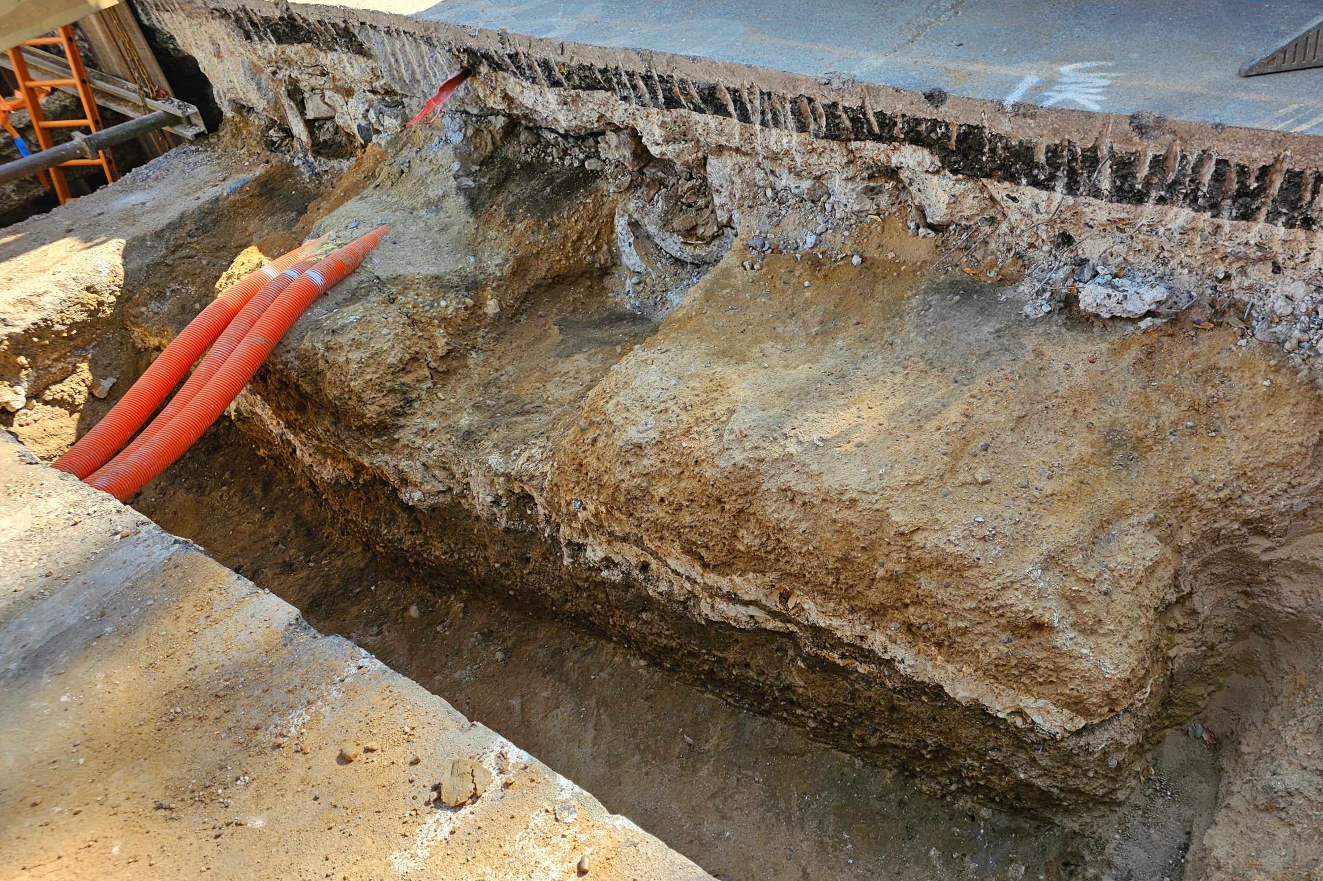
A well-preserved section of the 2,000-year-old road, known as Watling Street, was unearthed under Old Kent Road in Southwark
Your support helps us to tell the story
From reproductive rights to climate change to Big Tech, The Independent is on the ground when the story is developing. Whether it's investigating the financials of Elon Musk's pro-Trump PAC or producing our latest documentary, 'The A Word', which shines a light on the American women fighting for reproductive rights, we know how important it is to parse out the facts from the messaging.
At such a critical moment in US history, we need reporters on the ground. Your donation allows us to keep sending journalists to speak to both sides of the story.
The Independent is trusted by Americans across the entire political spectrum. And unlike many other quality news outlets, we choose not to lock Americans out of our reporting and analysis with paywalls. We believe quality journalism should be available to everyone, paid for by those who can afford it.
Your support makes all the difference.A section of one of Britain’s most important Roman roads has been unearthed in south-east London in a “remarkable” archaeological discovery.
The 2,000-year-old road, known as Watling Street, ran from the Roman port at Dover through London to the West Midlands.
The 276-mile route was built shortly after the Roman invasion of Britain in AD 43 and was used by visiting emperors, including Hadrian in AD 122 when he ordered the building of his wall separating England and Scotland.
But although Roman roads are characteristically straight, archaeologists have struggled to find evidence confirming the road’s exact route, especially through London.
However, ahead of work to expand the low-carbon heat network in Southwark in London, part of the road was discovered under Old Kent Road.
Archaeologist Gillian King said the discovery had redrawn the Roman road map in the capital. She added: “It is a key finding for archaeological research for London.”

The section of road revealed lies to the south of the junction of Old Kent Road and Ilderton Road and was well preserved, measuring about 19ft (5.8m) wide by almost 5ft (1.4m) high.
Southwark Council said distinct layers could be seen and showed a solid foundation of compacted gravel sealed by two layers of chalk, before it was topped with another layer of compacted sand and gravel.
It added that the original surface of the road would likely have been made from the same material and would have sat at a similar level to the modern road, but over time this had been lost.
The council’s in-house archaeology officer Dr Chris Constable said a section of the road to the south was excavated in the early 1990s, but questions had remained over the exact course of the road until now.

“I’m pleased this project has answered our questions over the course of the Roman road south of the Cantium Retail Park where a section was excavated in the early 1990s, south of the line of the modern road,” he said.
“In the planning for this project, we’d expected to solve this question but the extent of survival of the road is remarkable.”
The London portion of Watling Street was rediscovered during Christopher Wren’s rebuilding of St Mary-le-Bow in 1671–73, following the Great Fire of London in 1666.
The road ran straight from the bridgehead on the Thames to what would become Newgate on the London Wall. It then passed over Ludgate Hill and the Fleet, dividing into Watling Street and the Devil’s Highway west to Silchester.

Join our commenting forum
Join thought-provoking conversations, follow other Independent readers and see their replies
Comments