Tropical storm conditions expected for parts of the Carolinas as disturbance approaches coast
Tropical storm conditions are expected along a stretch of the U.S. Southeast seacoast and forecasters say the system bringing gusty winds, heavy rain and potential flooding has strengthened
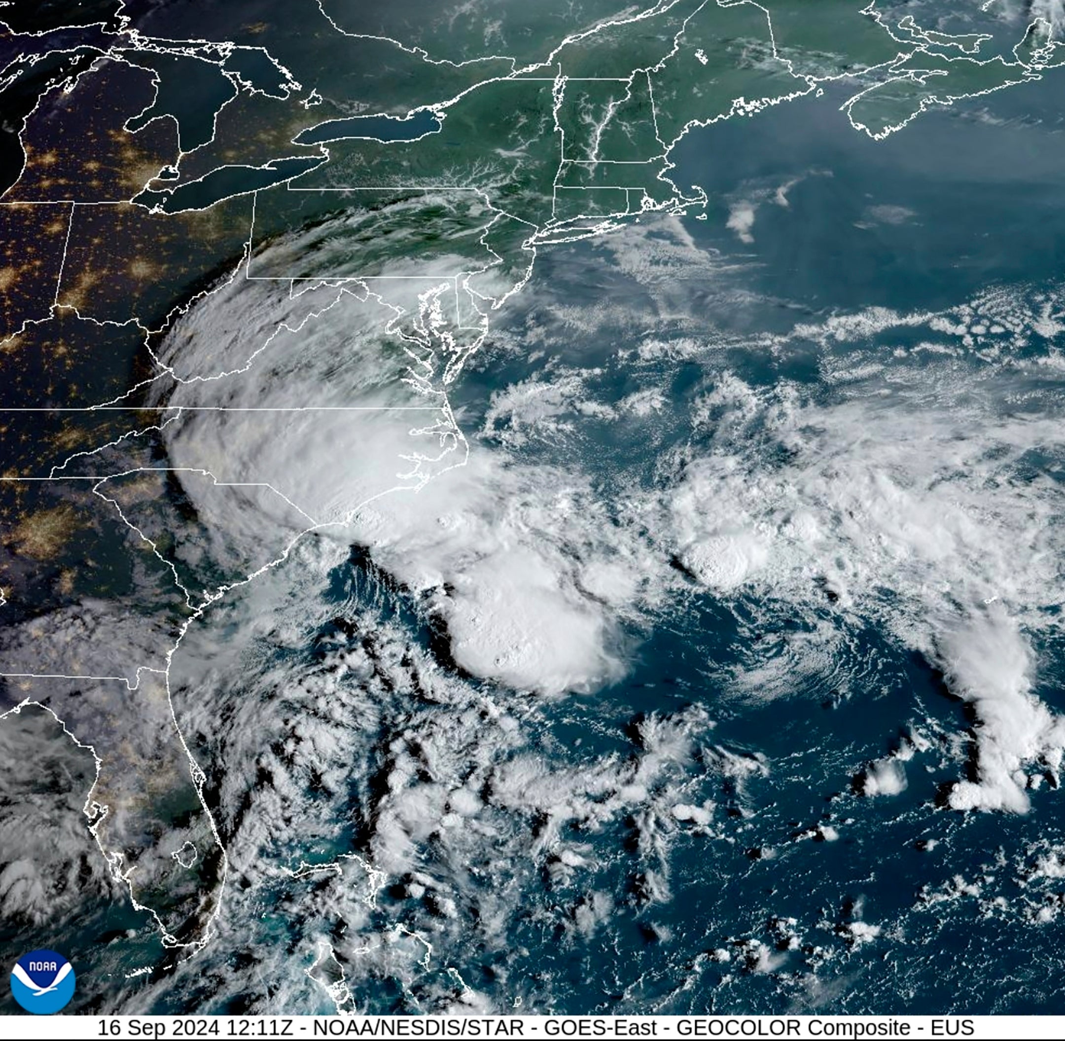
Tropical storm conditions were expected along a stretch of the U.S. Southeast seacoast as the system bringing gusty winds, heavy rain and potential flooding has strengthened, forecasters said Monday.
The storm system was expected to reach the South Carolina coast Monday afternoon and then move inland across the Carolinas from Monday night through Wednesday, the U.S. National Hurricane Center said. Strong winds were approaching the coast Monday morning and were expected to spread onshore.
A tropical storm warning was in effect from Edisto Beach, South Carolina, northward to Ocracoke Inlet, near the southernmost extreme of North Carolina's Outer Banks.
The low-pressure system was centered Monday morning about 100 miles (160 kilometers) east of Charleston, South Carolina, and about 85 miles (140 kilometers) south of Cape Fear, North Carolina. It had maximum sustained winds of 50 mph (85 kph) and was moving to the northwest at 3 mph (6 kph), forecasters said.
The system still had a chance of becoming a tropical or subtropical storm, but forecasters have said those chances may have started to decrease since it seemed to have become less organized.
In an updated hurricane outlook last month the National Oceanic and Atmospheric Administration was still predicting a highly active Atlantic hurricane season thanks to near-record sea surface temperatures and the possibility of La Nina. Emergency management officials have urged people to stay prepared.
Maximum winds were expected to decrease as the low approached the coast, but tropical-storm-force winds were still expected to occur within the warning areas. It would likely dissipate over the Carolinas by late Wednesday, forecasters said.
The storm was expected to dump 4 to 8 inches (10 to 20 centimeters) of rain in northeast South Carolina into southeast North Carolina and up to 10 inches (25 centimeters) in isolated spots, with smaller amounts expected across the remainder of North Carolina through Tuesday, according to forecasters.
Over much of Virginia, 1 to 3 inches (2.5 to 8 centimeters) of rainfall, with locally higher amounts, were expected from Monday night through Wednesday. The hurricane center predicted the rainfall could lead to isolated and scattered flash and urban flooding, as well as minor river flooding.
The Southeast coast also could expect rough surf over the next few days, forecasters said.
Elsewhere in the Atlantic, Tropical Storm Gordon weakened to a depression as it swirls through open ocean waters. Gordon could either dissolve in upcoming days or strengthen back into a tropical storm, forecasters said.
Bookmark popover
Removed from bookmarks