Eta races off to sea from Carolinas after soaking Florida
The former Tropical Storm Eta has been classified as a post-tropical cyclone off the coast of the Carolinas

Your support helps us to tell the story
From reproductive rights to climate change to Big Tech, The Independent is on the ground when the story is developing. Whether it's investigating the financials of Elon Musk's pro-Trump PAC or producing our latest documentary, 'The A Word', which shines a light on the American women fighting for reproductive rights, we know how important it is to parse out the facts from the messaging.
At such a critical moment in US history, we need reporters on the ground. Your donation allows us to keep sending journalists to speak to both sides of the story.
The Independent is trusted by Americans across the entire political spectrum. And unlike many other quality news outlets, we choose not to lock Americans out of our reporting and analysis with paywalls. We believe quality journalism should be available to everyone, paid for by those who can afford it.
Your support makes all the difference.The former Tropical Storm Eta was classified as a post-tropical cyclone early Friday, racing off the Southeast Atlantic coast and bringing heavy rains and gusty winds to the Carolinas after blustering across north Florida.
One death in Florida was linked to the storm, along with some scattered flooding, and forecasters said the system was on a path offshore of South Carolina that is expected to take it further out to sea
Early Friday, the storm was centered about 85 miles (135 kilometers) southeast of Wilmington, North Carolina. It had top sustained winds of 45 mph (75 kph) and was moving to the east-northeast at 21 mph (33 kph). The National Hurricane Center in Miami said Eta — which was now an extra-tropical low — was expected to pick up forward speed in the next day or so as it pulls away from the Southeast seaboard.
The storm system triggered flash flooding, multiple water rescues and road closures, and at least one collapsed bridge in South Carolina, said Sandy LaCourte, a meteorologist with the National Weather Service in Greenville, South Carolina.
Some parts of the Carolinas saw three to seven inches (7.5 to 17 centimeters) of rainfall already by Thursday afternoon with more expected. That came amid a combination of moisture from the Gulf of Mexico being carried up by a cold front that had pushed Eta across Florida earlier.
Earlier Thursday, Eta was in the Gulf of Mexico when it slogged ashore near Cedar Key, Florida. It then moved northeast across Florida in a matter of hours before crossing over into the Atlantic, forecasters said.
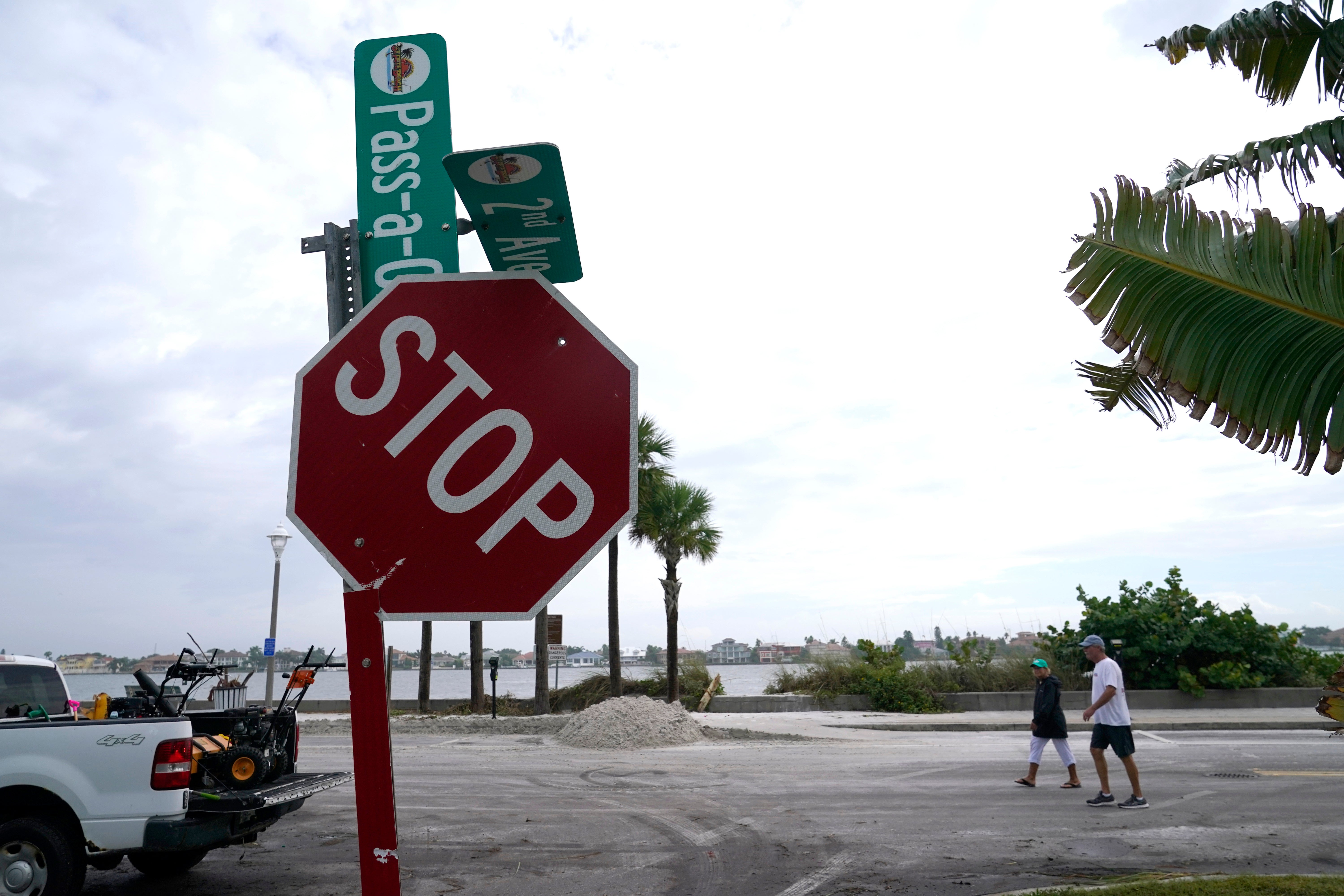
Although it was not the most powerful storm to hit the U.S. this year, Eta had broad impacts across the Tampa Bay region on Florida's Gulf Coast, buffeting an area of more than 3.5 million people with gusty winds and rain.
In Bradenton Beach, Florida, Mark Mixon stepped into his flooded garage as he was laying sandbags around his home Wednesday evening and was electrocuted, said Jacob Saur, director of public safety for Manatee County. There were appliances plugged into the garage and Mixon was killed when he stepped into the water, Saur said.
The storm earlier forced the closure of some lanes of Tampa Bay bridges because of storm surge but they began reopening Thursday. Also reopened was the Sunshine Skyway Bridge in the region.
Earlier, firefighters in Tampa had to rescue around a dozen people who got stuck in storm surge flooding on a boulevard adjacent to the bay. Some vehicles remained on the roadway Thursday. Isolated neighborhoods also experienced enough flooding to evacuate.
J.P. Brewer, owner of Salty's Gulfport, was cleaning up after her beachside restaurant flooded early Thursday.
“It was pretty bad last night when I came in," she said, adding that there were already 3 to 4 inches (8 to 10 centimeters) of water inside by just before high tide. “We’re in here doing our cleanup today and assessing the damage. I think we fared pretty well considering as bad as it looked last night."
Several sailboats broke free from their moorings and washed ashore in Gulfport, Florida, including the vessel where Mo Taggart has lived for two years with her dog. She thinks the boat is a total loss.
“I mean, it was disaster,” Taggart said. “I mean, I came out here. My boat's just up against the seawall, just smashing, smashing ... I need to get another boat. I want to be back on the water, (my dog) wants to be back on the water.”
The storm had made an earlier landfall in South Florida on Sunday after lashing Central America and Mexico with deadly force. Before that first brush with Florida, Eta first hit Nicaragua as a Category 4 hurricane and killed at least 120 people in Central America and Mexico, with scores more missing.
It was the 28th named storm of a busy Atlantic hurricane season, tying the 2005 record for named storms. A 29th named system, Tropical Storm Theta, was centered early Friday about 445 miles (715 kilometers) south-southeast of the Azores and moving east. It had top sustained winds of 60 mph (95 kph).
This extraordinarily busy season has focused attention on climate change, which scientists say is causing wetter, stronger and more destructive storms.
___
Frisaro reported from Fort Lauderdale, Florida. Associated Press photographer Lynne Sladky and video reporter Cody Jackson contributed to this report from Pinellas County and AP reporter Michelle Liu contributed from Columbia, S.C.