Philippines warns of flooding, landslide potential as Typhoon Mawar slowly passes to north
Philippine officials began evacuating villagers, shut schools and offices and imposed a no-sail ban as Typhoon Mawar approached the country’s northern provinces

Philippine officials began evacuating hundreds of villagers, shut down schools and offices and imposed a no-sail ban Monday as Typhoon Mawar approached the country’s northern provinces.
The storm, locally named Betty, was not expected to make landfall in the mountainous region. But forecasters warned that the typhoon would slow down considerably off the northernmost province of Batanes from Tuesday to Wednesday and could cause dangerous tidal surges, flash floods and landslides as it blows past.
Typhoon Mawar was moving northwest in the Pacific Ocean about 525 kilometers (326 miles) east of the coastal town of Aparri in Cagayan province with maximum sustained winds of 155 kph (96 mph) and gusts of up to 190 kph (118 mph).
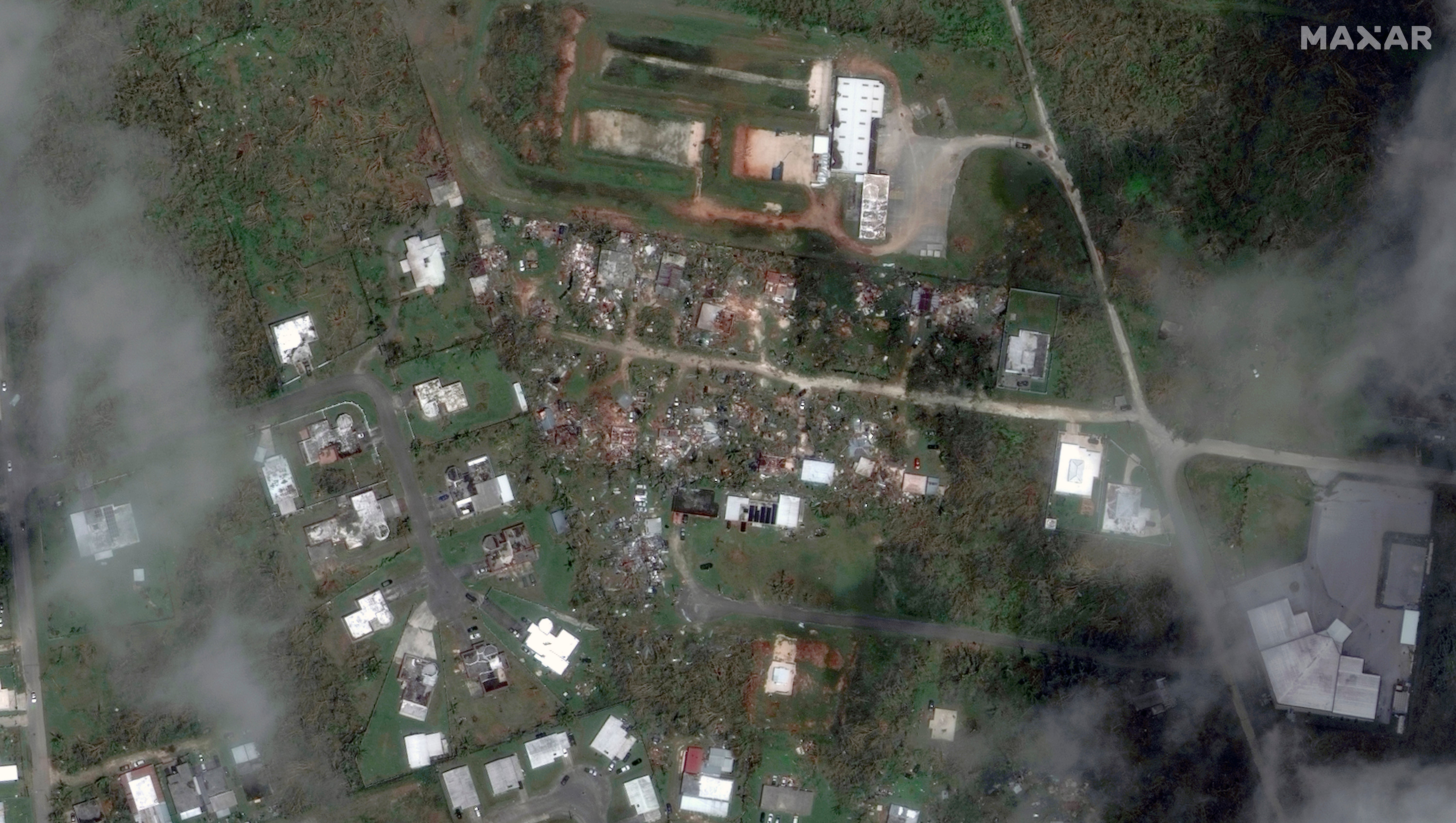
Mawar tore through Guam last week as the strongest typhoon to hit the U.S. Pacific territory in over two decades, flipping cars, tearing off roofs and knocking down power. It weakened as it blew toward the Philippines.
“These typhoons, earthquakes and natural calamities have been a part of our lives,” Batanes Vice Governor Ignacio Villa told The Associated Press by telephone. “We cannot afford not to prepare because that would potentially mean the loss of lives and major damages.”
Disaster-preparedness officials said army troops, police, firefighters and volunteer groups were standing by for possible search and rescue in northern provinces and more than a million food packs for displaced villagers have been prepared.
More than 400 villagers have been evacuated to emergency shelters by Monday in the high-risk coastal communities of Gonzaga and Santa Ana in Cagayan and outlying provinces ahead of the expected onslaught. Other emergency shelters in several northern provinces have been prepared with the expected influx of displaced residents from flood-prone villages, officials said.
Classes and office work, except those involved in disaster-preparedness, have been suspended in most of Cagayan and Batanes provinces, where occasional downpours and gusty wind were reported Sunday night. Flights to and from the provinces have been cancelled and fishing and passenger vessels have been prohibited from sailing in provinces where storm warnings have been raised.
Villa said the local government lent ropes to villagers living in high-risk communities to strengthen their houses as the typhoon approached.
About 20 typhoons and storms each year batter the Philippine archipelago, which also lies on seismic faults where volcanic eruptions and earthquakes occur, making the Southeast Asian nation one of the world’s most disaster-prone.
Bookmark popover
Removed from bookmarks