Stormchasers capture evolution of supercell thunderstorm
Your support helps us to tell the story
From reproductive rights to climate change to Big Tech, The Independent is on the ground when the story is developing. Whether it's investigating the financials of Elon Musk's pro-Trump PAC or producing our latest documentary, 'The A Word', which shines a light on the American women fighting for reproductive rights, we know how important it is to parse out the facts from the messaging.
At such a critical moment in US history, we need reporters on the ground. Your donation allows us to keep sending journalists to speak to both sides of the story.
The Independent is trusted by Americans across the entire political spectrum. And unlike many other quality news outlets, we choose not to lock Americans out of our reporting and analysis with paywalls. We believe quality journalism should be available to everyone, paid for by those who can afford it.
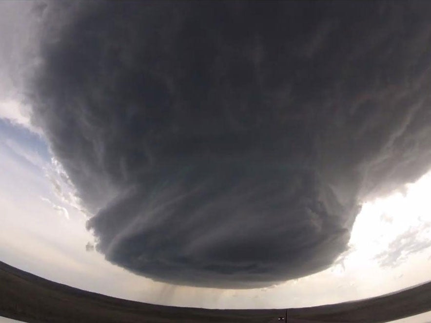
Your support makes all the difference.Stormchasers in the US have captured the evolution of a huge “supercell” storm from its formation until it disappears.
The stunning time-lapse, which has been viewed almost 2.5 million times, shows a mass of swirling clouds tighten into a rotating column reaching out of sight into the clouds.
As the storm grows larger, the chasers move away to reveal its size as it spins, dropping torrential rain, before the funnel unfurls and the clouds dissolve.
The group, Basehunters, tracked it for almost 70 miles from Wright to Newcastle in Wyoming on Sunday.
They are often found in the Great Plains of the US, where they cause much of the severe weather in the area known as Tornado Alley.
One storm can spawn several tornadoes in its lifespan and produce large hail, damaging winds, flooding, powerful lightning and heavy rain.
Video courtesy of Basehunters, see original here.
Join our commenting forum
Join thought-provoking conversations, follow other Independent readers and see their replies
Comments