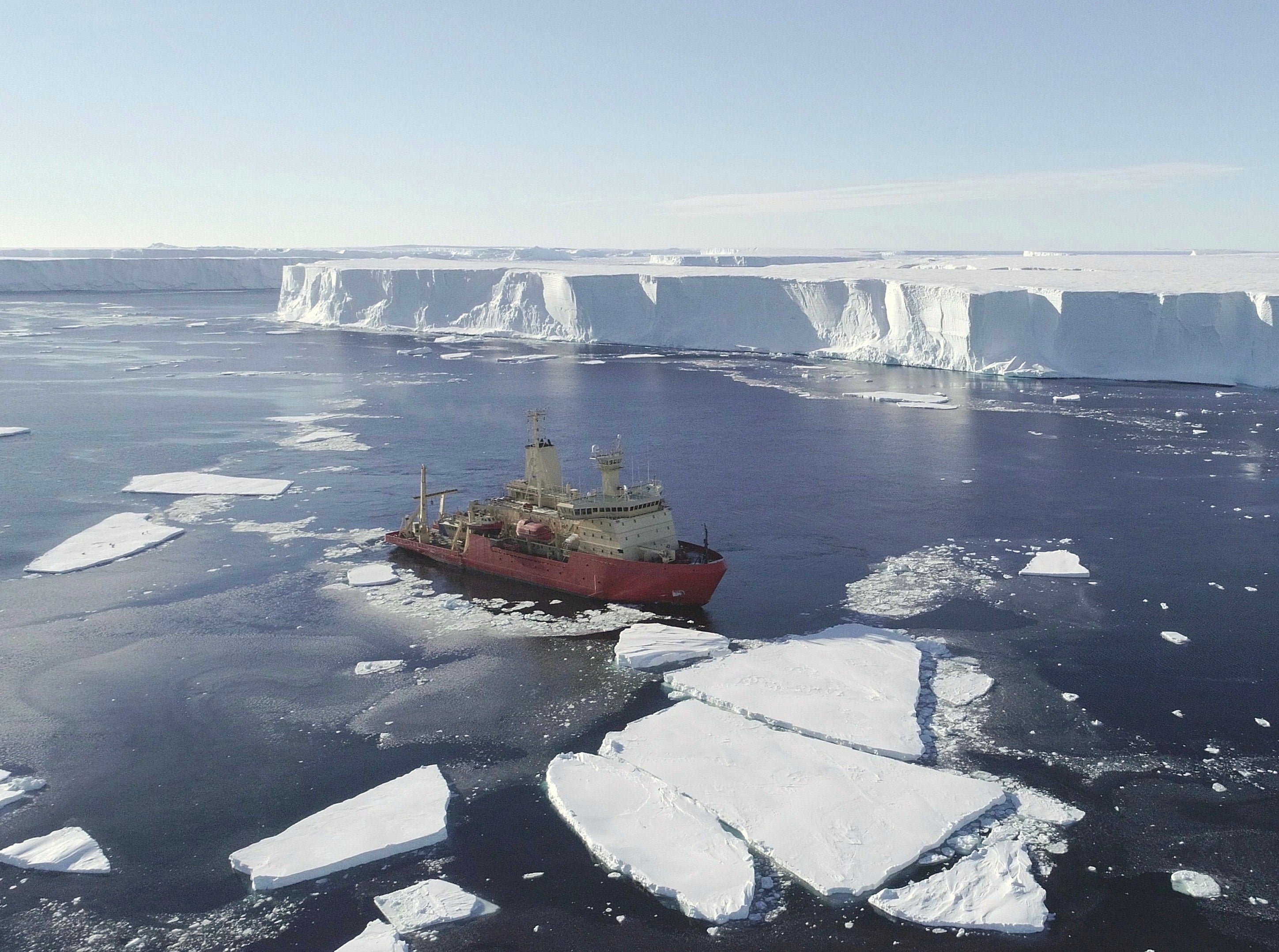
‘Doomsday glacier’ in Antarctica melting due to warm water channels under surface, scientists discover
‘I was shocked – it brought home how much how much this system has been damaged,’ says British Antarctica Survey scientist on break up of ice shelf

Your support helps us to tell the story
From reproductive rights to climate change to Big Tech, The Independent is on the ground when the story is developing. Whether it's investigating the financials of Elon Musk's pro-Trump PAC or producing our latest documentary, 'The A Word', which shines a light on the American women fighting for reproductive rights, we know how important it is to parse out the facts from the messaging.
At such a critical moment in US history, we need reporters on the ground. Your donation allows us to keep sending journalists to speak to both sides of the story.
The Independent is trusted by Americans across the entire political spectrum. And unlike many other quality news outlets, we choose not to lock Americans out of our reporting and analysis with paywalls. We believe quality journalism should be available to everyone, paid for by those who can afford it.
Your support makes all the difference.Scientists studying a giant mass of ice in Antarctica known as the “doomsday glacier” believe they have discovered why it is melting so rapidly and pushing up sea levels.
A team of UK and US researchers have found a series of deep channels beneath Thwaites Glacier thought to be acting as pathways for warm ocean water to melt the underside of the ice.
Around 80 billion tonnes of ice from the glacier is currently draining out into the Amundsen Sea each year – accounting for around four per cent of the planet’s annual sea-level rise.
The runaway collapse of Thwaites – which is around the size of Great Britain – could lead to an increase in sea levels of around 65cm, and scientists want to find out how quickly this catastrophic scenario might happen.
A series of missions by the International Thwaites Glacier Collaboration (ITGC) – using ship and aircraft – mapped the sea channels underneath the glacier in detail for the first time, and found they were far deeper than previously thought.
“I was shocked to fly over the glacier and see all the debris left behind as the ice shelf has collapsed – it was stunning,” said Dr Tom Jordan, an aero-geophysicist from the British Antarctic Survey (BAS) who led the airborne survey.
He told The Independent: “You look out the window and you see the broken-up fragments of the former ice shelf. It was breathtaking. It brought home how much how much this natural system has been damaged and is breaking up.”
Dr Jordan is in no doubt carbon emissions from human activity have contributed to the warming of the ocean in Antarctica. “It’s generally accepted that the warming of the ocean is part of what is driving the retreat at Thwaites Glacier,” he said.
“It is part of the changing climatic system, which is an anthropogenic effect. That’s the scientific consensus – that the changes relate to human-caused climate change.”
British and American researchers from ITGC project began collecting data from the glacier and adjoining ice shelves last year. While one team collected airborne data flying over the glacier and ice shelf in a British Antarctic Survey Twin Otter aircraft, the other mapped the sea floor at the ice front from the US Antarctic Program’s icebreaker vessel RV Nathaniel B Palmer.
“For the first time we have a clear view of the pathways along which warm water can reach the underside of the glacier, causing it to melt and contribute to global sea-level rise.”
Dr Hogan, author of one of the newly-released research papers on the work in west Antarctica, said the channels were up to 600 metres deep – the equivalent of six football pitches back to back.
Thwaites Glacier covers around 74,000 square miles and is particularly susceptible to climate and ocean changes. In the 1990s the glacier had been losing around 10 billion tonnes of ice each year, but is now losing around 80 billion tonnes annually.
It was only because of the rapid break-up of ice in the early part of 2019 that the team on the RV Nathaniel B Palmer were able to survey over 2,000 square kilometres of sea floor at the glacier’s ice front.
The area surveyed had previously been completely hidden beneath part of the floating ice shelf extending out from Thwaites Glacier, which broke off in 2002, and in most subsequent years the area was inaccessible due to thick sea-ice cover.
“Flying over the recently collapsed ice tongue and being able to see first-hand the changes occurring at Thwaites Glacier was both awe inspiring and disconcerting,” said Dave Porter from LDEO Columbia University, who helped carry out the airborne survey.
“But [it is] also gratifying to know the airborne data we were collecting would help reveal the hidden structures below.”
Dr Jordan said the team had stop working in Antarctica in March because of concerns about the coronavirus pandemic, which has put the next stage of the five-year project work on hold until 2021.
“We hope the work will help us understand how fast the glacier is going to change and what contribution it will make to sea levels,” he said. “We hope that will help governments plan for the long-term.
“Ultimately, we know what the solution to the problem is, which is to reduce carbon emissions.”


Join our commenting forum
Join thought-provoking conversations, follow other Independent readers and see their replies
Comments