UK weather: Powerful 80mph winds and heavy rain to batter Britain for two days, Met Office warns
Gusts may reach up to 80 mph on exposed coasts and hills in Scotland and Northern Ireland

Your support helps us to tell the story
From reproductive rights to climate change to Big Tech, The Independent is on the ground when the story is developing. Whether it's investigating the financials of Elon Musk's pro-Trump PAC or producing our latest documentary, 'The A Word', which shines a light on the American women fighting for reproductive rights, we know how important it is to parse out the facts from the messaging.
At such a critical moment in US history, we need reporters on the ground. Your donation allows us to keep sending journalists to speak to both sides of the story.
The Independent is trusted by Americans across the entire political spectrum. And unlike many other quality news outlets, we choose not to lock Americans out of our reporting and analysis with paywalls. We believe quality journalism should be available to everyone, paid for by those who can afford it.
Your support makes all the difference.The UK is bracing itself for another round of powerful winds and heavy rainfall today with forecasters warning of 80mph gusts bringing a second wave of power outages.
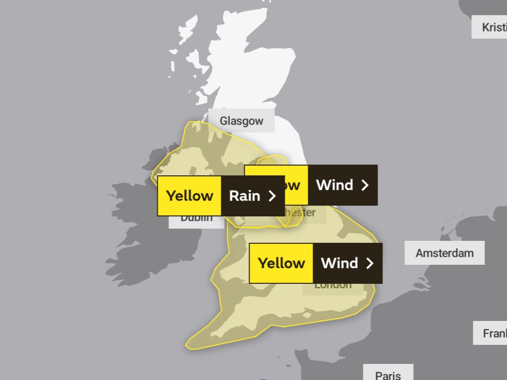
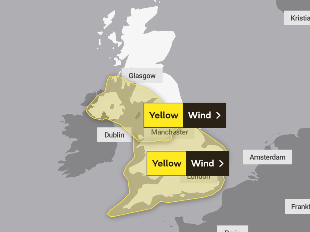
Three yellow weather warnings are in place across the country for today, with very strong winds expected to hit parts of Scotland, Northern Ireland and much of England and Wales, while Greater Manchester and its surrounding areas can expect heavy rainfall and possible risk of flooding to roads, homes and businesses.
Forecasters have said people living in south and west facing coasts in England and Wales can expect gusts of 55-60 mph, which could be more vulnerable to damage than usual in the wake of Storm Eunice.
The weather alert, in place from 12pm today until 3pm on Monday, forewarns that some places inland may see gusts as high as 70 mph moving through the country on the back of a band of rain moving southeastwards through the afternoon.


Meanwhile fierce winds are expected to tear through Northern Ireland, Scotland and some coastlines along the Irish Sea, bringing with them a slight chance of damage to buildings, such as tiles being blown from roofs amid gusts of 60-70 mph and 80 mph on exposed coasts and hills.
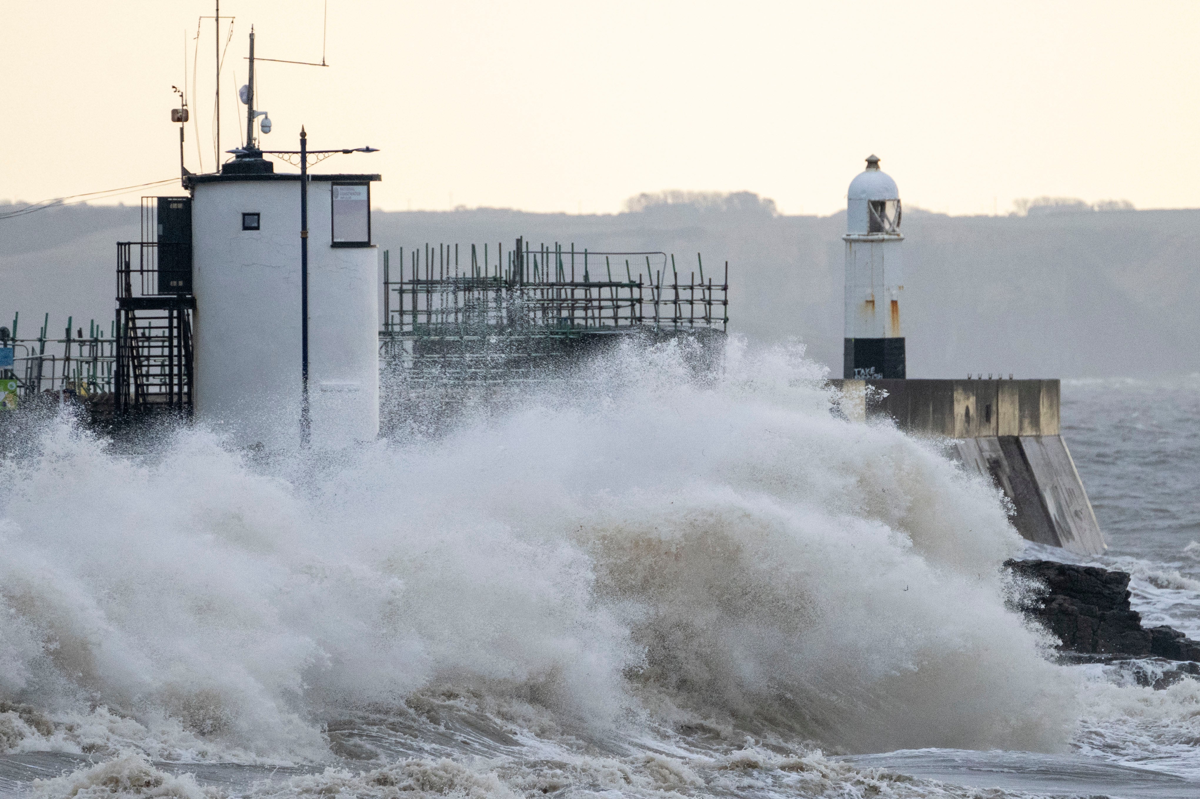
Met officials have warned of a small chance of “danger to life” as strong gusts whip up large waves causing beach material to be thrown onto sea fronts, coastal roads and properties.
There is also chance of conditions causing longer journey times and cancellations to road, rail, air and ferry services.

High wind speeds are also expected to bring some damage to buildings inland, such as tiles being blown from roofs, power and mobile phone service cuts, and damage to infrastructure and trees across the country.
The Met Office have also urged caution as heavy downpours in northwest England could cause a number of homes and businesses to flood on Sunday.
Forecasters have focused concerns on the Greater Manchester area, warning that fast flowing or deep floodwater could leave some communities cut off amid 20 to 40 mm of rainfall, with some exposed sites potentially seeing 60 to 80 mm.

Met Office meteorologist Greg Dewhurst said: “We will see a slight easing in the wind over the evening time tonight, but it’s not long before they pick up again tomorrow to lead to another windy day across the UK.
“This will have an impact on the clearing up process over the course of the day.”
It comes as some 155,000 people are still without power, and the Energy Networks Association said it believes the UK may have experienced a record outage over a 24-hour period on Friday, with around 1.3 million homes affected.
Electricity provider Western Power Distribution (WPD) confirmed the outage was the most widespread ever recorded for the south west of England.
The company said: “Since it first hit, Storm Eunice has officially caused the highest number of power cuts in a 24 hour period our South West region has ever experienced.
“Our engineers are continuing to work relentlessly to restore supplies to our customers despite the awful conditions.”

MET OFFICE OUTLOOK
Today:
Generally a dull and overcast day, drizzly at times this morning. Rain becoming widespread across the region during the afternoon, with a band of heavy rain arriving from the northwest towards dusk. Strong winds throughout the day. Maximum temperature 11 °C.
Tonight:
Heavy rain clearing the south coast early evening. Scattered cloud with isolated showers to follow, mostly towards the northwest. Very windy. Minimum temperature 2 °C.
Monday:
A brighter day although still very windy. Scattered cloud at times and the outside chance of a shower. Winds easing and skies clearing into the evening. Maximum temperature 10 °C.
Outlook for Tuesday to Thursday:
Cloudy with squally, heavy rain Tuesday afternoon, showery later. Cloudy but dry Wednesday. Heavy rain early Thursday then cold with potential wintry showers. Strong winds at times near the coasts.


Join our commenting forum
Join thought-provoking conversations, follow other Independent readers and see their replies
Comments