Major incident declared over flood risk in Somerset as 72 warnings issued
Fourteen flood alerts issued in Somerset alone following heavy downpours

Your support helps us to tell the story
From reproductive rights to climate change to Big Tech, The Independent is on the ground when the story is developing. Whether it's investigating the financials of Elon Musk's pro-Trump PAC or producing our latest documentary, 'The A Word', which shines a light on the American women fighting for reproductive rights, we know how important it is to parse out the facts from the messaging.
At such a critical moment in US history, we need reporters on the ground. Your donation allows us to keep sending journalists to speak to both sides of the story.
The Independent is trusted by Americans across the entire political spectrum. And unlike many other quality news outlets, we choose not to lock Americans out of our reporting and analysis with paywalls. We believe quality journalism should be available to everyone, paid for by those who can afford it.
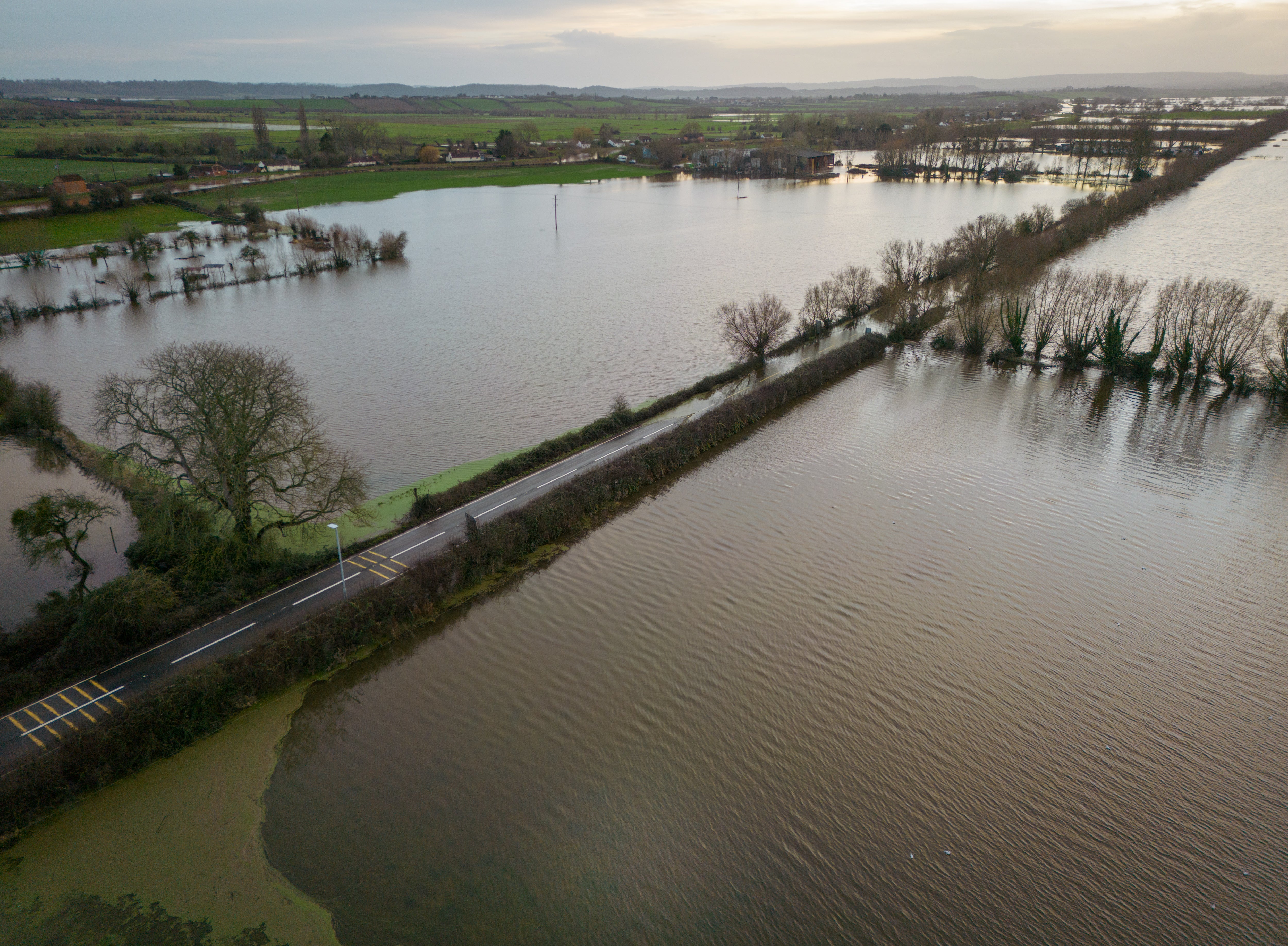
Your support makes all the difference.A major incident has been declared in Somerset due to flooding risks across the county.
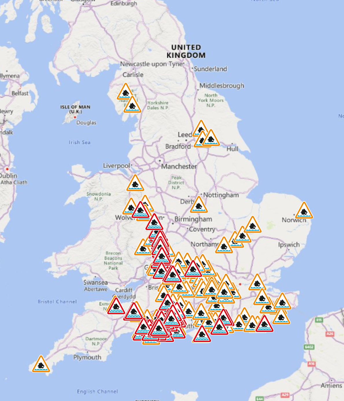
It comes as 111 flood alerts and 72 flood warnings have been issued in England, 14 of which have been declared for Somerset.
The Environment Agency says the decision to declare a major incident at this time is a “precautionary move and will mean partners become more coordinated and ready to support and take action should the situation worsen.”

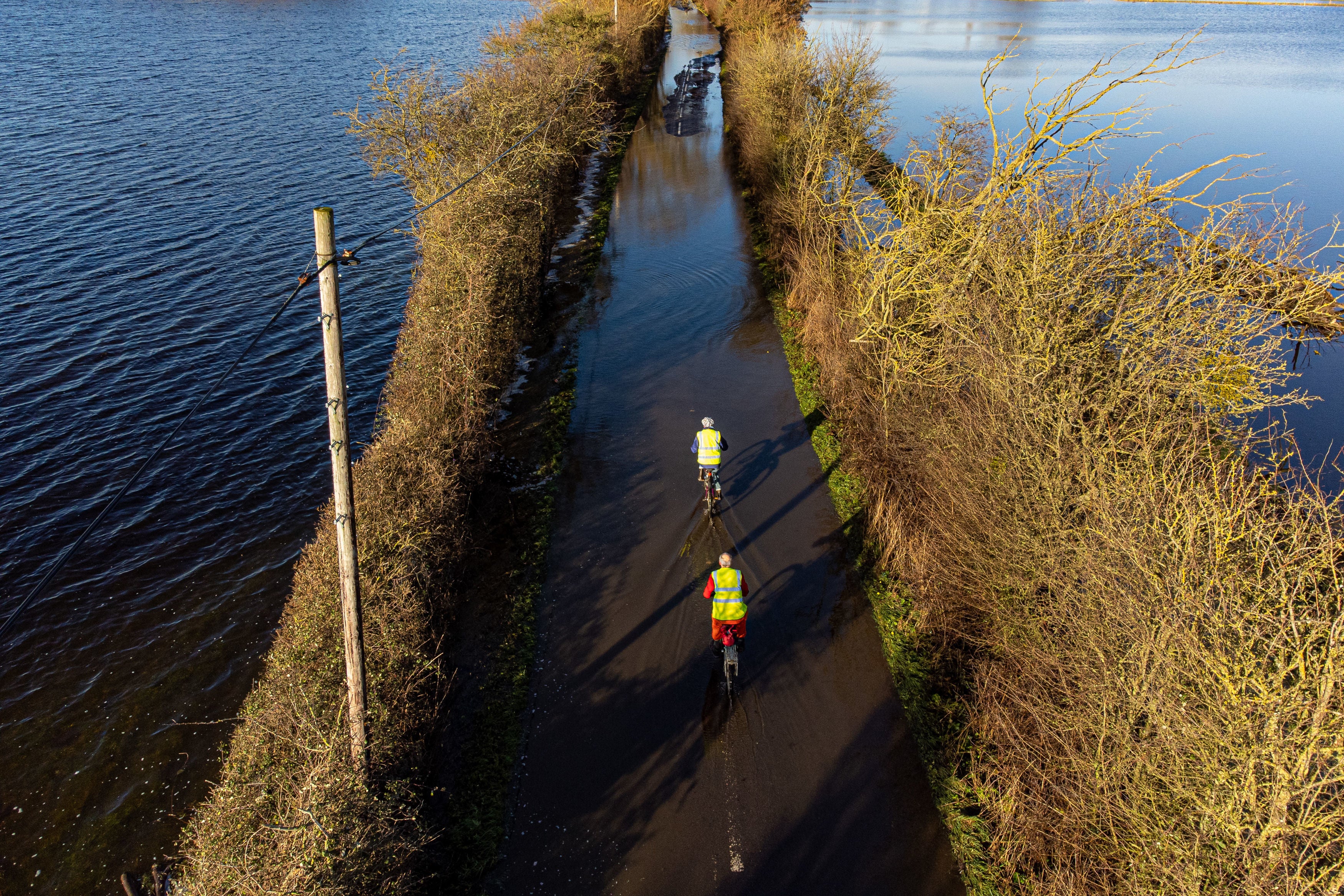
The recent heavy rain has triggered widespread flooding of the Somerset Levels and Moors, designed to store flood water when the rivers flowing through them burst their banks.
Enhanced pumping began on Tuesday evening at Northmoor to reduce the amount of water being stored until river levels allow pumping to resume at Currymoor, which remains full.
The agency is currently responding to flooding incidents across Somerset, flood risk in the Bristol Avon area, and monitoring rising groundwater levels in Dorset.
Ian Withers of the Environment Agency said the situation should improve when enhanced pumping begins.
“The sight of water on the Somerset Levels and Moors is obviously a concern to those who have suffered from flooding before,” he said.
“Our staff continue to work to the best of their abilities to protect people and properties, install pumps and engage with communities.
Mr Withers added: “It is prudent to plan for the worst and going into major incident mode is appropriate, so we coordinate with partners and everyone is ready to respond if needed.”

The major incident was issued jointly by the Environment Agency, Somerset County Council, Sedgemoor District Council, Somerset West and Taunton Council, Mendip District Council and South Somerset District Council.
Cllr Bill Revans, leader of Somerset County Council, said: “The decision to declare a major incident at this stage means we are well placed to respond. We will be supporting Environment Agency colleagues on the ground and taking every step to ensure our communities receive the help they need.”
Additional pumps have been deployed at Saltmoor and Northmoor, to help reduce levels as much as possible when the River Parrett has reached capacity.
A flood warning has been issued for both areas, and Environment Agency officers were in the village of Moorland, Northmoor, yesterday to offer advice and support to residents.

Extra pumps are also ready to use at Currymoor once conditions allow. Once the water level at Currymoor is reduced, Athelney spillway will stop flowing into Northmoor as well as the A361 between East Lyng and Burrowbridge.
A flood warning for that area remains in place and the road is closed.
To allow pumping to continue more frequently and for longer at impacted pump stations, water is being diverted to the Sowy flood relief channel and King’s Sedgemoor Drain to Dunball, where pumps are being installed to allow pumping to continue in the event of high tide.
The Environment Agency urges residents to check their flood risk by signing up for flood warnings and create a flood plan so they know what action to take and are prepared to act. You can find links at https://check-for-flooding.service.gov.uk.

There is further information to help you on what to do during a flood on the Somerset Prepared website.


Join our commenting forum
Join thought-provoking conversations, follow other Independent readers and see their replies
Comments