Typhoon Gaemi mapped: Storm heads for China after pounding Taiwan and Philippines
Chinese weather forecasters say Typhoon Gaemi’s impact will be felt by a wide region, including areas not directly on its path
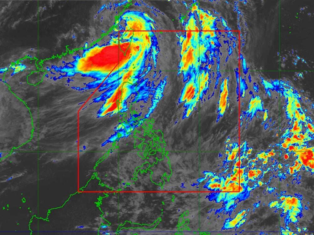
A powerful typhoon is churning towards the southeastern coast of China after pounding Taiwan and flooding the Philippines.
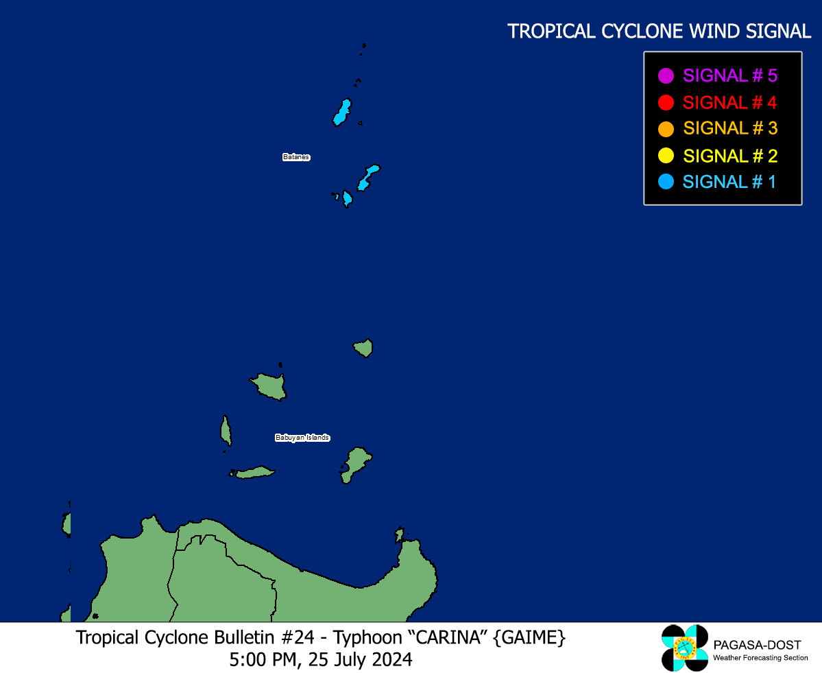
Typhoon Gaemi, also known as Typhoon Carina in the Philippines, made landfall in Taiwan in the early hours of Thursday as the worst storm in eight years.
It hit Yilan County with sustained winds up to 205 kph (125 mph), equal to a Category 3 major hurricane in the Atlantic.
Follow live updates on Typhoon Gaemi as it heads towards China
The storm brought powerful gusts and heavy rainfall and killed at least three people, as well as injuring hundreds of others, as authorities closed financial markets, schools and offices.

The typhoon was moving over the Taiwan Strait on Thursday towards mainland China’s Fujian province, where it is expected to make landfall later, bringing more strong winds and downpours to a country already hit hard by weeks of extreme rain and deadly flooding.
Chinese weather forecasters said Gaemi will pass through Fujian province on Thursday evening and head inland, gradually moving northward with less intensity.
However, forecasters are expecting heavy rain in many areas as it tracks north, even those not directly on the storm’s path.
Government officials have already prepared for heavy rain and flooding, issuing warnings to the coastal provinces of Fujian and Zhejiang.

In Fujian, officials have relocated about 150,000 people, mainly from coastal fishing communities, state media reported.
Most flights were cancelled at airports in Fuzhou and Quanzhou in Fujian, and Wenzhou in Zhejiang, according to the VariFlight app.
Guangzhou rail officials suspended some trains that pass through typhoon-affected areas, according to CCTV.

As gale force winds picked up, officials in Zhoushan in Zhejiang province suspended passenger waterway routes for up to three days.
Meanwhile, northern China is experiencing heavy rain from summer storms around a separate weather system.
Officials in capital Beijing upgraded and issued a red warning late on Wednesday night for torrential rain expected through most of Thursday, according to Chinese state media.

Some areas have already experienced heavy rain and emergency plans were activated, with more than 25,000 people evacuated, according to Beijing Daily.
Some train services were also suspended at the Beijing West Railway Station, state media said.
Gaemi had already killed 22 people in the Philippines on its way past that country, adding to flooding and landslides from already high monsoon rainfall, and taking the total death toll from the storm up to 25.

The typhoon is also believed to have been linked with several vessels in the sea capsizing. A cargo ship off Taiwan and an oil tanker off the Philippines sank on Thursday morning, both in rough seas.
In the Philippines authorities are searching for a missing crew member from the tanker, and warn they face a “race against time” to contain a huge oil spill that is heading for Manila.
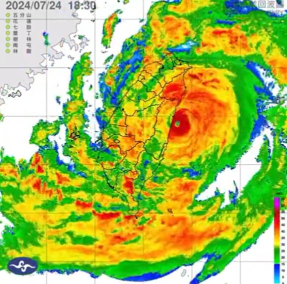
Typhoon Gaemi’s unexpected behaviour before slamming into Taiwan surprised many experts.

The typhoon was originally moving directly toward the northeastern coast of Taiwan. But radar data showed that instead of hitting the coast immediately, Gaemi performed a full loop just offshore.
This means that instead of hitting the coast immediately, it circled around the area before eventually making landfall.
The reason behind this unexpected loop is Taiwan’s rugged and mountainous terrain. The island’s mountainous landscape can significantly influence the path of typhoons, causing them to alter their course or slow down.
In Gaemi’s case, the interaction with the mountainous geography led to its looping pattern, deviating from its initial trajectory, a phenomenon that isn’t unprecedented.
Experts say excess ocean heat due to climate crisis may be helping fuel hurricanes and typhoons like Gaemi.
Tropical cyclones gain energy by feeding on ocean heat, so storms are becoming more intense, capable of reaching greater wind speeds and dumping more rain.
Join our commenting forum
Join thought-provoking conversations, follow other Independent readers and see their replies
Comments


Bookmark popover
Removed from bookmarks