Storm Eunice: Schools across UK to close as ‘dangerous’ weather front approaches
Met Office warns Storm Eunice will be ‘one of the most impactful’ in years

Your support helps us to tell the story
From reproductive rights to climate change to Big Tech, The Independent is on the ground when the story is developing. Whether it's investigating the financials of Elon Musk's pro-Trump PAC or producing our latest documentary, 'The A Word', which shines a light on the American women fighting for reproductive rights, we know how important it is to parse out the facts from the messaging.
At such a critical moment in US history, we need reporters on the ground. Your donation allows us to keep sending journalists to speak to both sides of the story.
The Independent is trusted by Americans across the entire political spectrum. And unlike many other quality news outlets, we choose not to lock Americans out of our reporting and analysis with paywalls. We believe quality journalism should be available to everyone, paid for by those who can afford it.
Your support makes all the difference.A number of schools will be closed on Friday after the Met Office issued a rare red weather warning over wind conditions that may pose a danger to life during Storm Eunice.
Some parts of the country can expect wind speeds of up to 100mph, forecasters have warned, which may see damage to buildings, roofs blown off, trees uprooted and flying debris.
The red weather warning stretches across a section of southwest England and south Wales.
Forecasters have also urged people to prepare for severe disruption to travel, with likely closures on roads, bridges and railways, and delays or cancellations to bus and train routes, ferry services and flights.
Expected damage to overhead power lines may also cause disruption to other services, including mobile phone coverage.
As a result, the council leader for Swansea announced that schools and non-essential council services will close on Friday.
Cllr Rob Stewart urged people to “follow guidance and stay safe”, amid fears the approaching Storm Eunice could be among the UK’s worst in 30 years.
Schools affected will move to remote learning, he said.
Following in Swansea’s footsteps, Rhondda Cynon Taf, a borough in southeast Wales, also announced school closures.
A council spokesman said: “All our schools will be closed in the interest of public safety, with remote learning opportunities in place. Further service updates and public advice to follow.”
A short while later, Merthyr Tydfil, a town 23 miles from Cardiff, said it will also close its schools.
A spokesman said: “Following advice from the Met Office and in line with other LAs across Wales, the decision has been made for all schools to move to remote learning for tomorrow, Friday 18th February with no members of staff or learners expected to attend.”
Follow our live weather updates here.
Vale of Glamorgan council announced some schools will shut, while Gwynedd council said schools will decide individually whether to close.
Across the border in England, Devon County Council has announced 17 school closures on Friday in light of warnings from the Met Office.
A full list of closures is available on the council’s website here.
Met Office Chief Meteorologist Frank Saunders has warned that the approaching storm will be “one of the most impactful” in years.

He said: “After the impacts from Storm Dudley for many on Wednesday, Storm Eunice will bring damaging gusts in what could be one of the most impactful storms to affect southern and central parts of the UK for a few years.
“The red warning area indicates a significant danger to life as extremely strong winds provide the potential for damage to structures and flying debris.
“Although the most exposed coastal areas in the south and west could see gusts in excess of 90mph, winds will remain notably strong further inland, with gusts of between 70-80mph for most within the amber warning area.”
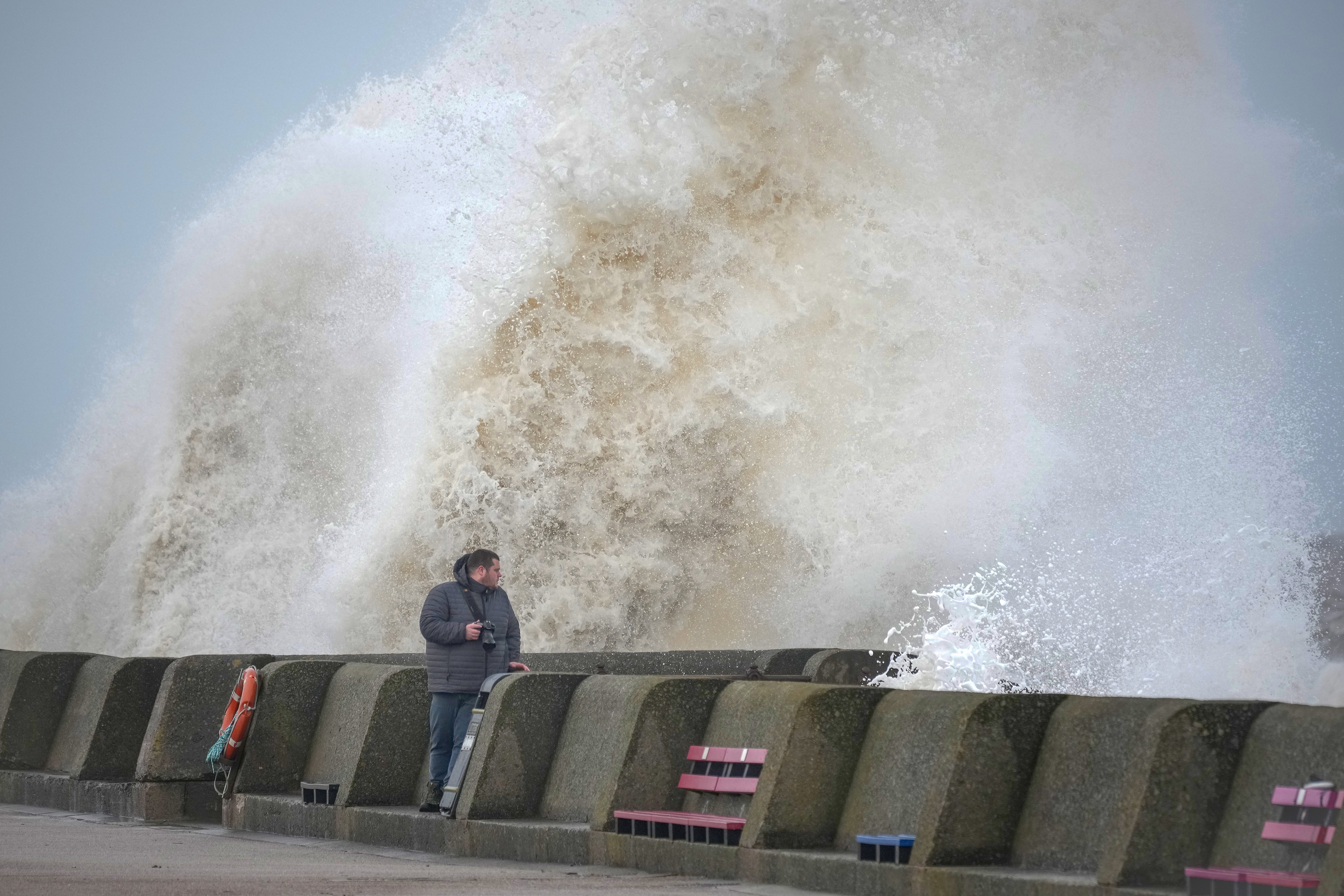
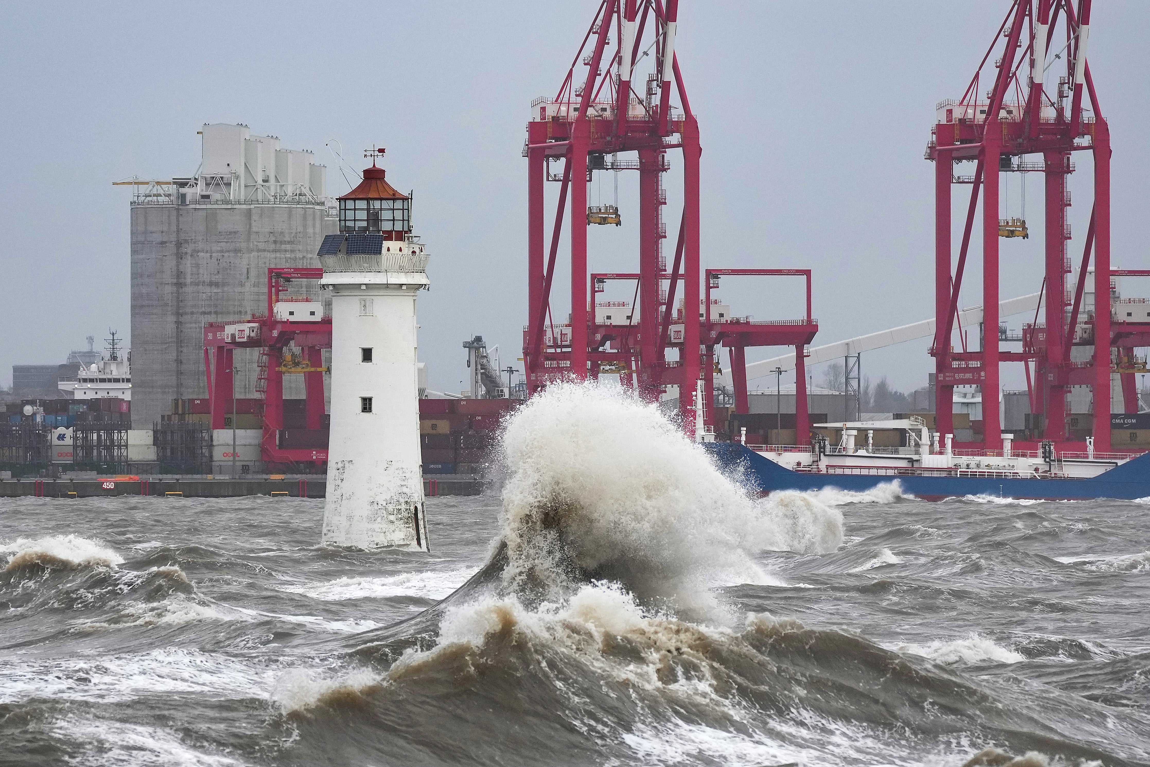
Seafronts are of particular concern to forecasters, warning of large waves and beach material being thrown onto coastal roads and homes, including flooding of some properties.
The Environment Agency is warning people in the south and west of England of the chance of flooding on Friday morning.
Katharine Smith, the agency’s flood duty manager, said: “Strong winds could bring coastal flooding to parts of the west, southwest and south coast of England, as well as the tidal River Severn, in the early hours of Friday morning.
“This is due to Storm Eunice resulting in high waves and potential storm surge coinciding with the start of a period of spring tides.”
Meanwhile, National Highways has advised drivers to consider delaying their journeys on Friday if they are not necessary.
Its head of road safety, Jeremy Phillips, said: “We’re encouraging drivers to check the latest weather and travel conditions before setting off on journeys and consider if their journey is necessary and can be delayed until conditions improve. If you do intend to travel, then plan your trip and take extra care, allowing more time for your journey.
“In high winds, there’s a particular risk to lorries, caravans and motorbikes so we’d advise drivers of these vehicles to slow down.

“Drivers of other vehicles should be aware of sudden gusts of wind which can affect handling and braking, and give high-sided vehicles, caravans, and motorbikes plenty of space. In the event of persistent high winds we may need to close bridges to traffic for a period, so please be alert for warnings of closures and follow signed diversion routes.”
It comes after Network Rail announced there will be blanket speed restrictions of 50mph in most places.
South Western Railway said a speed restriction will also be in place across its entire network for most of the day.
Avanti West Coast said it will run an amended timetable, with longer journey times due to speed restrictions.
“We will be doing everything we can to keep as many services as possible running safely and reliably on Friday, but with such strong winds expected we know that disruption to passengers’ journeys is inevitable,” said Network Rail group director Jake Kelly.
“Please consider whether your journey is necessary on Friday, and if possible re-plan your journey for another day.”


Join our commenting forum
Join thought-provoking conversations, follow other Independent readers and see their replies
Comments