Satellite images of Alps show dramatic drop in snowfall over year amid record temperatures
Photos taken just months apart reveal how much snow has melted, leaving mountain tops green
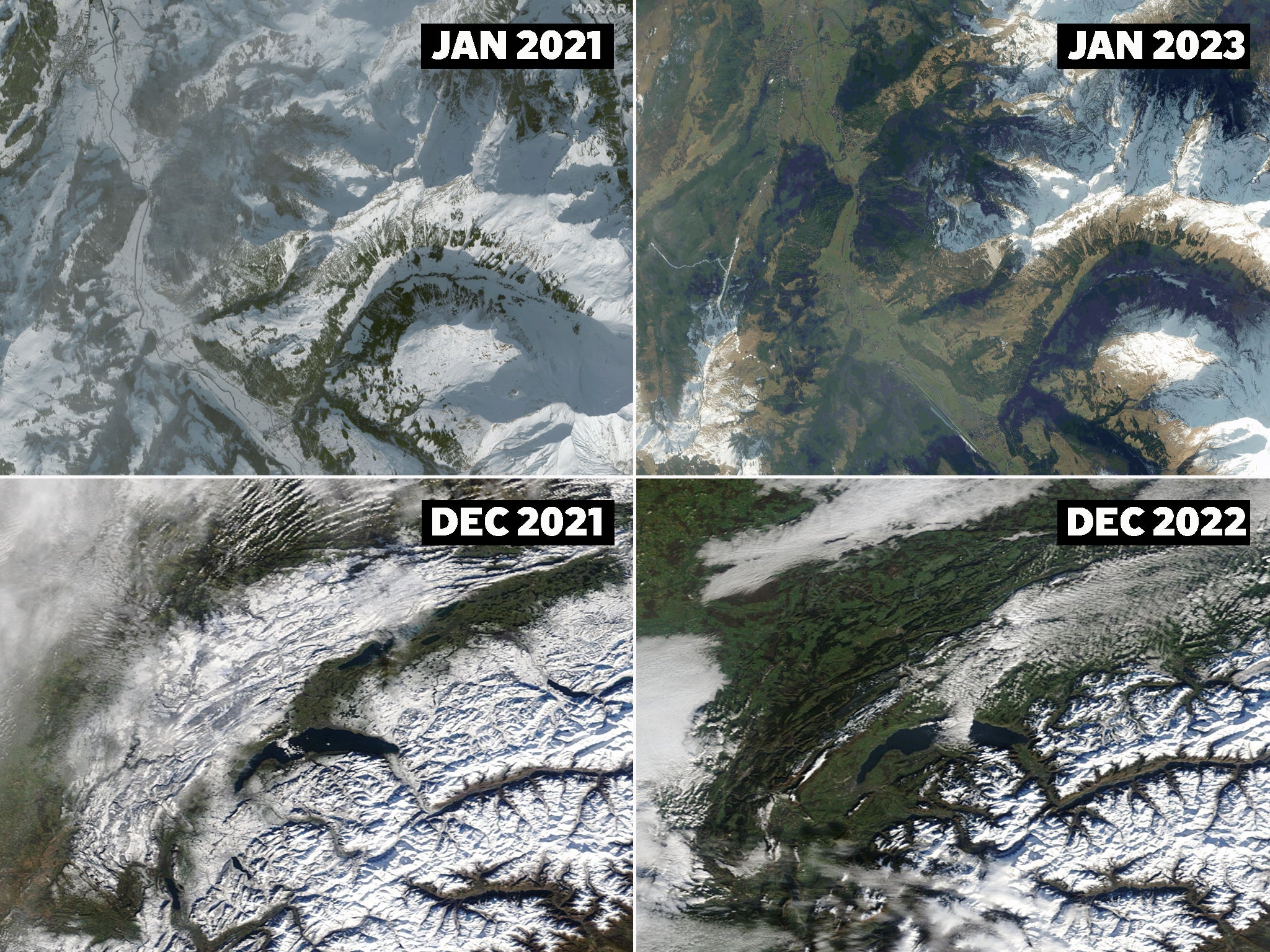
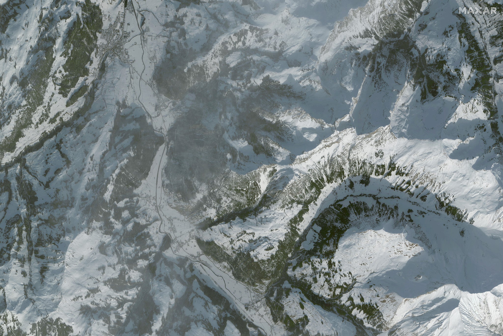
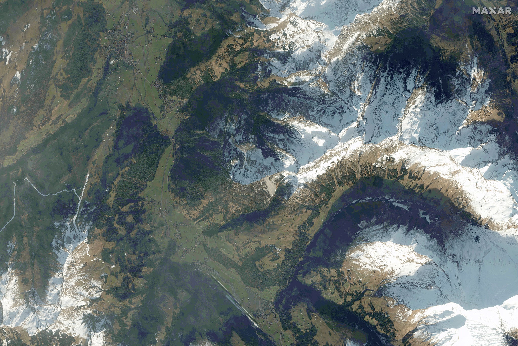
The shrinkage of snow cover in the Alps as Earth’s temperatures hit record highs is so dramatic it can be seen from space.
Satellite images have revealed how mountain tops across the region are showing more green grass than ever and smaller blankets of white.
Record high temperatures have been recorded in eight European countries and another three areas have experienced regional highs.
On Sunday, it was 25.1C in Bilbao, Spain – 10C warmer than average for the time of year.
Patchy snowfall and warm weather caused by the climate crisis in much of Europe have forced some European ski resorts to close just a few weeks after opening.
Temperatures have even hit the 20s in Switzerland, and in France, the thermometer hit the highest levels for 25 years for this time of year, according to national forecaster Meteo France.
The Netherlands, Liechtenstein, Lithuania, Latvia, Czech Republic, Poland, Denmark and Belarus were also warmer than usual, and records have been broken in Ukraine, France and Germany.
The Netherlands recorded its warmest day in January, at 16.9C.
Adelboden in Switzerland, which hosts the skiing World Cup, is being forced to run the race on artificial snow this year.
Course director Toni Hadi said: “The climate is a bit changing but what should we do here? Shall we stop with life? Everything is difficult.”
But while snow was melting across Europe, the US faced its coldest Christmas in living memory as swathes of the country suffered ice storms, whiteouts and ferocious subzero winds.
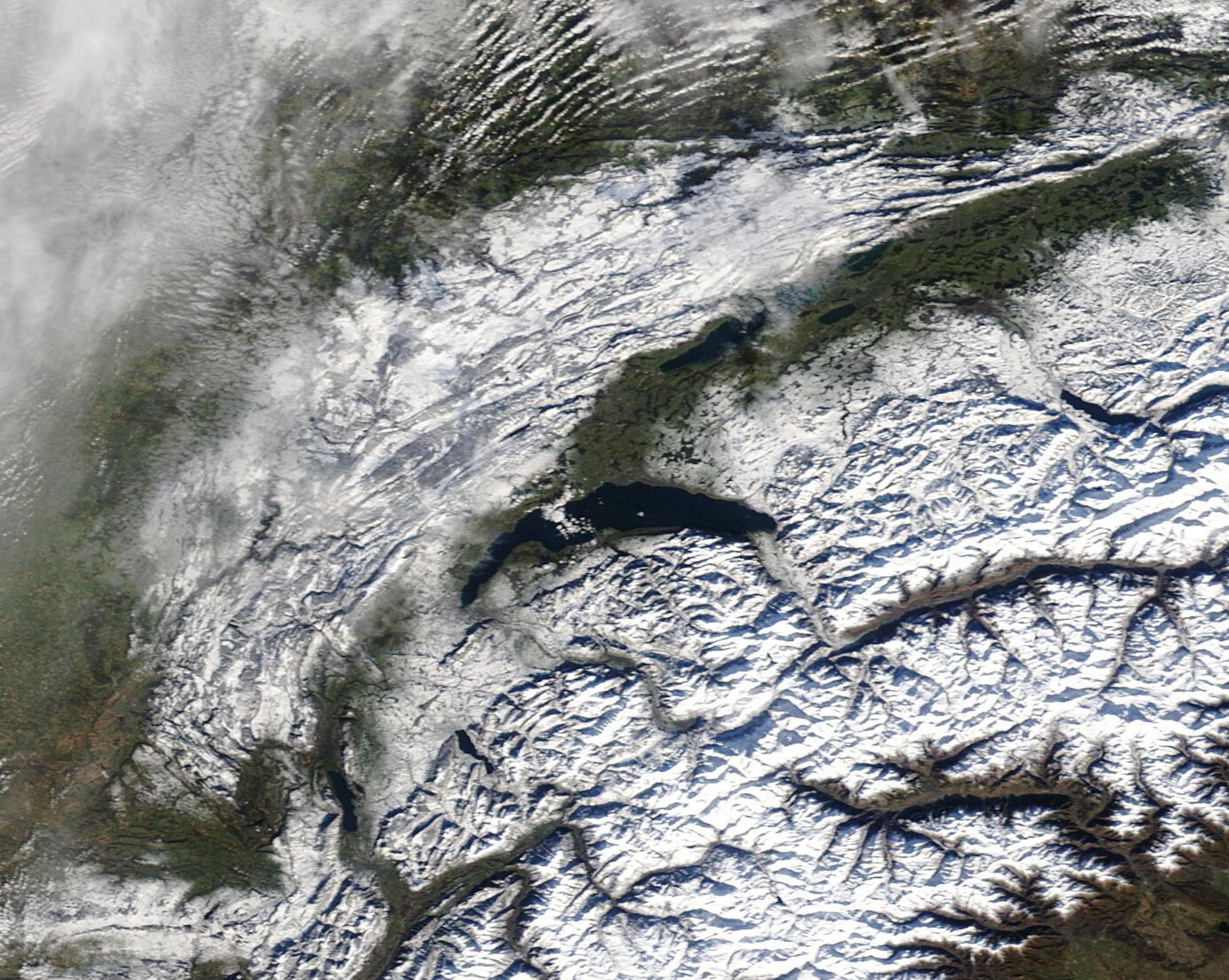
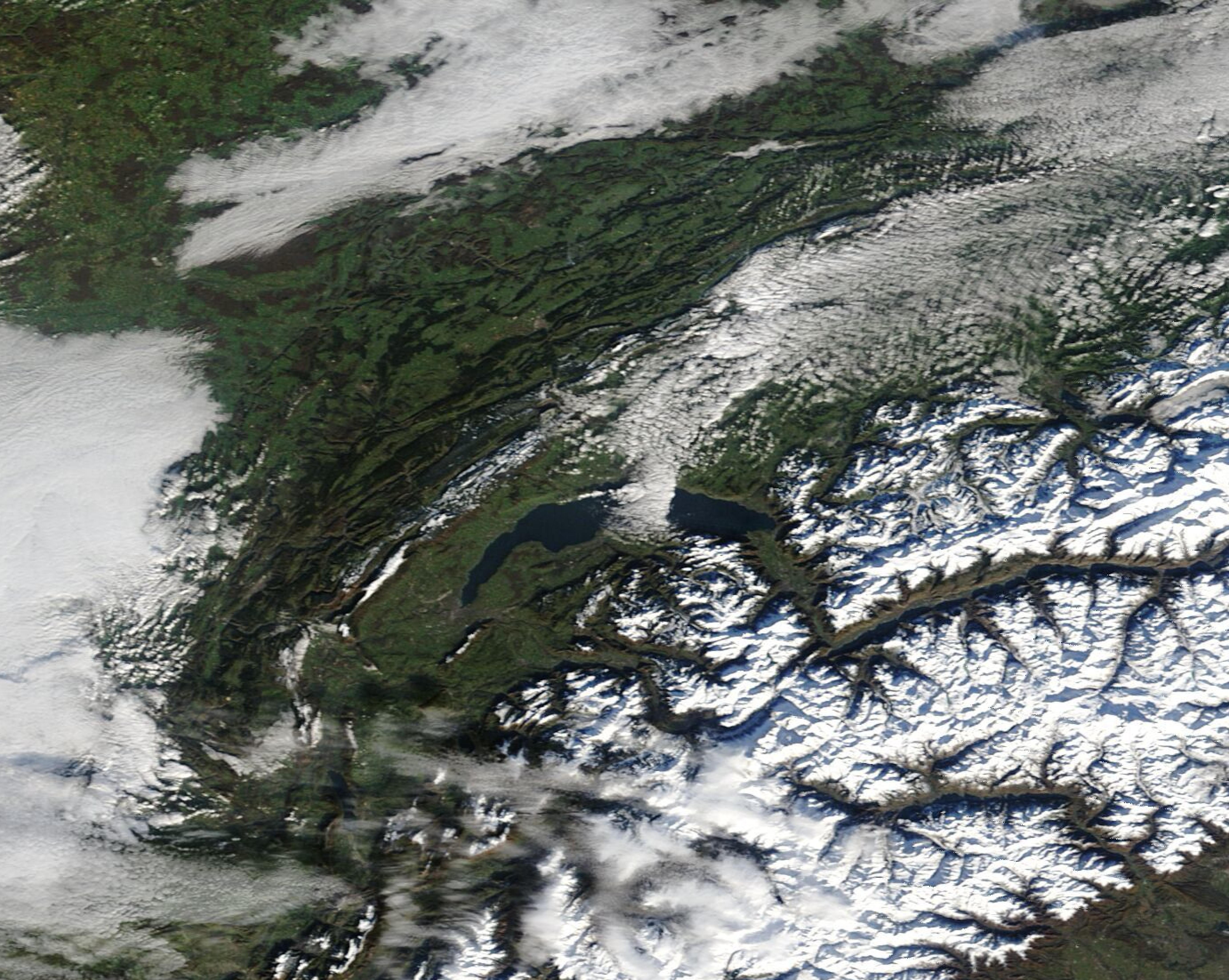
New satellite images show the scale of the lack of snow in areas shown just one or two years apart.
They were taken from Nasa’s Terra satellite, the European Space Agency’s Copernicus Sentinel-2 satellite and Maxar Technologies satellites.
Snow cover comparison in the Jura Mountains, 3 December 2021 and 8 December 2022:
Snow cover comparison at Adelboden, Switzerland, 20 December 2021 and 25 December 2022:
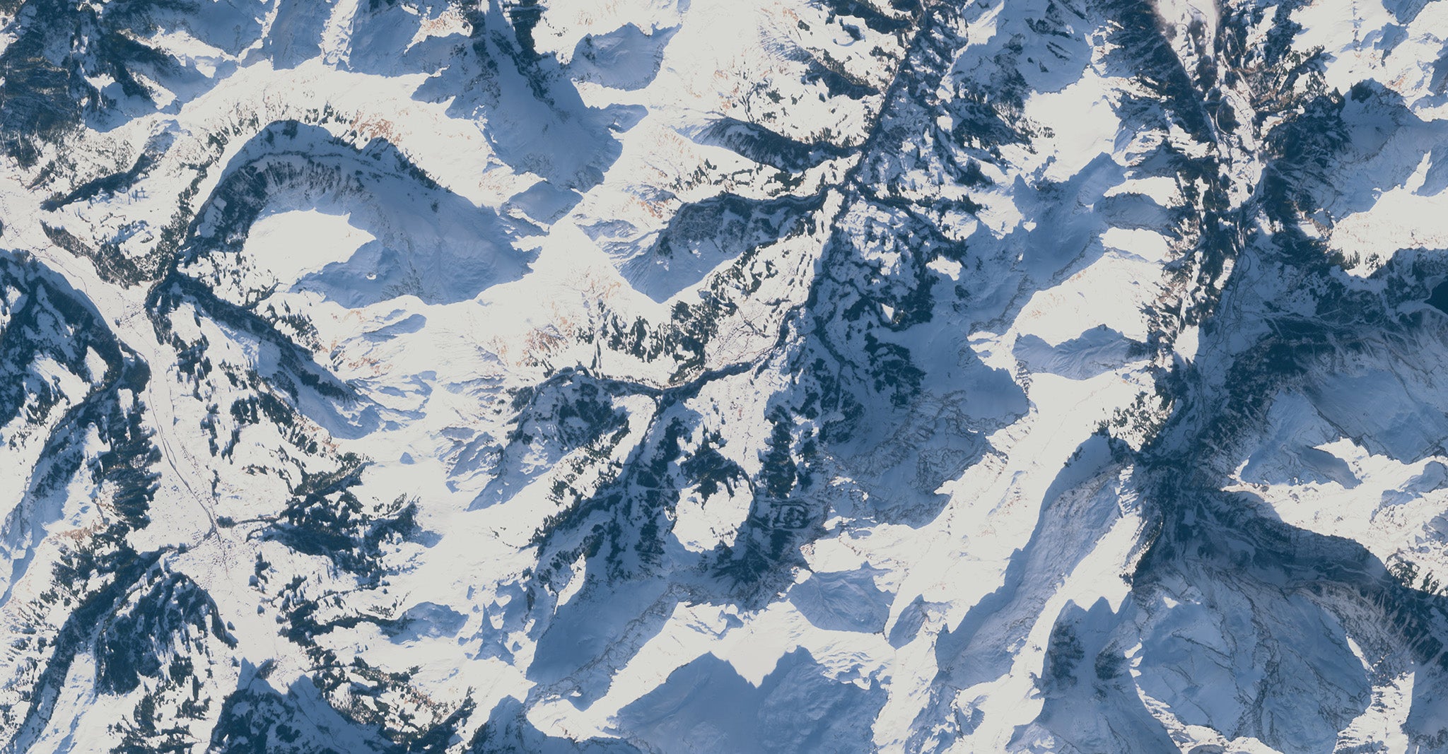
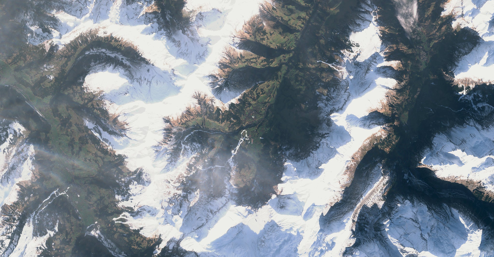
Snow cover comparison at St Stephan in Switzerland, 9 January 2021 and 1 January 2023:


Join our commenting forum
Join thought-provoking conversations, follow other Independent readers and see their replies
Comments