Another Saharan dust storm cloaks southern Europe with orange skies
Satellite images show the dust cloud covering southern Greece, but experts say it will not move across Europe
Your support helps us to tell the story
From reproductive rights to climate change to Big Tech, The Independent is on the ground when the story is developing. Whether it's investigating the financials of Elon Musk's pro-Trump PAC or producing our latest documentary, 'The A Word', which shines a light on the American women fighting for reproductive rights, we know how important it is to parse out the facts from the messaging.
At such a critical moment in US history, we need reporters on the ground. Your donation allows us to keep sending journalists to speak to both sides of the story.
The Independent is trusted by Americans across the entire political spectrum. And unlike many other quality news outlets, we choose not to lock Americans out of our reporting and analysis with paywalls. We believe quality journalism should be available to everyone, paid for by those who can afford it.
Your support makes all the difference.Southern Europe has been hit by another orange dust storm that mainly affected the skies over Greece, satellite images have shown.
Multiple Saharan dust storms have affected Europe over the past two months, with some sand even ending up in the UK.
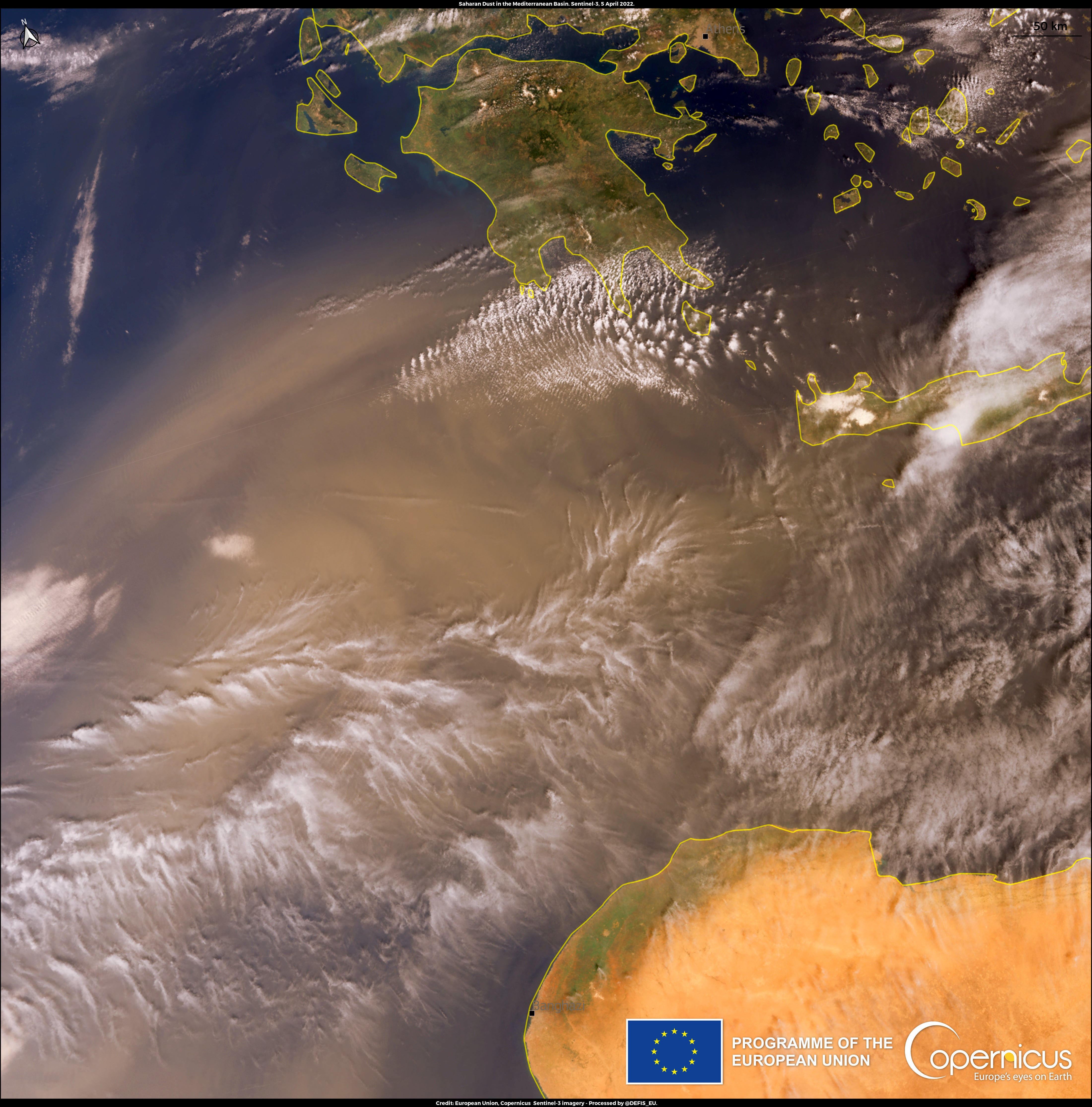
Images, taken by one of the European Union’s Copernicus Sentinel-3 satellites, show a dust storm encroaching on southern Europe on 5 April.
However, the latest aerosol observation from the EU’s earth observation programme predicts that the dust cloud will not travel further across Europe in the coming days.


The weather phenomenon is caused when particles of dust from arid regions, such as the Sahara, are blown over the Mediterranean and spread across Europe.
In a statement, the Copernicus programme described their satellite photo, saying: “This image, acquired on 5 April 2022 by one of the Copernicus Sentinel-3 satellites, shows the latest dust storm engulfing the Greek skies.
“The forecasting of these events is important because the suspended dust causes air quality to significantly worsen.
“They are harmful to human health, causing or worsening many respiratory diseases, as well as cardiovascular problems or meningitis.”
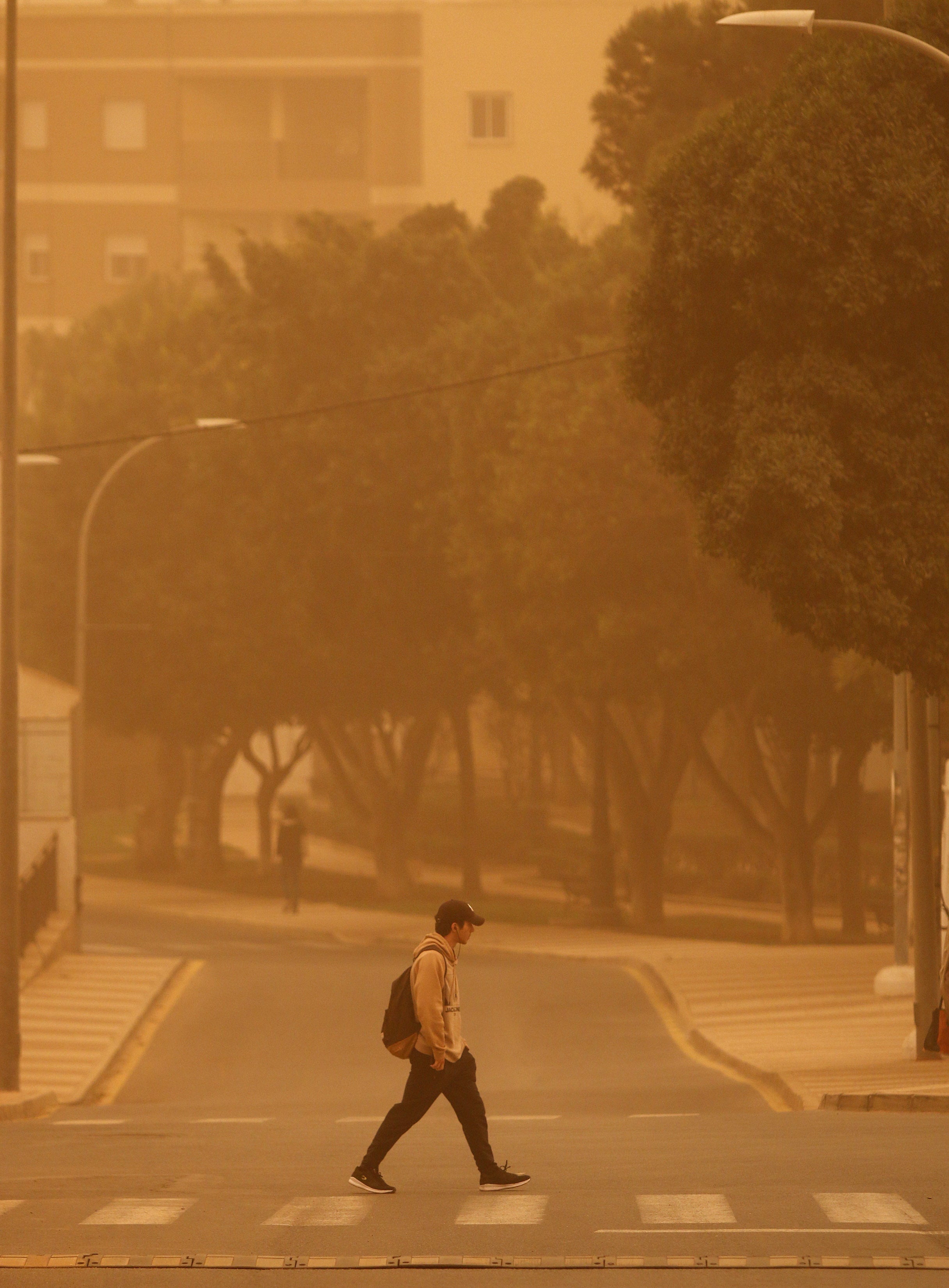
Saharan dust turned skies red and orange across Europe last month. Met Office meteorologist, Dan Stroud, explained at the time that the strange colours were caused by Rayleigh scattering (elastic scattering of light) from additional particles in the air.
He said: “The dust in the atmosphere causes the light to be more refracted, so you get the dominance of the red and orange tinges of the spectrum.”
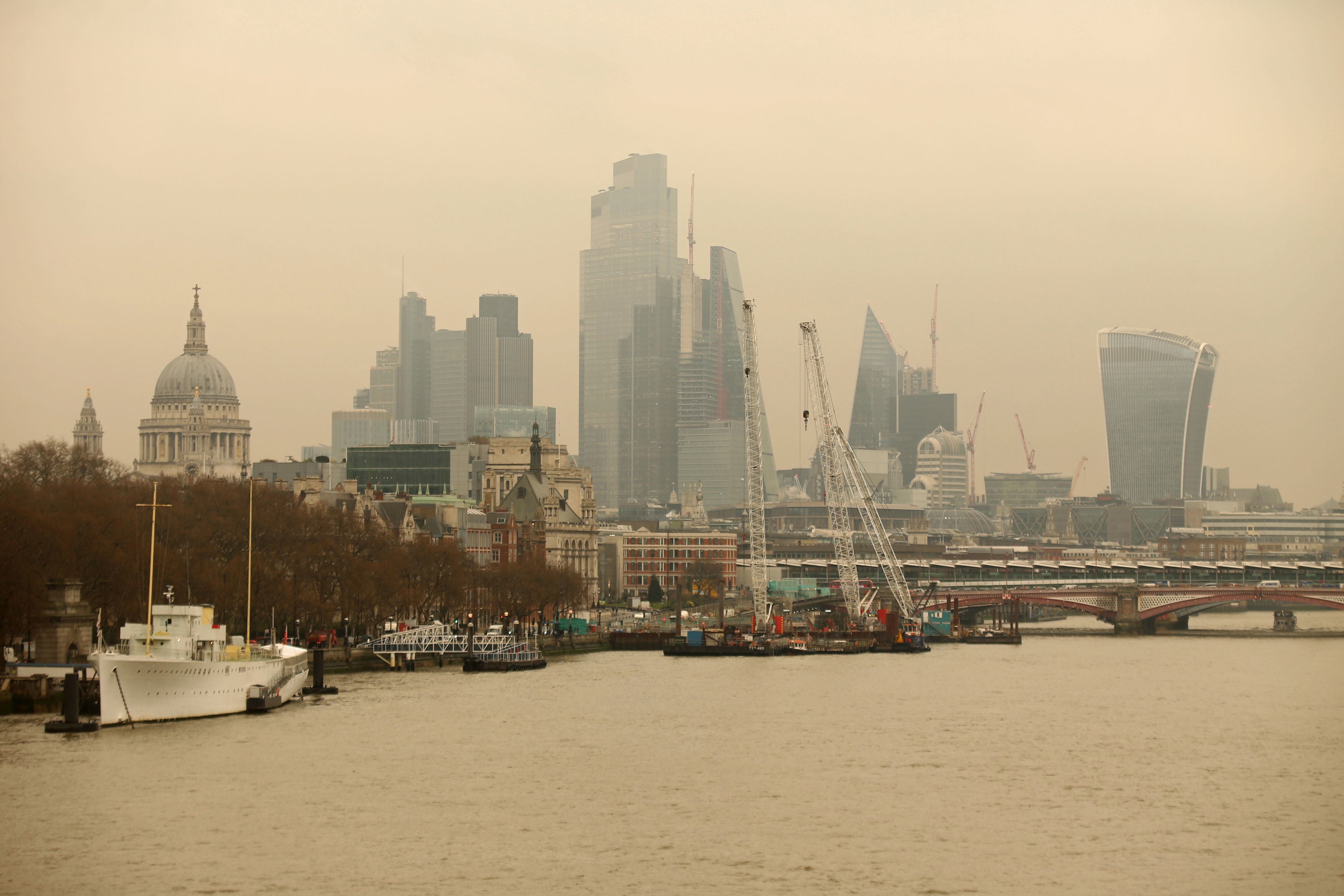
The March dust cloud hit Sussex, Kent and London and, during rainfall, dirt was brought down from the skies and left noticeable deposits on cars.
Join our commenting forum
Join thought-provoking conversations, follow other Independent readers and see their replies
Comments